Herefordshire Beacon and British Camp Walk with OS Map
![]()
![]() This walk climbs to Herefordshire Beacon in the Malvern Hills Area of Outstanding Natural Beauty. As well as some splendid views the site includes the significant British Camp Iron Age Hillfort, first constructed in the 2nd century BC. The boundary between Herefordshire and Worcestershire also runs just past the hill to the east.
This walk climbs to Herefordshire Beacon in the Malvern Hills Area of Outstanding Natural Beauty. As well as some splendid views the site includes the significant British Camp Iron Age Hillfort, first constructed in the 2nd century BC. The boundary between Herefordshire and Worcestershire also runs just past the hill to the east.
The hill includes a few different footpaths which you can use to make a circular walk. You can start from the car park just to the north of the hill, off the A449. There's handy information boards here giving a detailed history of the camp.
From the car park you can directly pick up a path to take you up to the top of the beacon. At the 338 m (1,109 ft) summit there are splendid views into the counties of Herefordshire, Worcestershire and Gloucestershire. Just to the west of the hill you can also see the lovely Eastnor Deer Park and mock 19th century castle.
Follow the paths south through the earthworks and defensive ditches of British Camp to Millenium Hill, before descending on other paths to the car park. You could also pick up other trails to take you to the pretty British Camp Reservoir, just to the south east of the car park.
You can pick up the Geopark Way long distance trail to further explore the Malvern Hills. Following the paths north will take you to the popular Worcestershire Beacon and the town of Great Malvern. If you head south you will soon come to Midsummer Hill where there is another Iron Age Hillfort and Scheduled Ancient Monument.
Postcode
WR13 6HR - Please note: Postcode may be approximate for some rural locationsHerefordshire Beacon and British Camp Ordnance Survey Map  - view and print off detailed OS map
Herefordshire Beacon and British Camp Open Street Map  - view and print off detailed map
*New* - Walks and Cycle Routes Near Me Map - Waymarked Routes and Mountain Bike Trails>>
Herefordshire Beacon and British Camp OS Map  - Mobile GPS OS Map with Location tracking
Herefordshire Beacon and British Camp Open Street Map  - Mobile GPS Map with Location tracking
Further Information and Other Local Ideas
Just below the hill on the eastern side you'll find Castlemorton Common. The expansive common is another popular local place for a walk with miles of trails, woodland, wildlife and great views back to the Malverns.
Also to the east there's the delightful village of Hanley Swan. The picturesque settlement includes a pretty village green, a pond, a 17th century pub and walking trails to neighbouring Hanley Castle where you can see the remains of the ancient fort. The river trails and historic 16th century pub at Upton Upon Severn are also located in this area.
Also nearby is a significant geological site on the Gullet Quarry Walk.
For an alternative circular walk starting from the Colwall train station see the Colwall Walk. Here you can also visit the Colwall Park Hotel where you can enjoy a delicious afternoon tea in the beautiful hotel grounds.
Cycle Routes and Walking Routes Nearby
Photos
View north from the top of the Herefordshire Beacon. The Malvern Hills Conservators have built a series of steps on the main paths to this popular summit in an effort to prevent too much erosion by walkers. This construction uses the pinkish Malvern granite and is typical of repairs made all over the hills.
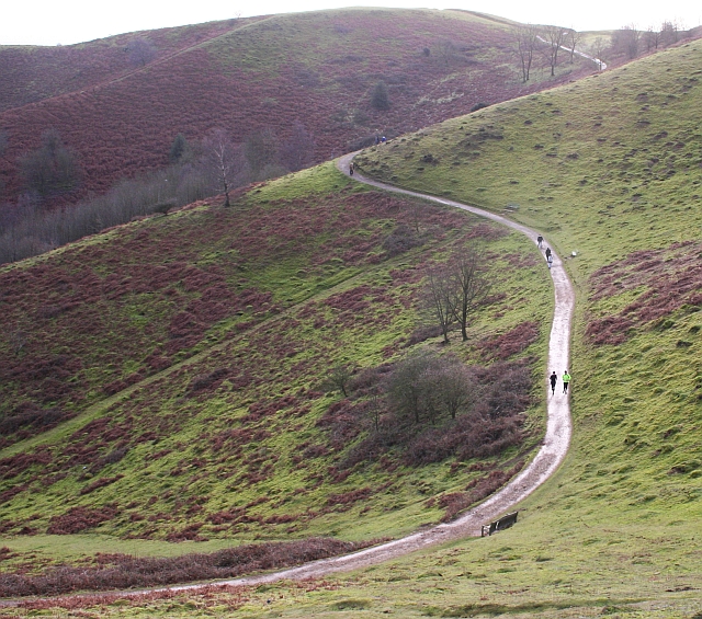
Eastern Path around British Camp. The path is fairly level, taking visitors from the car park towards Clutter's Cave without having to climb over Herefordshire Beacon.
Clutter's Cave. Hand hewn from granite and probably a medieval hermit's dwelling. Also known as Giant's Cave or Waum's Cave. A spring once lay beneath.


