Horton in Ribblesdale Walks
![]()
![]() This pretty Yorkshire Dales village is a popular place for walkers. It is often used as the start point for the Yorkshire Three Peaks which includes Whernside, Ingleborough Mountain and Pen y ghent. The latter is particularly close to the village and many climbs begin from Horton, visiting the wonderul natural hole of Hull Pot on the way.
This pretty Yorkshire Dales village is a popular place for walkers. It is often used as the start point for the Yorkshire Three Peaks which includes Whernside, Ingleborough Mountain and Pen y ghent. The latter is particularly close to the village and many climbs begin from Horton, visiting the wonderul natural hole of Hull Pot on the way.
This less strenuous walk from the village follows the River Ribble south to Stainforth and the Winskill Stones Nature Reserve. There's nice country views, riverside paths and some wonderful limestone scenery to enjoy. You'll also pass the village of Stainforth where a visit to the Stainforth Force waterfall is an option.
Start the walk from the village and head east to meet with the Ribble Way. You can follow this waymarked trail south along the river to Stainforth and then up to the Winskill Stones. Here you'll find an amazing section of limestone pavement which is very popular with photographers. There's also fine views over the Dales from the elevated position of the reserve.
After taking in the views the route returns to the village along the same paths.
Horton in Ribblesdale Ordnance Survey Map  - view and print off detailed OS map
Horton in Ribblesdale Open Street Map  - view and print off detailed map
Horton in Ribblesdale OS Map  - Mobile GPS OS Map with Location tracking
Horton in Ribblesdale Open Street Map  - Mobile GPS Map with Location tracking
Walks near Horton in Ribblesdale
- Pen y ghent - Climb to the 694 m (2,277 ft) summit of Pen y ghent on this challenging circular walk in the Yorkshire Dales
- Fountains Fell - Climb to this prominent fell in the Yorkshire Dales and enjoy wonderful views over the surrounding hills and countryside
- Malham Tarn Estate - This beautiful spot in the Yorkshire Dales is perfect for a safe cycle or walk
- Whernside - Climb to the highest point in North Yorkshire on this challenging circular walk in the Yorkshire Dales
- Ingleborough Mountain - Climb to one of Yorshire's Three Peaks, Ingleborough stands at a height of 723 metres (2,372 ft)
- Pennine Way - This fabulous 268 mile path takes you through three of England's finest national parks
- Ribble Way - Follow the River Ribble through the beautiful Ribble Valley from its mouth at Longton, near Preston, to the source at Gayle Moor in Yorkshire.
You start at Longton just to the west of Preston and follow the river through Ribchester and Clitheroe, before reaching Gisburn - Stainforth Force - Enjoy a short walk to Stainforth Force waterfall from the North Yorkshire village of Stainforth.
Start the walk from the main parking area in the village and head west, crossing the bridge over the river - Ingleton Falls - One of the loveliest walks in England, this circular trail visits a series of beautiful waterfalls in Ingleton in the Yorkshire Dales
- Hull Pot - This walk visits a wonderful natural hole and waterfall on the slopes of Pen y ghent
Pubs/Cafes
In Horton in Ribblesdale head to the Helwith Bridge Inn for some well earned refreshments after your walk. The friendly pub has a great menu, a good selection of beers and outdoor seating. Here you can sit next to the River Ribble and enjoy fine views towards the hills if the weather is fine. You can find it on Austwick Rd with a postcode of BD24 0EH for your sat navs. The pub is also dog friendly if you have your canine friend with you.
Further Information and Other Local Ideas
In Stainforth you could take a small detour from the route to visit Stainforth Force Waterfall. Here the River Ribble falls over a series of limestone ledges into a deep, broad pool. In October you can see leaping Salmon on their annual migration up the River Ribble.
The village is accessible by rail on the Settle–Carlisle Line. There is about one train every two hours in each direction: southbound to Leeds (seven in total) and northbound to Carlisle (eight, plus one evening train that terminates at Ribblehead).
Photos
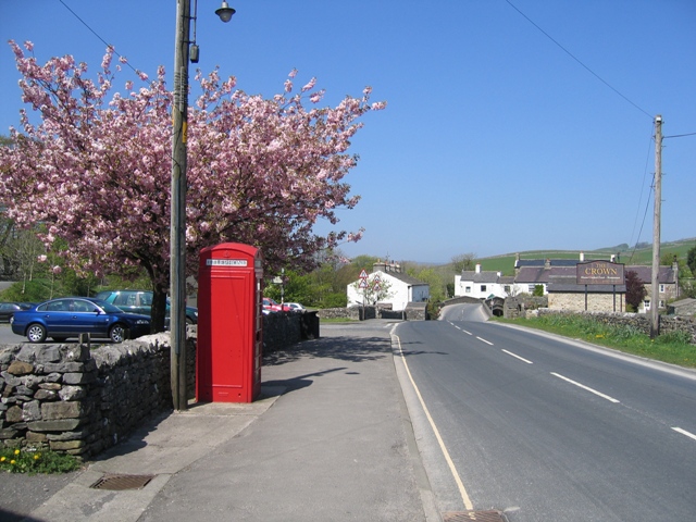
Looking along the B6479 in Horton in Ribblesdale, North Yorkshire, on a sunny day. On the left is a K6 telephone kiosk, which is useful in the area due to patchy mobile phone coverage. Behind the phone box is the National Parks car park, which is pay and display. There is also a toilet block beside the car park. In the distance is the first of the twin bridges at Horton, this one is over Brants Ghyll.
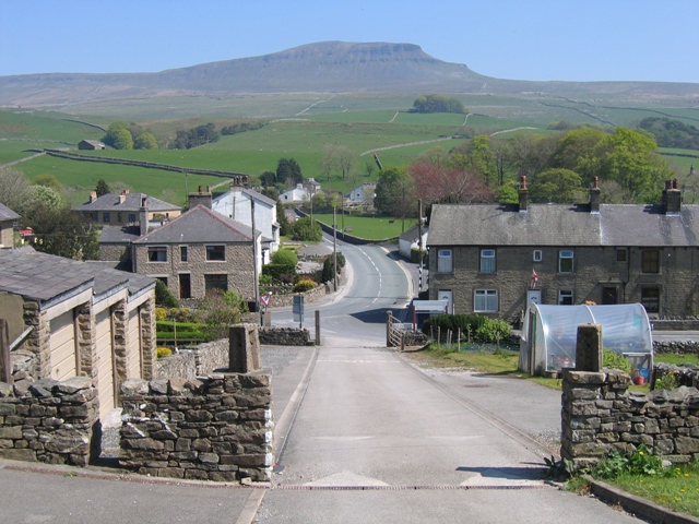
Two bridges in Horton in Ribblesdale New Inn Bridge, which carries the B6479 over the River Ribble, is in the centre of the photo. The wooden pedestrian bridge on the left enables pedestrians to avoid the narrow stone bridge.
Office Stores. The village shop in Horton in Ribblesdale is no longer the post office, and post office facilities are now only available at The Crown Inn. However, the shop itself is still an important part of the community.


