Hunters Hill and Harrock Hill Walk
![]()
![]() This circular walk visits Hunters Hill and Harrock Hill near Parbold in Lancashire.
This circular walk visits Hunters Hill and Harrock Hill near Parbold in Lancashire.
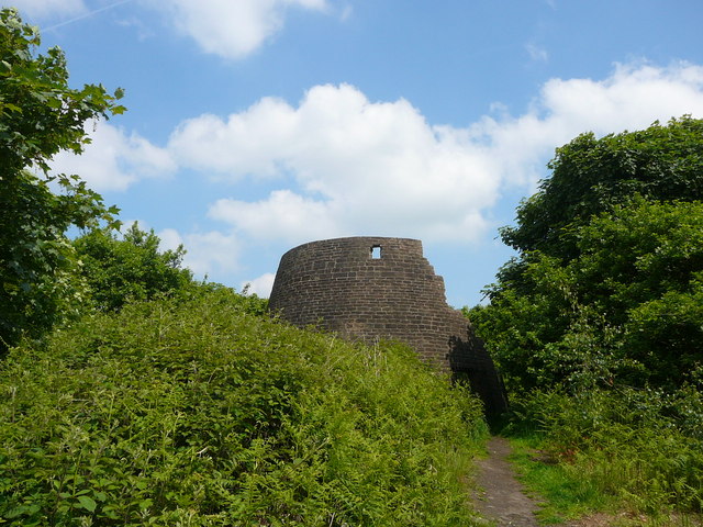
The walk starts from the Hunters Hill quarry car park on Bannister Lane at postcode WN6 9QD for your sat navs. From here you can follow Bannister Lane north to Bannister Farm where you turn east to climb up to Harrock Hill Windmill. It's a lovely spot with peaceful bluebell woods, a photogenic ruined windmill and some fine views to enjoy.
The route then heads south past Harrock Hall and Butteries Wood before coming to High Moor. You then follow Stony Lane west before turning north to round Hunters Hill Quarry and return to the car park.
To continue your walking in the area you could climb to Parbold Hill or visit the delightful Parbold Fairy Glen.
Postcode
WN6 9QD - Please note: Postcode may be approximate for some rural locationsHunters Hill and Harrock Hill Ordnance Survey Map  - view and print off detailed OS map
Hunters Hill and Harrock Hill Open Street Map  - view and print off detailed map
Hunters Hill and Harrock Hill OS Map  - Mobile GPS OS Map with Location tracking
Hunters Hill and Harrock Hill Open Street Map  - Mobile GPS Map with Location tracking
Dog Walking
The woodland and hillside trails make for a fine walk with your dog.
Further Information and Other Local Ideas
The circular Hunters Hill and Harrock Hill Walk starts nearby. It visits a fine viewpoint at Harrock Hill where there's also an interesting ruined windmill.
Just to the east is the watersports centre at Eccleston Delph where there's a lakeside footpath and a nice cafe.
For more walking ideas in the area see the Lancashire Walks page.
Cycle Routes and Walking Routes Nearby
Photos
Flooded part of Hunters Hill Quarry. View across Hunter's Hill Quarry and the West Lancashire Plain. This quarry was worked for its sandstone for 200 years up to the 1980's but is now a nature reserve with managed walkways and parking overlooking the Lancashire Plain.


