Hurstpierpoint Walks
![]()
![]() This large West Sussex village is located west of Hassocks next to the South Downs.
This large West Sussex village is located west of Hassocks next to the South Downs.
The village has an interesting high street with a number of historic properties dating from the 18th century and a 15th century public house of some note.
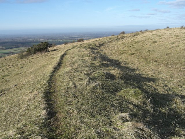
This walk from the village takes you south across the Downs to Danny House before climbing to the splendid viewpoint on Wolstonbury Hill.
Danny House lies just south of the village and is regarded as one of the finest stately houses in Sussex. The Grade I listed Elizabethan red brick mansion was built in 1595 by George Goring, on the site of an older house. The historic parkland estate covers 400 acres and includes a Bronze Age enclosure, eight acres of gardens and a large area of ancient woodland. Here you can see woodland flower species including butterfly orchid, early purple orchid, wild garlic and guelder rose. Butterflies such as white admiral and silver-washed fritillary can be found here too.
Cricket is recorded in the Thomas Marchant’s diaries as having been played at Sand Field, Danny Park in 1717. This makes Sand Field the earliest identifiable cricket ground in the world.
The route continues south to climb to Wolstonbury Hill where you can enjoy wonderful views over the South Downs. There's an ancient hill fort, chalk grassland and lots of pretty summer wildflowers here.
Postcode
BN6 9RQ - Please note: Postcode may be approximate for some rural locationsHurstpierpoint Ordnance Survey Map  - view and print off detailed OS map
Hurstpierpoint Open Street Map  - view and print off detailed map
Hurstpierpoint OS Map  - Mobile GPS OS Map with Location tracking
Hurstpierpoint Open Street Map  - Mobile GPS Map with Location tracking
Walks near Hurstpierpoint
- Hassocks - This West Sussex based village is in a great location for exploring some of the local highlights of the South Downs
- Wolstonbury Hill - This walk climbs to the splendid viewpoint on Wolstonbury Hill in the South Downs.
- Ditchling Beacon - Climb to the highest point in East Sussex and enjoy wonderful views of the Weald and the Downs on this circular walk
- Sussex Border Path - A fabulous long distance walk following the Sussex county border from Thorney Island in West Sussex to Rye in East Sussex
- The South Downs Way - This beautiful 100 mile long trail runs from Winchester to the coastal town of Eastbourne
- Devils Dyke - This circular walk explores this beautiful valley near Brighton
- Ditchling Common Country Park - Explore 188 acres of lovely parkland near Burgess Hill in East Sussex
- Plumpton - This East Sussex based village is located near Lewes on the edge of the South Downs
- Chanctonbury Ring - Climb to this early Iron Age hill fort on the South Downs and enjoy wonderful views over the surrounding countryside and coast
- Fulking - The pretty village of Fulking sits in a lovely position on the South Downs
- Truleigh Hill - This hill in West Sussex has a set of distinctive radio masts on the summit
- Burgess Hill - This West Sussex town is situated close to the South Downs where you can enjoy some splendid walks.
- Stanmer Country Park - Enjoy beautiful woodland walks and extensive open lands in this country park in Brighton
- Falmer - This small East Sussex based village is located between Brigthe campus of Brighton & Hove Albion's Falmer Stadium
- Bedelands Nature Reserve - This walk visits the Bedelands Farm Nature Reserve in Burgess Hill, West Sussex.
Pubs/Cafes
The New Inn is an historic pub of some note. The inn dates back to 1450 and was built from old ships timbers, though the building now has a Georgian façade. The cellar also has a strange tunnel (now bricked up) that is rumoured to lead to the church and Danny House some two miles away.
Outside there's a lovely large garden area surrounded by beautiful flowers and old walls. In the summer there's garden parties, BBQ's, Hog Roasts, open air music & plays. You can find them on the High Street at postcode BN6 9RQ for your sat navs.
Dog Walking
The woodland and downland trails make for a fine dog walk. The New Inn mentioned above is also dog friendly.
Further Information and Other Local Ideas
Head north of the village and you could pick up a pleasant waterside footpath along the Herrings Stream. The stream is a tributary of the eastern River Adur and includes old mills and a running mill leat with lots of wildlife to see. Just head north along the Cuckfield Road for about a mile and you will come to the footpath along the stream near Hurstpierpoint College.


