Kings Sutton Canal Circular Walk
![]()
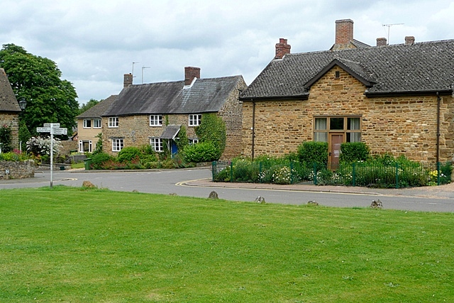
![]() This attractive West Northamptonshire village is a lovely place to start a walk. The settlement is located very close to a scenic river and canal with a water based nature reserve also within walking distance of the village centre.
This attractive West Northamptonshire village is a lovely place to start a walk. The settlement is located very close to a scenic river and canal with a water based nature reserve also within walking distance of the village centre.
This circular walk from the village visits the Oxford Canal and the River Cherwell before heading to the neighbouring settlements of Bodicote and Adderbury where you'll visit the pretty Adderbury Lakes.
The walk starts in the village centre and heads north west to meet up with the canal. Follow the canal north and it will take you towards Warkworth, Banbury and the point where the canal meets with the Jurassic Way long distance footpath. Here you leave the canal and head west towards Bodicote. Follow paths south through the village and you will pass the windmill before coming to nearby Adderbury. Just east of here you can visit the Adderbury Lakes Nature Reserve where there's lots of water loving wildlife to look out for.
After exploring the reserve you head east through Twyford to return to the canal. You can then follow this south back towards Kings Sutton.
Postcode
OX17 3RF - Please note: Postcode may be approximate for some rural locationsPlease click here for more information
Kings Sutton Ordnance Survey Map  - view and print off detailed OS map
Kings Sutton Open Street Map  - view and print off detailed map
*New* - Walks and Cycle Routes Near Me Map - Waymarked Routes and Mountain Bike Trails>>
Kings Sutton OS Map  - Mobile GPS OS Map with Location tracking
Kings Sutton Open Street Map  - Mobile GPS Map with Location tracking
Walks near Kings Sutton
- Adderbury Circular Walk - This three mile circular walk explores the countryside around the Oxfordshire villages of Adderbury and Bodicote
- Adderbury Lakes - Enjoy a short walk around this pretty nature reserve in the Oxfordshire village of Adderbury
- Bodicote Circular Walk - This short circular walk explores the countryside around the Oxfordshire village of Bodicote near Banbury
- Stoke Wood - These ancient woods are located near Bicester in Oxfordshire
- Oxford Canal Walk - Follow the Oxford Canal from Oxford to Coventry on this splendid waterside walk
- River Cherwell - Enjoy a nice waterside walk along the River Cherwell in Oxford
- Banbury - Explore the area surrounding the Oxfordshire town of Banbury on this long circular walk
- Bloxham - This circular walk explores the countryside around the pretty village of Bloxham
- Deddintgon Circular Walk - A nice circular walk through the countryside surrounding the Oxfordshire village of Deddington
- Clattercote Reservoir - This small reservoir is located just south of Claydon in Oxfordshire.
- Boddington Reservoir - Enjoy a peaceful walk around this pretty reservoir near Banbury
- Tusmore Park Estate - This walk explores the Tusmore Park Estate, near Bicester in Oxfordshire.
- Aynho - This Northamptonshire based village lies close to the border with Oxfordshire and the town of Banbury.
Pubs/Cafes
The White Horse is a good choice for some post walk refreshments. They have a lovely garden bar at the front with a fine view of the village green. Inside there's a charming interior with wood panelling, beams and log fires. They serve classic British dishes and can be found on The Square with a postcode of OX17 3RF for your sat navs.
Dog Walking
The country trails make for a fine dog walk and the White Horse mentioned above is also dog friendly.
Further Information and Other Local Ideas
This route is coincident with the Bodicote Circular Walk. This visits some of the local highlights including Bodicote Lake, the restored 19th century windmill, the 13th century church and the Georgian Bodicote House. There's also an 18th century pub to visit in the pretty village afterwards.
Also nearby there's neighbouring Aynho where you can explore the 17th century Aynho Park Estate. There's also a fine canalside pub to visit in this area.
For more walking ideas in the area see the Oxfordshire Walks and the Northamptonshire Walks pages.


