Lamaload Reservoir
![]()
![]() This circular walk takes you around the pretty Lamaload Reservoir near Macclesfield in the Peak District National Park. The route runs for about 2 miles with some small climbs on the way.
This circular walk takes you around the pretty Lamaload Reservoir near Macclesfield in the Peak District National Park. The route runs for about 2 miles with some small climbs on the way.
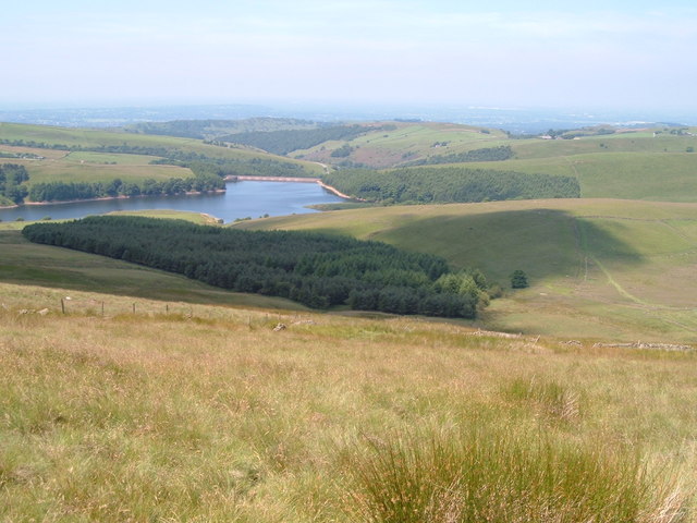
You can start the walk from the car park on the north eastern side of the water, just off Hooleyhey Lane. Then follow footpaths and country lanes around the site, passing through woodland areas as you go. It's a lovely peaceful place with great views across the water to the surrounding hills and countryside.
You could extend the walk by following footpaths south west to visit Tegg's Nose Country Park. There's some excellent views to enjoy from the elevated park.
Postcode
SK10 5XL - Please note: Postcode may be approximate for some rural locationsLamaload Reservoir Ordnance Survey Map  - view and print off detailed OS map
Lamaload Reservoir Open Street Map  - view and print off detailed map
Lamaload Reservoir OS Map  - Mobile GPS OS Map with Location tracking
Lamaload Reservoir Open Street Map  - Mobile GPS Map with Location tracking
Pubs/Cafes
The circular walk from nearby Rainow visits the reservoir, passing through some lovely Dean Valley countryside on the way. The village has a fine local pub in the shape of the Robin Hood where you could enjoy some relaxation and refreshment after your exercise. The pub has a large car park and a fine outdoor decking area with splendid views towards White Nancy and other Peak District hills. The quaint old inn also serves fine food with a good tapas selection on the menu. You can find them at Chapel Brow with postcode SK10 5XE for your sat navs.
Further Information and Other Local Ideas
Just to the east there's a fine circular walk to Shining Tor and Cats Tor. The route also visits Errwood Reservoir and Fernilee Reservoir where you can enjoy more pleasant waterside paths.
A few miles to the north east of the site there's Combs Reservoir near Chapel en le Frith. Here you can also enjoy some splendid rock formations and an excellent viewpoint at Castle Naze. The Promontory fort on Combs Edge commands fine views to the surrounding Peak District hills.
For more walking ideas in the area see the Peak District Walks and the Cheshire Walks pages.
Cycle Routes and Walking Routes Nearby
Photos
A view of Lamaload Reservoir seen from the footpath towards Shining Tor. The reservoir is fed by the River Dean. It serves the town of Macclesfield, which lies to the west.


