Walks Near Macclesfield
![]()
![]() This market town in Cheshire has an abundance of local options for walkers. There's canalside trails, an expansive forest, several pretty reservoirs and hill climbs with fabulous views over the Cheshire Plain.
This market town in Cheshire has an abundance of local options for walkers. There's canalside trails, an expansive forest, several pretty reservoirs and hill climbs with fabulous views over the Cheshire Plain.
This circular walk from the town visits several of the area's walking highlights including the Macclesfield Canal, the neighbouring town of Bollington, the fine viewpoints at White Nancy and Tegg's Nose Country Park and the woodland trails at Macclesfield Forest and Trentabank Reservoir.
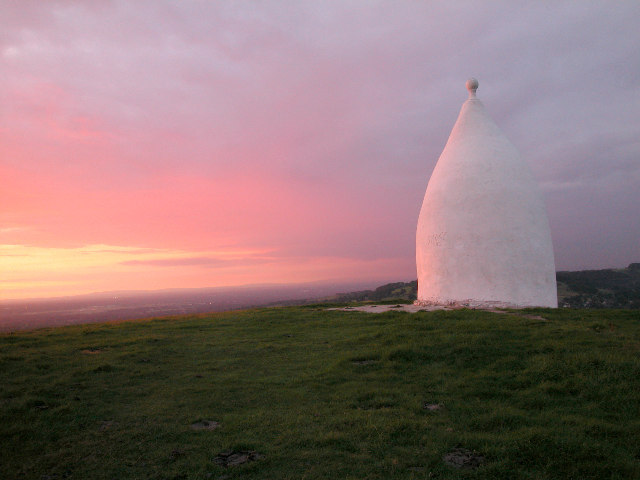
You start on the canal to the east of the town centre. Head north along the towpath to Bollington where you can climb to White Nancy. The unusual folly is in the shape of a small domed sugar loaf and thought to have been built in 1817 by Colonel Gaskell as a monument to the Battle of Waterloo. There's great views from this elevated spot over the Cheshire Plain to the mountains of North Wales.
From here you continue south along the popular Gritstone Trail to Tegg's Nose. There's a country park here with a visitor centre, viewpoint, reservoirs, woodland and some fine cycling trails to try.
The route continues into Macclesfield Forest where there's a series of reservoirs and lots of wildlife to see. Keep your eyes peeled for red deer and birds such as common sandpiper, green sandpiper and little ringed plover. Around here you can also enjoy a climb to the distinctive Shutlingsloe. The hill is known as the Cheshire Matterhorn due to its shape from certain directions.
After exploring the forest the route heads west through Langley and Sutton Lane Ends to return to the canal. Follow the towpath north past Gurnett and it will soon return you to the town.
Postcode
SK11 6JL - Please note: Postcode may be approximate for some rural locationsMacclesfield Ordnance Survey Map  - view and print off detailed OS map
Macclesfield Open Street Map  - view and print off detailed map
*New* - Walks and Cycle Routes Near Me Map - Waymarked Routes and Mountain Bike Trails>>
Macclesfield OS Map  - Mobile GPS OS Map with Location tracking
Macclesfield Open Street Map  - Mobile GPS Map with Location tracking
Walks near Macclesfield
- Macclesfield Forest and Trentabank Reservoir - This circular walk explores Macclesfield Forest and also pays a visit to the pretty Trentabank Reservoir on the western edge of the Peak District.
The walk starts at the Standing Stone car park on the eastern edge of the forest - Bollington - This circular walk explores the area surrounding the Cheshire town of Bollington
- White Nancy - This walk climbs to unusual structure of White Nancy overlooking the town of Bollington in Cheshire
- Macclesfield Canal - Follow the towpath of the Macclesfield Canal from Marple to Kidsgrove on this waterside walk in Cheshire
- Tegg's Nose Country Park - This lovely country park in Macclesfield has splendid views of the Peak District National Park and the Cheshire plain
- Gritstone Trail - This beautiful, challenging walk runs through the Peak District from Disley to Kidsgrove.
The walk begins at the train station at Disley and soon comes to the wonderful Lyme Park (video below) with its mansion house and Medieval deer park - Poynton - This circular walk from Poynton visits Poynton Park and the Macclesfield Canal
- Lyme Park - This is a circular walk through the splendid Lyme Park in Disley, Cheshire
- Macclesfield to Marple - Middlewood Way - Follow the Middlewood Way - a lovely off road cycle and walking path running from Macclesfield to Marple and passing by the Macclesfield Canal.
- Hare Hill - This walk visits the National Trust's lovely Hare Hill Gardens before heading to the nearby Alderley Edge for fine views over the Cheshire Plain.
The walk starts from the Hare Hill car park which is located between Macclesfield and Alderley Edge - Alderley Edge - This lovely circular walk explores the beautiful National Trust owned area of Alderley Edge
- Wizard Trail - This lovely trail takes you through some attractive Cheshire countryside and is ideal for an afternoon's cycle.
Starting at Alderley Edge highlights on the route include the Wizard's well, the 15th century Alderley mill and National Trust owned Hare Hill. - Wilmslow - This walk from Wilmslow visits the popular Carrs Park before following the River Bollin to the nearby Styal Country Park and Woods
- North Cheshire Way - Starting at Hooton Station, near Ellesmere Port, follow the North Cheshire Way through Frodsham, Northwich, Knutsford and Wilmslow to the finish point at Disley
- Bollin Valley Way - Follow the River Bollin from Macclesfield to Partington on this delightful waterside walk through Greater Manchester and Cheshire.
The walk starts at the Macclesfield Riverside Park and follows the river through Prestbury, Wilmslow, Hale and Bowdon to Partington on the Manchester Ship Canal.
On the route you will pass the 18th century Grade II listed Mottram Hall and National Trust owned Dunham Massey - Prestbury - This delightful Cheshire based village is a fine place for an easy stroll
- Shutlingsloe - Enjoy fabulous views over Cheshire on this climb to Shutlingsloe Hill in the Peak District
- Shining Tor and Cats Tor - Climb to the highest point in Cheshire on this wonderful walk in the Goyt Valley.
The walk starts from the Erwood Hall Car Park at the southern end of Erwood Reservoir - Errwood Reservoir and Fernilee Reservoir - Enjoy some lovely waterside walking along these two reservoirs in the Goyt Valley area of the Peak District
- Lamaload Reservoir - This circular walk takes you around the pretty Lamaload Reservoir near Macclesfield in the Peak District National Park
Pubs/Cafes
The George and Dragon is a good choice for post walk refreshments in the town centre. The friendly pub serves a good selection of real ale and has a nice garden to sit out in. You can find them on Sunderland Street at postcode SK11 6JL for your sat navs.
Dog Walking
The country and woodland trails make for a fine dog walk. The George and Dragon pub mentioned above is also dog friendly.
Further Information and Other Local Ideas
A few miles to the north there's the circular Pott Shrigley Walk which will take you around the old Shrigley Hall to the surrounding moors.
Just south of Macclesfield the canal passes Sutton Reservoir and Danes Moss Nature Reserve. The reservoir is a nice place for a waterside stroll while the reserve has some pleasant boardwalks taking you over lowland raised bog. It's an interesting area with some rare flora and fauna to see. In this same area there's also the worthy village of Gawsworth. The village includes three noteworthy historic buildings including the 15th century Gawsworth Hall. The house and grounds of the historic Tudor house are well worth exploring.
For more walking ideas in the area see the Cheshire Walks and the Peak District Walks pages.
Photos
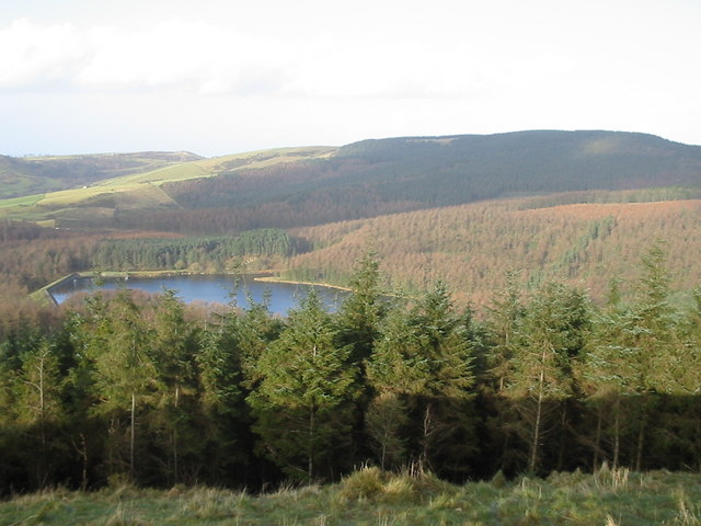
Tegg's Nose and Bottoms Reservoirs View from the viewpoint off Sutton footpath 39 in Tegg's Nose Country Park. Tegg's Nose and Bottoms Reservoirs in mid-field; Crocker Hill (with the telecommunications tower) and Bosley Minn (to the left of it) in the distance.


