Little Chalfont Walks
![]()
![]() This attractive Buckinghamshire village is part of the 'Chalfonts' along with Chalfont St Giles and Chalfont St Peter.
This attractive Buckinghamshire village is part of the 'Chalfonts' along with Chalfont St Giles and Chalfont St Peter.
There's some lovely Chilterns countryside, riverside trails and the local Little Chalfont Nature Park for walkers to explore.
This circular walk from the village takes you along the River Chess to the nearby Chenies village and manor house.
The walk starts at the Chalfont and Latimer train station where you can pick up the Chess Valley Walk. Follow the waymarked trail north and it will take you up to the river, passing through West Wood on the way.
Follow the river path east and it will take you past Latimer to Chenies Bottom where you cross the river and head into Chenies village. Here you'll find the Tudor Chenies Manor House which is open to the public during the summer months.
The route then heads south west past Old Hanging Wood before heading through Little Chalfont to return to the train station. You can extend the walk by heading a short distance south west of the station to visit Little Chalfont Nature Park. The lovely little park includes a rare wild flower meadow, old woodlands and relics of its past as a farm and a cherry orchard. There's information boards where you can learn about the variety of flora and fauna at the site. You can find them on Cokes Lane at postcode HP7 9QB for sat navs.
Little Chalfont Ordnance Survey Map  - view and print off detailed OS map
Little Chalfont Open Street Map  - view and print off detailed map
Little Chalfont OS Map  - Mobile GPS OS Map with Location tracking
Little Chalfont Open Street Map  - Mobile GPS Map with Location tracking
Walks near Little Chalfont
- Sarratt - This picture postcard village sits in a delightful spot in the Chess Valley in Hertfordshire
- Chipperfield Common - The 117 acre common in Chipperfield has some waymarked woodland walking trails
- Chesham - The town of Chesham is in a great location for exploring the Chiltern Hills AONB and the lovely Chess Valley
- Chess Valley Walk - Follow the River Chess through the Chess Valley on this delightful trail through Buckinghamshire and Hertfordshire
- Chess Valley Circular Walk - This route uses a section of the Chess Valley Walk and other public footpaths to create a circular walk through the area
- Chorleywood - This village in the Three Rivers District of Hertfordshire has some nice walks to try
- Great Missenden - Enjoy a circular walk around the village of Great Missenden in the Chilterns
- Colne Valley Trail - Follow the Colne Valley Trail from Uxbridge to Rickmansworth and enjoy riverside and canalside walking or cycling.
The trails follows the Grand Union Canal and the River Colne while also passing a series of pretty Lakes including Lynsters, Stocker's and Batchworth Lake - Hodgemoor Woods - These woods near the town of Amersham have some good footpaths and mountain bike trails to try.
You can start off at the car park on Bottrells Lane at the northern edge of the site - Gerrards Cross - This Buckinghamshire based town is in a nice location for exploring the Chiltern Hill AONB
- Little Missenden - This delightul Buckinghamshire village has some nice country and river walking trails to try
- Shardeloes - This circular walk visits the lovely Shardeloes Park and Lake near Amersham in Buckinghamshire
- Croxley Green Boundary Walk - This circular walk in Rickmansworth explores the area around the village of Croxley Green.
Pubs/Cafes
Near the train station you'll find The Metropolitan. The beautifully restored pub serves high quality food and has a nice garden area and patio to sit out in. You can find them at Chalfont Station Rd, HP7 9PN.
Further Information and Other Local Ideas
For more walking ideas in the area see the Chilterns Walks page.
Photos
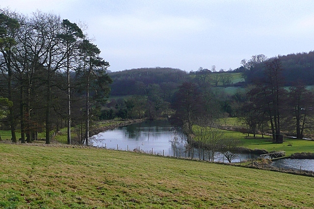
River Chess. Below Latimer Park Farm, which has a lake formed from the River Chess, it appears that another small lake has been created here, as the river is wider than one would expect.
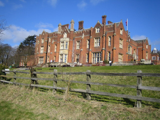
Latimer House. Latimer House. Built in 1838 and replacing an old manor house on the site, this was originally the home of Lord Chesham. From 1947 to 1983 it was used as the Joint Services Staff College, which existed to train officers to fill joint command and staff appointments by studying modern war on a joint service basis and by widening their knowledge of inter-service problems.
Latimer: River Chess & Great Water. The weir at the downstream end of Latimer Park's Great Water lake is on the right, with the River Chess on the left, viewed looking upstream from the Flaunden Bottom road bridge.
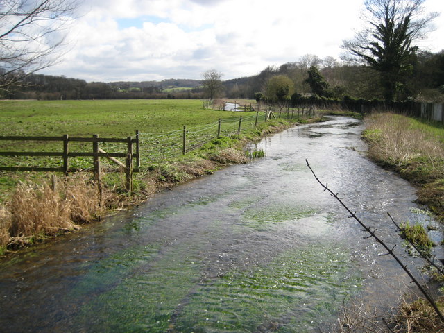
River Chess at Chenies Bottom. Viewed looking downstream from the bridge on the road to Flaunden with water meadows on the left.
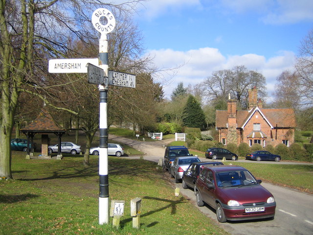
Chenies village. Viewed looking westwards across the village green. The village pump is visible to the left of the old style road sign, and the house in the distance has a plaque indicating that it was built in 1857.
Chenies. The Manor House, a popular local attraction. The fine Tudor House is a Grade I listed building and is surrounded by award-winning gardens. Original 13th Century features including a Medieval well, a dungeon and a reputed priest hole. You can tour the house and garden for a fee, from April to October.
