Littleborough Walks
![]()
![]() The town of Littleborough has a lot of great options for walkers visiting the region. It is nicely located in the upper Roch Valley by the foothills of the South Pennines. There's several waymarked trails, hill climbs, reservoirs and a canal running through the area.
The town of Littleborough has a lot of great options for walkers visiting the region. It is nicely located in the upper Roch Valley by the foothills of the South Pennines. There's several waymarked trails, hill climbs, reservoirs and a canal running through the area.
This circular walk visits several of the highlights of the area using a some of the waymarked trails that circle the town. The walk starts at the train station which lies on the Caldervale Line 13¾ miles (22 km) north of Manchester Victoria towards Halifax, Bradford Interchange and Leeds. From here you can pick up the Station Walk and follow it south to visit Hollingworth Lake. The lake is a popular local attraction with a waterside trail and lots of wildlife to look out for on the water.
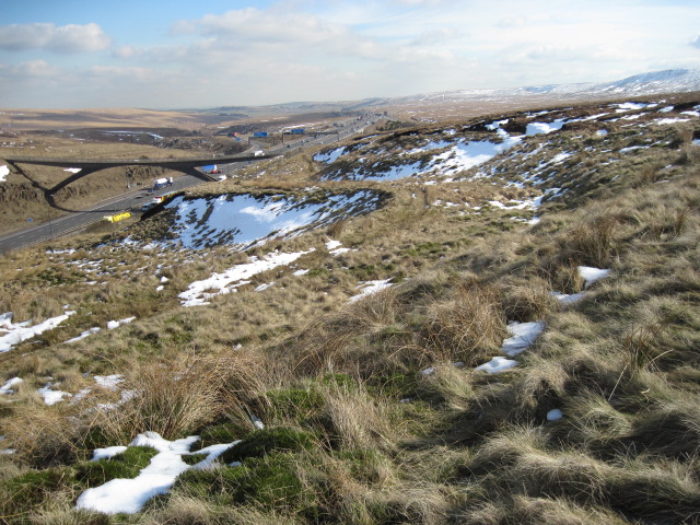
The route then picks up a section of the Pennine Bridleway, following it east towards Longdon Clough. The route then follows a different bridleway up to Windy Hill and Rook Stone Hill, where you pick up the Pennine Way National Trail. This will take you north to another highlight of the area at Blackstone Edge. This geologically significant gritstone escarpment commands wonderful views over Greater Manchester and Yorkshire. The path will take you north along the Edge to Blackstone Edge Reservoir where there's some more nice waterside trails.
At the resevoir you continue west and then north around the Chelham Reservoirs before picking up the Rochdale Canal. You can then follow the towpath south back to the train station.
Littleborough Ordnance Survey Map  - view and print off detailed OS map
Littleborough Open Street Map  - view and print off detailed map
Littleborough OS Map  - Mobile GPS OS Map with Location tracking
Littleborough Open Street Map  - Mobile GPS Map with Location tracking
Walks near Littleborough
- Hollingworth Lake - Enjoy a lovely circular walk around this 130 acre reservoir in Littleborough
- South Pennine Water Trail - This circular walk around Littleborough includes waterside trails along Hollingworth Lake and the Rochdale Canal
- Ogden Reservoir and Piethorne Reservoir - Explore this area of the Piethorne Valley on this circular walk in the Metropolitan Borough of Rochdale, Greater Manchester
- Rochdale Canal - Follow the Rochdale canal from Manchester to Sowerby Bridge on this waterside route through Greater Manchester and Yorkshire
- Rochdale Way - A fabulous circular walk around Rochdale which visits a series of lovely reservoirs and includes a section along the River Roch
- Blackstone Edge - Climb to this gritstone escarpment in the Pennine Hills and enjoy wonderful views over Greater Manchester and Yorkshire
- Pennine Bridleway - This fabulous 120 mile long trail runs through the beautiful Derbyshire Peak District, through Lancashire and on into Yorkshire.
It is suitable for mountain bikers, horse riders and walkers taking you on a tour through some of the most beautiful parts of the country - Pennine Way - This fabulous 268 mile path takes you through three of England's finest national parks
- Weighver's Way - This is a terrific, challenging walk from Littleborough to Catley Lane Head, Rochdale.
The path begins at the lovely Hollingworth Lake and heads through Littleborough along the Rochdale Canal
Pubs/Cafes
Next to Hollingworth Lake is the splendid Wine Press. This contemporary British Restaurant includes a lovely outdoor seating area where you can enjoy fine views over the lake with your lunch. There's also an attractive modern interior for cooler days.
There's also a couple of fantastic old pubs with great views near Blackstone Edge. The White House is located next to Blackstone Edge Reservoir and an inn of some note. The remote pub is in a fabulous location in an elevated position on the Halifax Road with panoramic views of the surrounding moors and Hollingworth Lake far below. It also has a wonderful history being originally an old coaching house dating from 1671. It is situated 1,300 feet above sea level and includes an outdoor seating area where you can relax on warmer days. The pub has an extensive menu and a nice cosy interior. You can find it at postcode OL15 0LG for your sat navs.
Just up the road is the Moorcock Inn, located at the foot of the Pennines in Littleborough. There's more great countryside views from the garden area with home-made food and fine real ales on tap. It's also located on the Halifax Road at postcode OL15 0LD.
Photos
Looking across the lake from the visitor facilities at SD937147. The white building is The Winery pub/restaurant at the junction of Hollingworth Road and Rakewood Road 500 metres away. Above the pub construction work at Cleggswood is underway.
War memorial at Littleborough. Littleborough's stone-built town centre is designated as a Conservation Area for its special architectural qualities. The town, its suburbs of Calderbrook and Smithy Bridge, and the surrounding countryside contain 79 listed buildings that are recorded in the National Heritage List for England. This includes the 15th century timber framed Stubley Old Hall and Shore Hall which dates to 1605.
The River Roch flowing through Littleborough. The river is a tributary of the River Irwell. Rising on Chelburn Moor (south of Todmorden in the Pennines), the river flows south through Littleborough towards Rochdale where it is joined by the River Beal at Belfield, and the River Spodden from Whitworth. Turning west it runs past Heywood and Bury before meeting the River Irwell just to the east of Radcliffe.


