Llantwit Major to Nash Point Walk
![]()
![]() This pleasant town in the Vale of Glamorgan has some lovely coastal walks along the Bristol Channel. You can stroll down to Colhugh Beach which has the remnants of an Iron Age fort and some of the finest examples of Jurassic Period fossils in Wales. It's also a popular spot for surfers when the conditions are right.
This pleasant town in the Vale of Glamorgan has some lovely coastal walks along the Bristol Channel. You can stroll down to Colhugh Beach which has the remnants of an Iron Age fort and some of the finest examples of Jurassic Period fossils in Wales. It's also a popular spot for surfers when the conditions are right.
In the town there's medieval cobbled streets and some fine 15th and 16th century buildings to see. Of particular interest to historians is the 13th-century St Illtyd's Church, which was built near the ancient monastery. The church is a Grade I listed building and one of the oldest parish churches in Wales. It highlights the significance of the town as the most important early Christian settlement in Wales, founded by St Illtud.
This walk takes you from the town to the coastal viewpoint at Nash Point. It's about a 4 mile walk from the town to the lighthouse along a reasonably flat path which forms part of the Glamorgan Heritage Coast.
Start the walk from the town centre near to the visitor centre. From here you can pick up footpaths and head south to meet up with the Afon Col-Huw. You then follow the river down to Llantwit Major beach.
The route then heads west to Tresilian Bay where there's an old Second World War pill box and some fine views.
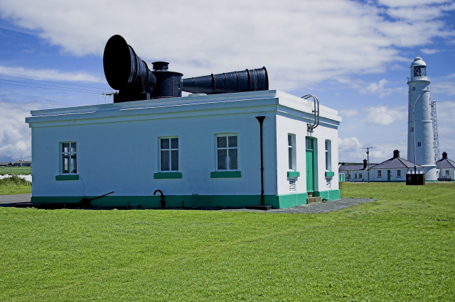
The route continues to St Donat's, passing the college and medieval castle before coming to Nash Point. Here you'll find a Grade II listed lighthouse, which dates from 1831-32. There's some wonderful cliff top views over the Bristol Channel from here. After taking in the views you return to the town on the same paths.
Llantwit Major Ordnance Survey Map  - view and print off detailed OS map
Llantwit Major Open Street Map  - view and print off detailed map
*New* - Walks and Cycle Routes Near Me Map - Waymarked Routes and Mountain Bike Trails>>
Llantwit Major OS Map  - Mobile GPS OS Map with Location tracking
Llantwit Major Open Street Map  - Mobile GPS Map with Location tracking
Walks near Llantwit Major
- Nash Point - This coastal circular walk in the Vale of Glamorgan visits Nash Point Lighthouse on the Monknash Coast
- Glamorgan Heritage Coast - This walk follows a section of the lovely Glamorgan Heritage Coast from Southerdown to Dunraven Bay and Nash Point lighthouse and St Donat's Castle
- Cowbridge - This attractive market town is located in the Vale of Glamorgan near to Cardiff and Bridgend
- Church College and Lighthouse Walk - A 9 mile circular walk along the beautiful Glamorgan Heritage Coastline.
Pubs/Cafes
Head to the Old Swan Inn for some refreshments after your walk. The pub dates all the way back to the 12th Century and includes a charming old interior with log fires and oak beams. They have a very good menu and a lovely garden area to relax in on warmer days. You can find the pub on Church Street with a postcode of CF61 1SB for your sat navs.
Dog Walking
The coastal paths and the beach make for a fine dog walk. The Old Swan Inn mentioned above is also dog friendly.
Further Information and Other Local Ideas
Just a few miles to the north you'll find the neighbouring town of Cowbridge. Here you can try the circular Cowbridge Walk. This pleasant route explores the attractive market town with its Physic Garden and pretty riverside park.
Head north east of the town and you can explore the Hensol Forest, where there's miles of peaceful trails and a tranquil lake to see.


