Modbury Walks
![]()
![]() This large village in South Devon is a nice place to enjoy a stroll. There's an attractive high street with lots of independent shops, a Grade I listed 14th century church and some lovely countryside to explore.
This large village in South Devon is a nice place to enjoy a stroll. There's an attractive high street with lots of independent shops, a Grade I listed 14th century church and some lovely countryside to explore.
This circular walk from the village explores the footpaths and country lanes to the south of the settlement. You'll visit the Mill Leat, Little Modbury and the Ayleston Brook on the walk. On the way there's some lovely views of the surrounding countryside and rolling hills.
Postcode
PL21 0QR - Please note: Postcode may be approximate for some rural locationsModbury Ordnance Survey Map  - view and print off detailed OS map
Modbury Open Street Map  - view and print off detailed map
Modbury OS Map  - Mobile GPS OS Map with Location tracking
Modbury Open Street Map  - Mobile GPS Map with Location tracking
Walks near Modbury
- Erme Plym Trail - Follow the Erme - Plym trail from Ivybridge to Laira Bridge on the outskirts of Plymouth on this pleasant walk through Devon
- Kingsbridge and Bowcombe Creek - Enjoy a circular walk to the lovely Bowcombe Creek from the popular market town of Kingsbridge in the South Devon AONB
- Salcombe and Bolt Head Circular Walk - This coastal circular walk takes you from Salcombe to the coastal headland at Bolt Head
- Prawle Point - Visit this wonderful coastal headland on this exhilarating walk in South Devon
- Bolberry Down - This easy circular walk explores the National Trust owned Bolberry Down on the Devon coast
- Gara Rock - This circular walk on the South Devon coast visits Gara Rock from East Portlemouth
- Bigbury on Sea - This attractive seaside village is located in the South Hams area of South Devon
- Avon Estuary Walk - This lovely circular walk explores both sides of the beautiful Avon Estuary in south Devon
- Burgh Island - Visit this beautiful island off the south coast of Devon on this lovely coastal walk
- Loddiswell - This Devon based village has some lovely walking trails to follow through the Avon Valley
- Blackdown Rings - This walk visits an ancient Iron Age Hillfort and viewpoint in South Devon near Loddiswell.
- Wembury Point - This delightful area near Plymouth has recently been restored by the National Trust
- Yealmpton - This village in South Devon sits in a pleasnt riverside location just east of Plymouth
- Aveton Gifford - This short circular walk explores the area around the little village of Aveton Gifford in Devon.
- Soar Mill Cove - This circular walk explores the beautiful Soar Mill Cove on the Devon Coast.
Further Information and Other Local Ideas
Just to the west you can pick up the Erme Plym Trail in the neighbouring village of Ermington.
Head south west and you could visit the delightful Wembury Point. There's a marine reserve here with a variety of sea birds and some of the most significant rock pools in the country. The Yealmpton Walk visits the area from the nearby village which lies on the River Yealm. In the pretty settlement you could visit the 400 year old Mother Hubbard's cottage. The quaint old dwelling provided the inspiration for the famous nursery rhyme.
For more walking ideas in the area see the Devon Walks page.
Photos
Looking down Galpin Street towards the town centre. This was once the main road in from the east, continuing along the line of Broad Street (centre right) and Church Street, but it is now a minor lane.
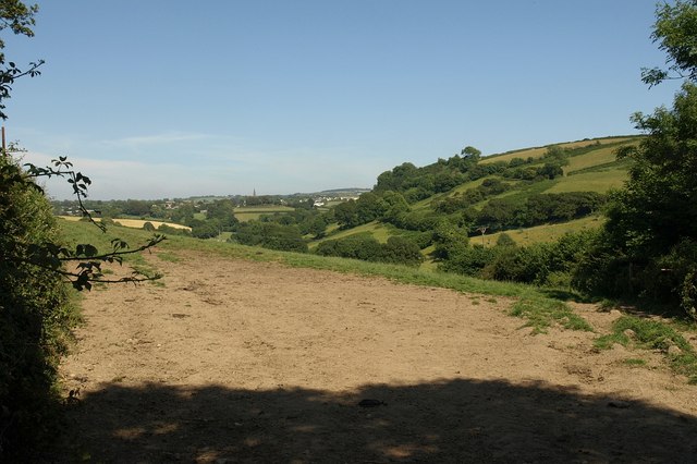
Hillside overlooking Modbury. Shadows on the hill north of Little Modbury farm. The centre of Modbury is half a mile to the left. Seen from a gateway on the lane to Hunts Cross.
Bluegate Hill. Tufted vetch and other summer blooms brighten the laneside by this junction of the road with Cottlass Lane, dropping down to the right into the Ayleston Brook.
Maize field and view to the north of the village. The west side of a maize field, seen from the road between Mary Cross and Sheepham. The hedge on the far side of the Sheepham Brook valley leads up to Ridge Road. (This point is at the extreme top left of that photo). In the distance, Western Beacon and southern Dartmoor.


