Monkton Combe Walks
![]()
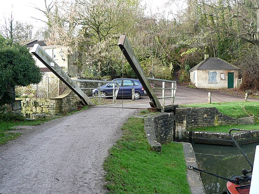
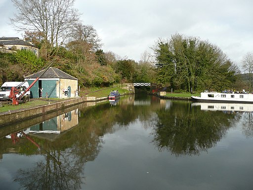
![]() This Somerset based village is located near the historic city of Bath. It has some lovely waterside trails along the Somerset Coal Canal, the Kennet and Avon Canal and the River Avon.
This Somerset based village is located near the historic city of Bath. It has some lovely waterside trails along the Somerset Coal Canal, the Kennet and Avon Canal and the River Avon.
Monkton Combe is also noted for its prominent public school which owns several of the historic buildings you can see in the village.
This circular walk from the village visits Dundas Aqueduct, the Kennet and Avon Canal , Avoncliff and the neighbouring village of Freshford.
The walk starts in the village and heads east to visit the impressive Dundas Aqueduct. The photogenic structure is a Scheduled Ancient Monument carrying the Kennet and Avon Canal over the River Avon (the Somerset / Wiltshire border) and the Wessex Main Line railway from Bath to Westbury.
The route then picks up a waterside path along the River Avon, heading south past Conkwell Wood before coming to Avoncliff. Here you'll find the 18th century Avoncliff Aqueduct, a Grade II listed structure. From the top there are some excellent views over the surrounding countryside.
After crossing the river you head west past Avoncliff Wood to the village of Freshford where theres a 16th century pub and a train station.
The final section passes Limpley Stoke and Chatleigh House before returning to the village.
Postcode
BA2 7HB - Please note: Postcode may be approximate for some rural locationsMonkton Combe Ordnance Survey Map  - view and print off detailed OS map
Monkton Combe Open Street Map  - view and print off detailed map
*New* - Walks and Cycle Routes Near Me Map - Waymarked Routes and Mountain Bike Trails>>
Monkton Combe OS Map  - Mobile GPS OS Map with Location tracking
Monkton Combe Open Street Map  - Mobile GPS Map with Location tracking
Walks near Monkton Combe
- Dundas Aqueduct - This waterside walk visits the impressive Dundas Aqueduct in Somerset
- Kennet and Avon Canal Walk - A splendid waterside walk from the Thames at Reading, through Thatcham, Newbury, Hungerford, Great Bedwyn, Pewsey, Devizes, Bradford on Avon to Bath
- Somerset Coal Canal - Follow the Somerset Coal Canal from Tucking Mill to Combe Hay on this easy walk in the Cotswolds
- Avoncliff - A circular walk from Avoncliff, visiting the impressive Avoncliff Aqueduct, the Kennet and Avon Canal and the River Avon.
You can start the walk from the car park on the south side of the river in Avoncliff - Freshford - This circular walk from the Somerset village of Freshford takes you to Avoncliff with its splendid aqueduct on the River Avon and Kennet and Avon Canal.
The walk starts from Freshford train station which is on the Great Western Railway - Bradford on Avon Canal and River Walk - The West Wiltshire town of Bradford on Avon is a great place for walkers, officially recognised as a Walkers are Welcome town
- Barton Farm Country Park - This delightful country park is conveniently situated near Bradford On Avon town centre
- Bath Canal Walk - This is a popular walk along the Kennet and Avon Canal from Bath to Bradford on Avon
- Bath Skyline Walk - Enjoy wonderful views of the city of Bath on this popular circular walk
- Limestone Link - Starting at Cold Ashton in St Catherine's Valley, Gloucestershire follow the Limestone Link from the Cotswolds to the Mendip Hills in Somerset.
The walk first heads south towards Batheaston where you join the River Avon and the Kennet and Avon Canal for a lovely waterside stretch to Monkton Coombe - Warleigh Weir Walk - This walk takes you along a section of the Kennet and Avon Canal Walk to the picturesque Warleigh Weir.
Pubs/Cafes
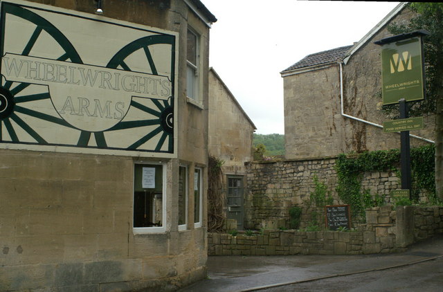
Head to the Wheelwright's Arms for some refreshments after your walk. The building dates back to the 18th century and includes a noteworthy large garden which can seat up to 140 people. They serve a fine Sunday lunch and also provide accommodation if you need to stay over. You can find them on Church Lane with postcode BA2 7HB for your sat navs.
Dog Walking
The woodland, country and waterside paths make for a fine dog walk. The Wheelwright's arms mentioned above is also dog friendly.
Further Information and Other Local Ideas
The settlement is located near Bath where you can pick up the popular Bath Canal Walk and Bath Skyline Walk.
For more walking ideas in the area see the Somerset Walks page.
Photos
From Summer Lane near the village. Midford Brook is at the bottom of the valley, Monkton Combe to the left and Midford about 1.5 miles to the right.


