New Mills River and Canal Walk
![]()
![]() A circular waterside walk around the Peak District town of New Mills with sections along the River Goyt and the Peak Forest Canal. The varied walk also visits a wonderful local park and a lovely nature reserve with peaceful woodland trails. It runs for just over 5 miles on fairly flat paths so is quite an easy walk.
A circular waterside walk around the Peak District town of New Mills with sections along the River Goyt and the Peak Forest Canal. The varied walk also visits a wonderful local park and a lovely nature reserve with peaceful woodland trails. It runs for just over 5 miles on fairly flat paths so is quite an easy walk.
The walk starts from New Mills central rail station and heads east to the Torrs Riverside Park and Millennium Way. It's a delighful spot with a beautiful river gorge and a 160 metre long walkway elevated over the waters of the River Goyt. Here you can also see the Torrs Hydro, a micro hydroelectric scheme which makes enough electricity to supply 70 homes.
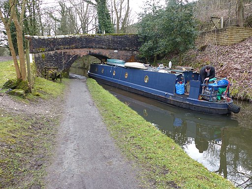
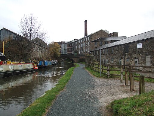
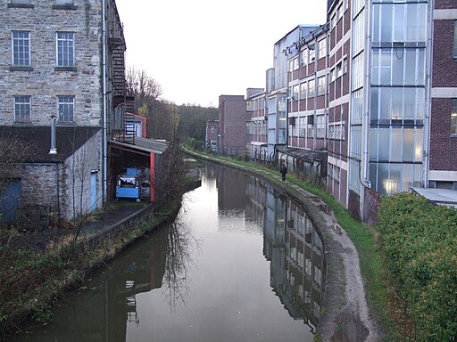
From the park you then head south along a section of the Goyt Way which takes you to the canal. Follow the towpath west past Newtown and Brunswick Mill to Woodend where you can rejoin with the river. The riverside trail heads east taking you past Disley Paper Mill to Mousley Bottom Nature Reserve. There's some nice woodland trails with lots of wildlife to look out for here.
Shortly after passing through the reserve you return to the train station where the walk finishes.
To extend the walk you can continue along the canal to Marple and visit the noteworthy Marple Canal Locks.
The Sett Valley Trail also starts in the town. The popular cycling and walking trail runs through the beautiful Sett Valley from New Mills to Hayfield, which is a great base for exploring the Kinder Plateau.
New Mills Ordnance Survey Map  - view and print off detailed OS map
New Mills Open Street Map  - view and print off detailed map
New Mills OS Map  - Mobile GPS OS Map with Location tracking
New Mills Open Street Map  - Mobile GPS Map with Location tracking
Walks near New Mills
- Peak Forest Canal - Travel from Derbyshire into Greater Manchester on this waterside walk along the Peak Forest Canal
- Sett Valley Trail - This splendid cycling and walking trail runs through the beautiful Sett Valley in the Peak District
- Goyt Way - Follow the Goyt Way along the Peak Forest Canal and the River Goyt on this lovely waterside walk through Greater Manchester and Derbyshire.
The walk starts by Etherow Country Park Lake in Compstall and heads south through Marple and New Mills to Whaley Bridge - Torrs Riverside Park and Millennium Way - This special park in New Mills takes you through a beautiful river gorge with a fabulous 160 metre long walkway elevated over the water.
- Marple Canal Locks - This easy walk takes you along a particularly lovely section of the Peak Forest Canal in Marple
- Macclesfield Canal - Follow the towpath of the Macclesfield Canal from Marple to Kidsgrove on this waterside walk in Cheshire
- Lyme Park - This is a circular walk through the splendid Lyme Park in Disley, Cheshire
- Chadkirk Country Estate - This pretty country park is located on the River Goyt near Marple
- Romiley - This village in Greater Manchester has some nice local parks and a canal to explore on foot.
- Etherow Goyt Valley Way - The Goyt Valley is an excellent place for walks with fine riverside trails along the Rivers Goyt and Etherow
- Etherow Country Park - Enjoy a stroll along the River Etherow and around the large reservoir in this pretty country park near Marple and Stockport
- Mellor - This circular walk takes you up to the Mellor Cross on Mellor Moor in Greater Manchester.
- Pott Shrigley - This little village in the Peak District is close to some splendid hill climbs and canalside trails
- Cown Edge Way - Visit the striking Cown Edge rocks on this walk through Greater Manchester and Derbyshire
- Marple Bridge - This pretty village in Greater Manchester has some nice river and canalside trails to try
Pubs/Cafes
The Rock Tavern is in a good location close to the river and the Torrs Riverside Park. They have a good menu and a sunny garden area if the weather is fine. You can find them at Wirksmoor Road with a postcode of SK22 3HJ. They are also dog friendly if you have your canine friend with you.
Further Information and Other Local Ideas
The neighbouring village of Disley is another good base for starting a walk in the area. The circular Disley Walk starts from the train station and visits the National Trust's Lyme Park and the Macclesfield Canal. The expansive park is one of the walking highlights of the area and includes a historic hall and resident deer.
Near Marple Bridge there's the climb to the Mellor Cross. The religous cross marks the site where John Wesley preached during the 18th century. There are fine views from the elevated position of the site.
Also nearby is the pretty little hamlet of Rowarth. Here you will find the Little Mill Inn, a delightful Grade II listed inn set in a former candlewick mill, with a waterwheel in the adjacent stream. The historic mill is well known locally and includes an outdoor area with ducks and geese on the river, chickens roaming free and rabbits in a large outdoor pen. Our walk from the village climbs to the geologically fascinating Cown Edge Rocks and Robin Hood's Picking Rods.
For more walking ideas in the area see the Peak District Walks page.
Photos
New Mills, Torrs Hydro. View of the Union Bridge which lies close to the confluence of the River Sett and the River Goyt
New Mills. Splendid view of the Goyt valley from Peak Forest Canal towpath. The Midland Railway viaduct can be seen in the middle of the photo.


