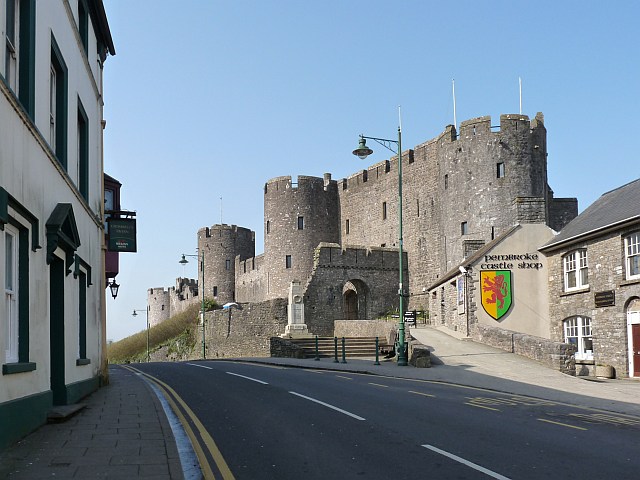
Pembroke Castle
![]()
![]() This is a short walk around the fascinating medieval Pembroke Castle. It's an attractive area with the castle surrounded by a large Mill Pond.
This is a short walk around the fascinating medieval Pembroke Castle. It's an attractive area with the castle surrounded by a large Mill Pond.
This walk starts near the castle at a parking area in the town and explores the castle grounds before crossing the mill pond bridge for a great view across the water to the castle. You can return the same way or head through the town. Here you can explore Pembroke Dock and enjoy a walk along the River Pembroke to the Daugleddau estuary.
To continue your walk you can pick up the Pembrokeshire Coast Path which runs past the castle. Following it north will take you to Neyland and then on to Milford Haven.
Postcode
SA71 4LA - Please note: Postcode may be approximate for some rural locationsPlease click here for more information
Pembroke Castle Ordnance Survey Map  - view and print off detailed OS map
Pembroke Castle Open Street Map  - view and print off detailed map
Pembroke Castle OS Map  - Mobile GPS OS Map with Location tracking
Pembroke Castle Open Street Map  - Mobile GPS Map with Location tracking
Explore the Area with Google Street View 
Walks near Pembroke
- Pembrokeshire Coast Path - Brace yourself for some spectacular coastal scenery on this magnificent 186 mile trail that passes through the Pembrokeshire Coast National Park
- Milford Haven - The town of Milford Haven is in an ideal location for exploring the wonderful Pembrokeshire Coast.
This walk heads west along the coast path to visit the Dale Peninsula and Marloes Sands - Carew Castle - This fine castle in Pembrokeshire has a lovely one mile circular walking trail taking you around the pretty 23-acre Millpond
- Lawrenny Quay and the Daugleddau River - Enjoy woodland trails and riverside paths on this walk in the heart of the Pembrokeshire Coast National Park
- Landsker Borderlands Trail - A super circular walk through the Pembrokeshire and Carmarthenshire countryside visting the River Cleddau estuary, the Ogham stones, the Norman castles at Llawhaden and Carew Castle as well as the prehistoric remains at Llawhaden.
- Freshwater West - This walk from Freshwater West explores the Pembrokeshire coast around the lovely Freshwater Bay and the village of Angle.
- Llangwm - These pretty little Pembrokeshire village is located in a fine spot on the western side of the River Cleddau estuary near Haverfordwest.
Further Information and Other Local Ideas
Just to the east of the town you can continue your historical walking with a visit to Carew Castle. The noteworthy site includes the only restored tidal Mill in Wales and one of just five in the UK. Near here you can pick up the Lawrenny Quay Walk and enjoy riverside walking along the Cresswell River and the Daugleddau River. The epic Landsker Borderlands Trail also passes through the area.
Head south west and you can visit Freshwater West where there's a lovely beach with sand dunes and rock pools. There's also a fine circular walk around Angle Bay and the village of Angle starting from here.
Photos
Pembroke Castle and the River Pembroke. Taken from Mill Bridge in Northgate Street and showing the north and east walls of the castle. The Pembroke River would be tidal at this point but for a dam a short way downstream from this point.
The entrance to Pembroke Castle. The nearest tower on the right is the Barbican Tower with walls 9 feet thick. Next comes the Gatehouse and By-Gate Tower. The third tower is Henry VII Tower which is believed to be the birthplace of Henry Tudor, later King Henry VII. The tower in the distance is Westgate Tower. Some parts of this side of the castle were restored in the 1930s.
Pembroke Castle Gatehouse. Norman Castle founded in 1093, which was the birthplace of Henry Tudor, who later became Henry VII.
Hobbs Point, Pembroke Dock. The boat has just been towed up a slipway from the Daugleddau estuary. The Cleddau toll bridge is in the background.


