Rookhope Walks
![]()
![]() This village in County Durham is an interesting place for a walk. There's some great North Pennines scenery, nice riverside trails, hill climbs and evidence of the area's lead mining history to see.
This village in County Durham is an interesting place for a walk. There's some great North Pennines scenery, nice riverside trails, hill climbs and evidence of the area's lead mining history to see.
This route from the village uses sections of the Weardale Way to create a circular walk through the area to the south of the settlement.
The walk starts at Bolt's Burn and heads south along the waymarked footpath and the Rookhope Burn. You'll pass Pry Barr and Smailsburn before climbing to the viewpoint at Bishop Seat. You then descend south east to North Hanging Wells and the burn where you'll pass the Turn Wheel Waterfall.
At Eastgate you turn north to head to Ashy Bank and Brandon Walls where there's some woodland trails along the burn. The route then passes Stotfield Burn before returning to the village and finishing by the ford.
Postcode
DL13 2BG - Please note: Postcode may be approximate for some rural locationsRookhope Ordnance Survey Map  - view and print off detailed OS map
Rookhope Open Street Map  - view and print off detailed map
Rookhope OS Map  - Mobile GPS OS Map with Location tracking
Rookhope Open Street Map  - Mobile GPS Map with Location tracking
Walks near Rookhope
- Weardale Way - Follow the River Wear from the coast at Sunderland to Killhope Lead Mining Museum in the Pennines
- Bishop Auckland - This fine town in County Durham has some excellent walking opportunites with the River Wear and River Gaunless running through the town
- Stanhope - This small market town is located in County Durham on the River Wear
- Pow Hill Country Park and Derwent Reservoir - This walk explores Pow Hill Country Park and the expansive Derwent Reservoir in County Durham
- Slalely Forest - This large area of coniferous woodland is located a few miles south of Hexham
- Allendale - The village of Allendale is located in a lovely spot by the River East Allen in the North Pennines Area of Outstanding Natural Beauty
- Edmundbyers - This County Durham based village is located in a lovely spot close to Pow Hill Country Park and Derwent Reservoir.
- Allensford Country Park - Enjoy riverside woodland walks and magnificent views of the Derwent Valley in this country park near Consett
- Whitworth Hall Country Park - Explore 73 acres of parkland surrounding the Grade II listed stately mansion of Whitworth Hall in Spennymoor
Further Information and Other Local Ideas
For more walking ideas in the area see the County Durham Walks and the North Pennines Walks pages.
Photos
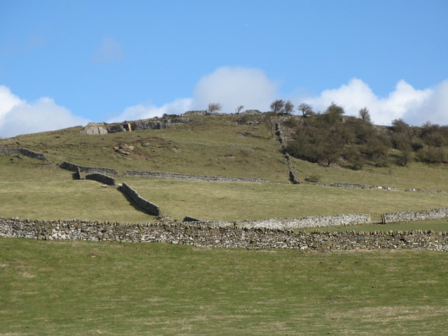
Rookhope village. The lead mining community of Rookhope took its name from the valley and grew up from the originally separate settlements of Boltsburn and Stotsfield. The poet WH Auden was inspired by the decaying industrial heritage in this area. In a letter to Lord Byron (1937) he states: "Tramlines and slagheaps, pieces of machinery. That was, and still is, my ideal scenery."


