Rowlands Castle Walks
![]()
![]() This interesting village is located in East Hampshire, near Portsmouth and Havant. It includes an unusual lung shaped village green, the remains of a motte-and-bailey castle and a 19th century church. The village is located in a lovely spot for walkers being close to the South Downs, Stansted Park, the Forest of Bere and the south coast.
This interesting village is located in East Hampshire, near Portsmouth and Havant. It includes an unusual lung shaped village green, the remains of a motte-and-bailey castle and a 19th century church. The village is located in a lovely spot for walkers being close to the South Downs, Stansted Park, the Forest of Bere and the south coast.
This loop from the town visits some of the highlights of the area including Stansted Forest, Stansted Park, Havant Thicket and Staunton Country Park. All of these locations are within walking distance of the village and provide scenic footpaths and lovely views.
The walk starts from the train station, just to the east of the village centre. The station is on the Portsmouth Direct Line between London Waterloo and Portsmouth served by the generally hourly stopping service. From the station you can pick up the Monarch's Way and follow the waymarked trail east along the Avenue through Stansted Forest to Stansted Park. The expansive park is an excellent place for walkers with 1800 acres of parkland surrounding the Edwardian Stansted House.
After exploring the park the route then heads back along the Sussex Border Path and then through the forest to visit Havant Thicket. The peaceful woods form part of the wider the Forest of Bere. There's a network of fine trails with woodland birds and deer to look out for on the way. From the thicket it's a short walk south into the adjacent Staunton Country Park. There's two pretty lakes and more woodland trails here. You can pick up the Staunton Way in the park and follow it north back to the village and the train station.
Rowlands Castle Ordnance Survey Map  - view and print off detailed OS map
Rowlands Castle Open Street Map  - view and print off detailed map
Rowlands Castle OS Map  - Mobile GPS OS Map with Location tracking
Rowlands Castle Open Street Map  - Mobile GPS Map with Location tracking
Pubs/Cafes
Back in the village head to the Castle Inn for some post walk refreshments. The pub has an interesting history when in 1853, the pub (which was then called The White Hart) had to make way for the new railway. Rather than be demolished, the pub was moved to its current location and painstakingly rebuilt brick by brick. They do delicious home-cooked dishes, crafted from fresh, seasonal local produce. There's also a lovely large garden area to sit out in on warmer days. You can find them just south of the train station on Finchdean Road at a postcode of PO9 6DA for your sat navs. On the route there's also the lovely Pavilion Tea Room at Stansted Park.
Dog Walking
The woodland, parkland and countryside on the route are ideal for dog walking. The Castle Inn mentioned above is also dog friendly. Dogs are not allowed in the gardens, maze and house at Stansted Park though.
Further Information and Other Local Ideas
If you head a few miles south from the village you will come to the south coast. Here you can try the Emsworth Walk and visit the picturesque harbour in this attractive coastal village.
If you head east along the Monarch's Way to Stoughton you will come to another highlight of the area at the Kingley Vale National Nature Reserve. Here you can enjoy a large yew forest, lots of wildlife and fabulous views over the South Downs towards the south coast.
To forther explore the Forest of Bere head to Creech Woods near Denmead and West Walk where there are miles of peaceful woodland trails to try.
A few miles to the north there's another a splendid viewpoint at Harting Down. There's also the nearby village of South Harting where you could pay a visit to the National Trust's Uppark. Here you'll find a fine 17th century Georgian House surrounded by lovely gardens with views of the English Channel. The author H.G Wells stayed in the house during the late 19th century. The class divisions he observed here inspired his socialist views which later manifested themselves in work such as 'The Time Machine'. You can find the house at postcode GU31 5QR.
Just to the north you can pick up the Clanfield Walk and visit Butser Ancient Farm and Windmill Hill. The farm is one of the area highlights and includes an archaeological open-air museum with reconstructions of Neolithic dwellings, Iron Age roundhouses, a Romano-British villa and an early Saxon house.
For more walking ideas in the area see the South Downs Walks and Hampshire Walks pages.
Cycle Routes and Walking Routes Nearby
Photos
Rowlands Castle. Nice view across the distinctive village green. No one knows for sure where Rowlands Castle got its name. It is possible that the Castle gave the village its name although it is suggested that Rowlands Castle may be a corruption of much older Celtic words.
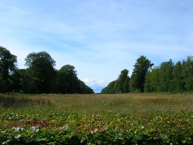
The Avenue, Stansted Forest. This avenue is a mile and a half long and was laid out in the early 18th century and replanted with beech trees in 1820. According to Daniel Defoe who visited in 1724, "... [you could] see the town and harbour of Portsmouth, the ships at Spithead and also at St Helens [Isle of Wight]," all from the dining room of Stansted House. This view was taken from the road to Forestside that crosses this avenue.
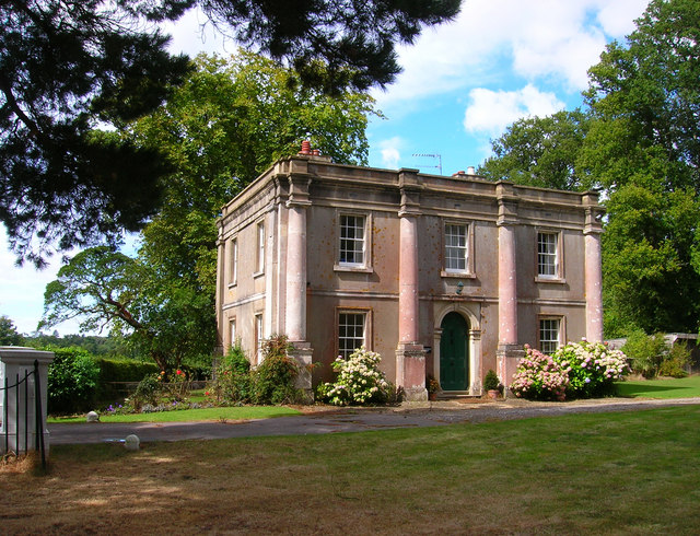
Emsworth Lodge, Stansted House. This entrance leads to the garden centre of Stansted House. The lodge itself was built in 1820 when the grounds were laid out.
Racton Monument. The 80 ft (24m) high folly dates from the 18th century and affords wonderful views to the Isle of Wight. The structure was commissioned by the 2nd Earl of Halifax, either as a summerhouse for the nearby Stansted Estate or so he could watch his merchant ships dock at the nearby port, Emsworth, or as a personal viewing tower to watch for his son's return from an ill-fated voyage.


