Rowsley to Chatsworth and Bakewell Walk
![]()
![]() This village is located in a lovely spot in the Derbyshire Dales area of the Peak District. It is notable as being on the border of the Peak District National Park which runs through the village west of the River Wye and immediately to the north of Chatsworth Road. Rowsley is also near the point where the River Wye flows into the River Derwent.
This village is located in a lovely spot in the Derbyshire Dales area of the Peak District. It is notable as being on the border of the Peak District National Park which runs through the village west of the River Wye and immediately to the north of Chatsworth Road. Rowsley is also near the point where the River Wye flows into the River Derwent.
The village is home to the Peak Shopping Village. There's a good range of stores with plenty of eateries for refreshment. At the time of writing a new nature reserve on the banks of the Derwent is being created by the shopping outlet and Derbyshire Wildlife Trust.
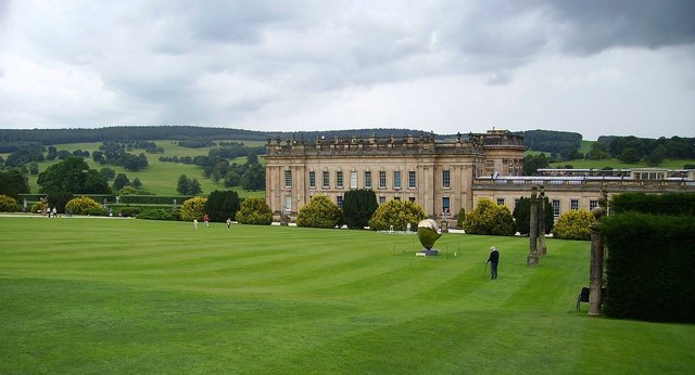
This circular walk from the village visits Chatsworth Park, Bakewell and the historic Haddon Hall Park.
The walk starts in the village and heads north along the Derwent Valley Heritage Way to Calton Lee and Chatsworth. This section runs along a waymarked footpath, running alongside the Derwent River.
From Chatsworth you head west through the countryside to Edensor to Bakewell.
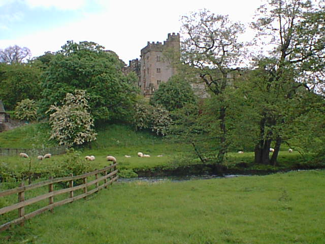
At Bakewell you pick up a section of the Monsal Trail and follow it south towards Haddon Hall. The hall is another of the highlights of the area and located just a few miles west of the village on the River Wye. The hall dates from the 11th century with additions at various stages between the 13th and the 17th centuries. The fine stately home also includes a grand Tudor hall and Elizabethan gardens. From the hall the route finally heads east to return to Rowsley.
Rowsley Ordnance Survey Map  - view and print off detailed OS map
Rowsley Open Street Map  - view and print off detailed map
*New* - Walks and Cycle Routes Near Me Map - Waymarked Routes and Mountain Bike Trails>>
Rowsley OS Map  - Mobile GPS OS Map with Location tracking
Rowsley Open Street Map  - Mobile GPS Map with Location tracking
Pubs/Cafes
The Peacock hotel includes a fine restaurant which has been awarded three AA rosettes. The hotel dates from the 1830s and is part of the Haddon Estate, owned by Lord and Lady Edward Manners who live at nearby Haddon Hall. At The Peacock there's also an informal bar area with an open fire and a good lunch menu. They have a lovely garden area and are located in a fine spot close to the river in the village. You can find them on Bakewell Road at postcode DE4 2EB for your sat navs.
There's also the Grouse and Claret which is housed in an attractive 18th Century building. They have a light conservatory and a beautiful beer garden with fine views of the Derbyshire countryside. There's a delightful interior with books, pictures and charming country farmhouse décor. They serve high quality food including delicious Rotisserie chicken. You can find them on Station Road with a postcode of DE4 2EB for your sat navs.
Peak Shopping village mentioned above also has cafes at the complex.
Dog Walking
The river, country and woodland trails on the walk are ideal for dogs. Dogs are not allowed however, at Haddon Hall aside from guide and support dogs. They do provide water bowls in the car park and you can walk along the public footpaths opposite the hall though. At Chatsworth dogs are allowed on leads in the grounds but not in the house. There are bins dotted around the estate and doggy drinking stations are available near the toilets, adjacent to the gate that leads to the entrance to the house, and also in the Stables courtyard near the Carriage House Cafe exit. The Grouse and Claret pub mentioned above is also dog friendly.
Further Information and Other Local Ideas
Just to the north is the neighbouring village of Beeley where you can explore the expansive Beeley Moor and visit the village's excellent 18th century coaching inn. Just to the north east of the moor there's the fascinating Hob Hurst's House. Here you will find an ancient Bronze Age burial mound and fine views from Harland Edge.
Head south and you can explore Darley Dale where you'll pass Churchtown and Darley Bridge. Near here you can also visit the popular town of Matlock, Stanton Moor and the interesting Bronze Age Nine Ladies Stone Circle.
If you head north you could visit the neighbouring village of Baslow and enjoy a climb to Baslow Edge.
For more walking ideas in the area see the Peak District Walks and the White Peak Walks pages.


