Salthouse Circular Walk
![]()
![]() This circular walk explores the area around Salthouse on the Norfolk coast. You'll visit the local beaches before heading up to the nearby Kelling Heath.
This circular walk explores the area around Salthouse on the Norfolk coast. You'll visit the local beaches before heading up to the nearby Kelling Heath.
The walk starts in the village and follows footpaths north to the coast at Salthouse Marshes. This area is also a nature reserve and a great place to look out for a number of coastal birds. At Little Eye you pick up the Peddars Way and Norfolk Coast Path and follow the waymarked trail along the beach to Gramborough Hill and Kelling Marsh, an area run by the National Trust with a rich Roman history.
You continue east to the neighbouring village of Weybourne, turning inland to pass the settlement where you'll find the remains of the ancient priory and Grade II listed windmill.
The route then climbs to the south towards Kelling Heath. There's a variety of footpaths to follow around the heath with good views from the elevated position of the site. You can pick up the heritage North Norfolk Railway from Kelling Heath Rail Station here too.
The route heads west from the heath to Salthouse Heath, Three Halfpenny Hill to the north. The route then turns north to follow a country lane back to the village, passing Bard Hill on the way.
Postcode
NR25 7XA - Please note: Postcode may be approximate for some rural locationsSalthouse Ordnance Survey Map  - view and print off detailed OS map
Salthouse Open Street Map  - view and print off detailed map
Salthouse OS Map  - Mobile GPS OS Map with Location tracking
Salthouse Open Street Map  - Mobile GPS Map with Location tracking
Pubs/Cafes
Back in the village The Dun Cow is a nice place for some post walk refreshments. The rustic pub serves high quality food and includes a lovely garden area with views to the coast. You can find them on Purdy Street with postcode NR25 7XA for your sat navs.
Dog Walking
The coast, heathland and woodland on the trail makes for a fine dog walk. The Dun Cow mentioned above is also dog friendly.
Further Information and Other Local Ideas
You could hop back on the North Norfolk Railway and further explore the area. Also known as the Poppy line, the old steam trains will take you along the beautiful coast to the Georgian town of Holt where you can explore Holt Country Park. The Holt-Mannington Walk also starts in the park. The circular waymarked footpath will take you south east to Mannington Hall and Gardens near Itteringham. The historic house is surrounded by lovely parkland with delightful gardens, woodland and a lake to see. The return section also passes close to Baconsthorpe Castle. Here you can explore the 15th century ruins of a fortified manor house which includes a moat and a pretty lake.
Just to the east there's the West Runton Walk which climbs to the highest point in Norfolk at Beacon Hill before heading to Beeston Bump.
For more walking ideas in the area see the Norfolk Walks page.
Cycle Routes and Walking Routes Nearby
Photos
The Salthouse Sculpture Trail. The modern sculpture beside the path is one of the first pieces erected along the Salthouse Sculpture Trail - all created by local artists as an ongoing project. Many more are planned and will be added to the trail in the coming months and years.
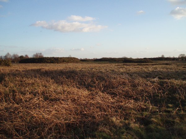
The northern edge of Kelling Heath. Kelling Heath in mid April. The heath is criss-crossed by a network of paths and bridleways including a nature trail and the North Norfolk Railway's smallest 'station' is located here. Salthouse Heath has some of the largest barrow groups in this part of England. In mid-April the gorse is flowering profusely.
View taken in easterly direction from Kelling Halt rail station. Kelling Heath Park Halt, not on the original British Rail line, was opened after the line was preserved and it is used mainly by hikers. It is a request stop only and steam trains do not stop here on the way up to Holt due to difficulties in restarting the train on the gradient.
Salthouse village And St Nicholas' church, viewed from the Salthouse Marshes Nature Reserve by the New Cut. The salt marshes below the village of Salthouse - an area encompassing 66 hectares of coastal grazing marsh populated by saltmarsh plants and traversed by brackish dykes and drains - are one of a number of important sites for migrating and breeding bird species such as avocet, redshank, lapwing, meadow pipit, skylark, reed bunting and sedge and reed warblers. A shingle bank protects the marshland from the North Sea.
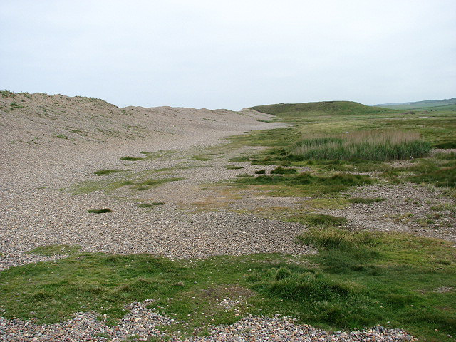
The shingle ridge and Gramborough Hill. The shingle ridge protects the adjacent saltmarshes from the North Sea which lies on the other side. The view is easterly, looking from past the beach car park at the end of Beach Road towards Gramborough Hill, the grassed over spit seen jutting out into the marshes in mid-distance. Gramborough Hill belongs to the National Trust. A Romano-British settlement once occupied this site - a grassed-over hill composed of gravels and sands and a thin layer of top soil - rising from the surrounding marsh to approximately 30 metres in height, offering good views across the surrounding land. It is believed that in Roman times the shoreline reached out into the sea for another mile and that the hill might have been situated on the edge of an estuary, with a fort guarding the entrance. A number of Roman bricks and pottery sherds have been found here over the years, with the most notable find (to-date) being a bronze bird (or duck). The chief feature of the site is a small pit, about 100 cm in diameter and 90 cm deep, sunk in the natural gravel.


