Silent Pool
![]()
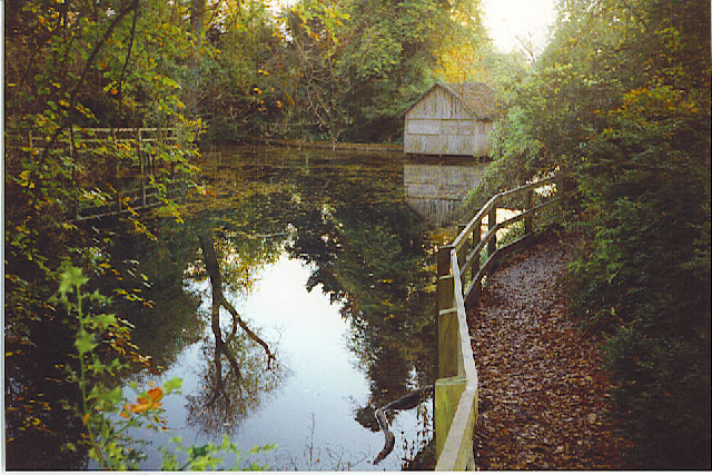
![]() This tranquil lake in the North Downs has a pleasant circular walkway and surrounding woodland trails. You can start your walk from the parking area just off the A25, a few miles east of Guildford.
This tranquil lake in the North Downs has a pleasant circular walkway and surrounding woodland trails. You can start your walk from the parking area just off the A25, a few miles east of Guildford.
The pool is a popular destination with an eerie stillness and folklore tales. It is said King John on his horse abducted a woodcutter's daughter who was forced into the deep water and drowned.
If you'd like to extend your walk you can follow the woodland trail north from the pool and link up with the North Downs Way. You could then continue to the nearby Newlands Corner. Albury Park is also nearby and is also great for walking.
The Fox Way long distance circular trail visits the Albury Estate and the Silent Pool. It will take you on a tour of the countryside, woodland and canals surrounding Guildford.
Postcode
GU5 9BW - Please note: Postcode may be approximate for some rural locationsSilent Pool Ordnance Survey Map  - view and print off detailed OS map
Silent Pool Open Street Map  - view and print off detailed map
Silent Pool OS Map  - Mobile GPS OS Map with Location tracking
Silent Pool Open Street Map  - Mobile GPS Map with Location tracking
Explore the Area with Google Street View 
Cycle Routes and Walking Routes Nearby
Photos
Silent Pool, near Shere. A spring line pool at the foot of the North Downs. It gets its name supposedly from the murder here of a young girl by King John. Since then, no birds are said to sing here. The pool has only dried out once due to drought in the last 30 years at least. The building is a thatched boathouse.
Silent Pool Vegetation. Bright green growth on the floor of the Silent Pool is easily seen through the clear water. The pool is about 3 feet deep here and lies on the chalky North Downs spring line.


