Skipwith Common
![]()
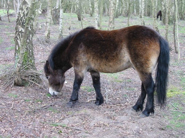
![]() This large open space near Selby has three colour coded, waymarked walks to try. There's 270 hectares of open heath, ponds, reed-bed and woodland to explore on miles of trails. The common is a nature reserve so look out for a wide variety of flora and fauna. Of particular note are the Exmoor ponies and a herd of wild fallow deer and roe deer. There are also a number of rare plants, including the unusual sundew, which is only found in the peat bogs and damp moorland of the common. The site includes boardwalks and viewing platforms from which to conveniently observe the plantlife and wildlife.
This large open space near Selby has three colour coded, waymarked walks to try. There's 270 hectares of open heath, ponds, reed-bed and woodland to explore on miles of trails. The common is a nature reserve so look out for a wide variety of flora and fauna. Of particular note are the Exmoor ponies and a herd of wild fallow deer and roe deer. There are also a number of rare plants, including the unusual sundew, which is only found in the peat bogs and damp moorland of the common. The site includes boardwalks and viewing platforms from which to conveniently observe the plantlife and wildlife.
You can also visit the nearby village of Skipwith with its church of St. Helen which dates back to the 10th century. Also of note are the Danes Hills Bronze age burial mounds and a number of pretty ponds.
About a mile to the west of the common you can pick up the Trans Pennine Trail in Riccall. The epic long distance trail is a great way of extending your walking in the area. You could follow it south into Selby or north into Bishopthorpe.
Postcode
YO19 6QL - Please note: Postcode may be approximate for some rural locationsPlease click here for more information
Skipwith Common Ordnance Survey Map  - view and print off detailed OS map
Skipwith Common Open Street Map  - view and print off detailed map
Skipwith Common OS Map  - Mobile GPS OS Map with Location tracking
Skipwith Common Open Street Map  - Mobile GPS Map with Location tracking
Explore the Area with Google Street View 
Pubs/Cafes
In the little village of Skipwith you can visit the excellent Drovers Arms for some post walk refreshments. The delicious homemade food is locally sourced and reflects the changing seasons, mirroring the wonderful walks to be found on the common. There's a cosy log fire to sit by in the winter months and a garden area for warmer days. You can find it in the village on York Road with a postcode of YO8 5SF for your sat navs.
Dog Walking
The common is a great place for dog walking but please keep your dog on a short lead as there are ponies and cattle on the reserve. The Drovers Arms pub mentioned above is also dog friendly.
Further Information and Other Local Ideas
Just to the east you can pick up the circular Howden 20 and pay a visit to the impressive Howden Minster in the nearby market town.
Just to the east you can pick up the Bubwith Rail Trail. This flat, easy path will take you along an old railway line toward Holme-on-Spalding-Moor and Market Weighton from the village of Bubwith.
Cycle Routes and Walking Routes Nearby
Photos
Skipwith Common is an area of over 500 acres of lowland heath - one of the last remaining areas in the North of England. A nationally important nature reserve, it is managed by the Yorkshire Wildlife Trust, principally because of insect and birdlife.


