Holme-on-Spalding-Moor Walks
![]()
![]() This large village in the East Riding of Yorkshire is located just to the west of Market Weighton.
This large village in the East Riding of Yorkshire is located just to the west of Market Weighton.
This circular walk from the village takes you north to explore the Bubwith Rail Trail. Here you can visit the site of the old Holme-on-Spalding-Moor rail station and enjoy easy walks along the now disused railway line.
You can extend the walk by continuing west to visit the neighbouring village of Bubwith. Following the trail east will take you towards Market Weighton where you can enjoy easy waterside walks along the Market Weighton Canal.
Holme-on-Spalding-Moor Ordnance Survey Map  - view and print off detailed OS map
Holme-on-Spalding-Moor Open Street Map  - view and print off detailed map
Holme-on-Spalding-Moor OS Map  - Mobile GPS OS Map with Location tracking
Holme-on-Spalding-Moor Open Street Map  - Mobile GPS Map with Location tracking
Walks near Holme-on-Spalding-Moor
- Bubwith Rail Trail - This walk takes you along the Bubwith Rail Trail from the village of Bubwith in East Riding of Yorkshire.
- Market Weighton Circular Walk - This circular walk around Market Weighton makes use of the Yorkshire Wolds Way to take you on a tour of the countryside, woodland, lakes and parkland surrounding the East Riding town
- Market Weighton Canal - Follow the Market Weighton Canal from the town of Market Weighton to the Humber Estuary on this waterside walk in the East Riding of Yorkshire.
Starting in the town centre follow the Weighton Beck south west for about 1.5 miles and you will join with the canal - Howden 20 - This 20 mile circular walk takes you on a tour of the countryside around the market town of Howden in Yorkshire.
- Londesborough Park - Enjoy a lovely stroll through the Londesborough Estate on this short walk near Pocklington, in the East Riding of Yorkshire
- Yorkshire Wolds Way - Starting on the banks of the Humber Estuary at Hessle follow this charming route through the peaceful and beautiful Yorkshire countryside
- Goodmanham - A circular walk from the Wolds settlement of Goodmanham exploring the countryside to the east of the village
- North Cliffe Woods - This peaceful walk visits North Cliffe Woods in the East Riding of Yorkshire.
- North Cave Wetlands - This walk visits the North Cave Wetlands nature reserve in North Cave, East Riding of Yorkshire.
- Southfield Reservoir - This short walk visits Southfield Reservoir near Doncaster and Goole.
- Hudson Way - This shared cycling and walking route runs along a disused railway path from Beverley to Market Weighton in East Riding of Yorkshire.
- Hotham - This small village is located in East Riding of Yorkshire, near North Cave and Market Weighton.
Photos
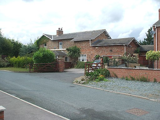
Holme Moor railway station (site). Actually located in Holme-(up)on-Spalding-Moor village, the station always carried the abbreviated name. Believed to have opened in 1848 by the North Eastern Railway on the line from Market Weighton to Selby, this station closed to passengers in 1954 and completely in 1965. Former forecourt.


