Southwater Country Park Walk Map
![]()
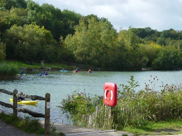
![]() Enjoy peaceful lakeside walking at this pretty country park in Horsham. As well as the delightful lakes the park also includes a beautiful wildlife area which supports wildlife such as lizards, Kingfishers, Nightingales and various butterflies and dragonflies. There are also excellent facilities with a Visitor Centre, Cafe, an adventure-style play area, an orienteering course and tuition in canoeing and sailing.
Enjoy peaceful lakeside walking at this pretty country park in Horsham. As well as the delightful lakes the park also includes a beautiful wildlife area which supports wildlife such as lizards, Kingfishers, Nightingales and various butterflies and dragonflies. There are also excellent facilities with a Visitor Centre, Cafe, an adventure-style play area, an orienteering course and tuition in canoeing and sailing.
The Downs Link footpath runs just past the park. You can pick this up to extend your walk. Heading south will take you through the countryside towards the attractive village of Henfield.
For cyclists National Cycle Route 223 runs past the park on its way from Chertsey to Shoreham.
Postcode
RH13 9UN - Please note: Postcode may be approximate for some rural locationsPlease click here for more information
Southwater Country Park Ordnance Survey Map  - view and print off detailed OS map
Southwater Country Park Open Street Map  - view and print off detailed map
*New* - Walks and Cycle Routes Near Me Map - Waymarked Routes and Mountain Bike Trails>>
Southwater Country Park OS Map  - Mobile GPS OS Map with Location tracking
Southwater Country Park Open Street Map  - Mobile GPS Map with Location tracking
Pubs/Cafes
There's a nice on site cafe selling a good range of meals and snacks.
The Hornbrook Inn is worth a detour from the park. It's located just to the south of Horsham town centre on the Riverside Walk. This rustic pub has a good menu, beamed ceilings, wood panelling, stone floors and a beer garden to relax in. It's located next to Huxley Birds of Prey Centre which is a good option for a day out. This attraction features falcon & owl flying demonstrations & hands-on visitor encounters.
Dog Walking
The park is a great place for dog walking so you'll probably bump into other owners on your visit. The Hornbrook Inn mentioned above is also dog friendly. The nearby St Leonard's Forest is another good local spot to take your dog.
Further Information and Other Local Ideas
The nearby village of Henfield makes for a nice extension to your outing. The attractive settlement includes some historic buildings including a 13th century church and 17th century pub. The circular Henfield Walk explores the area, visiting the River Adur and the surrounding farmland.
If you head north east towards Horsham you can visit St Leonard's Forest. The expansive forest has miles of woodland walking trails to try.
Head south and you can explore the expansive Knepp Castle Estate. The estate is one of the walking highlights of the area with miles of trails, a 12th century castle and interesting wildlife including wild boar, nesting storks, horses and deer to look out for on the way.
For more walking ideas in the area see the Sussex Walks page.
Cycle Routes and Walking Routes Nearby
Photos
In this view we see an orienteering marker, which is part of a permanent course in the Country Park. Horsham District Council, who operate the Country Park, have several such facilities to encourage Park visitors to make the best of their time in the park.
The Park was created by the local authority on the site of an old brick works in the 1980s. The area was landscaped and planted with native species. The view here shows how the planting of this disused industrial area has developed from scrubby thicket into fine open woodland.


