Stinchcombe Hill
![]()
![]() This circular walk climbs to the lovely viewpoint at Stinchcombe Hill in the Cotswolds. The hill is located just to the west of Dursley so you could start your walk from there and follow the Cotswold Way to the hill. This circular walk, however, starts from the car park about half a mile east of the hill. You follow the Cotswold Way to the hill summit where you will find a topograph displaying all the landmarks you can see from the peak. It's a lovely view with the Tyndale Monument and the village of North Nibley visible across the attractive countryside and woodland below. You can also see the Vale of the River Severn and Forest of Dean from the 219 metres (719 ft) Drakestone Point.
This circular walk climbs to the lovely viewpoint at Stinchcombe Hill in the Cotswolds. The hill is located just to the west of Dursley so you could start your walk from there and follow the Cotswold Way to the hill. This circular walk, however, starts from the car park about half a mile east of the hill. You follow the Cotswold Way to the hill summit where you will find a topograph displaying all the landmarks you can see from the peak. It's a lovely view with the Tyndale Monument and the village of North Nibley visible across the attractive countryside and woodland below. You can also see the Vale of the River Severn and Forest of Dean from the 219 metres (719 ft) Drakestone Point.
The public footpaths pass Stinchcombe golf course so please keep to the signposted paths only.
After descending back to the car park you have the option of extending your walk along the Cotswold Way. You can follow it through the series of woods on the outskirts of Dursley. This includes Sheep Path Woods, Cockshott Woods and Hermitage Woods. If you continue south along the path you can visit the Tynedale Monument view point and the town of Wotton-under-Edge.
Postcode
GL11 6AQ - Please note: Postcode may be approximate for some rural locationsStinchcombe Hill Ordnance Survey Map  - view and print off detailed OS map
Stinchcombe Hill Open Street Map  - view and print off detailed map
Stinchcombe Hill OS Map  - Mobile GPS OS Map with Location tracking
Stinchcombe Hill Open Street Map  - Mobile GPS Map with Location tracking
Pubs/Cafes
Head into Dursley and you can enjoy some post walk refreshments at the excellent Old Spot Inn. The inn dates back to 1776 and includes a charming interior with low ceilings and comfortable connecting bar-rooms which are adorned with interesting "breweriana" from times gone by. The inn is also a CAMRA National Pub of the Year with a fine range of ales to choose from. Outside there's a lovely garden area where you can relax on warmer days. You can find the pub at 2 Hill Road with a postcode of GL11 4JQ.
Dog Walking
The hill is a fine place for a dog walk with some nice woodland trails in Sheep Path Wood and Westfield Wood which surround the site. The Old Spot Inn mentioned above also welcomes dogs.
Further Information and Other Local Ideas
You can continue your walking to the east of the town on the circular Dursley Walk. This climbs to the nature reserve at Cam Peak before visiting the Iron Age Hillfort at Uley Bury.
Just south of nearby Wotton-Under-Edge there's Kingswood where you could visit the 15th century Abbey Gatehouse. The historic site is owned by English Heritage and is all that survives of the former Cistercian abbey.
For more walking ideas in the area see the Cotswolds Walks page.
Cycle Routes and Walking Routes Nearby
Photos
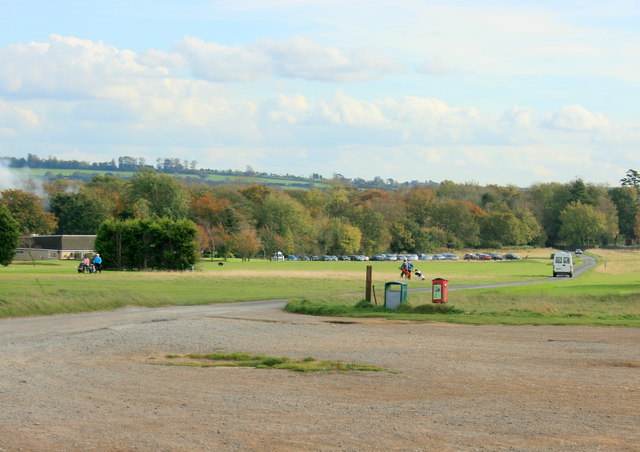
The good sized Public car park on Stinchcombe Hill. By far the best place to park for a visit to the hill. Should be safe from even the worst of hooks and slices from the golf course.
Trigpoint and toposcope on the hill. In the background the Malvern Hills are faintly visible.
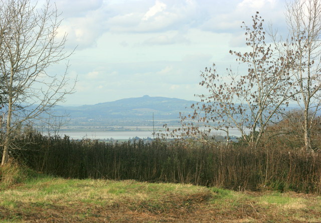
West of north from the hill. The Severn estuary stretches across the scene before us with May Hill about 15 miles away on the horizon.
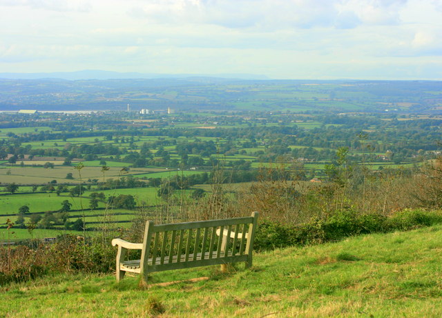
North of west from the hill. Sharpness, at the southern end of the Gloucester and Sharpness Canal can be seen, the grain silos are visible above the seat. The Severn estuary is to the left. On the horizon to the right of this Hay Bluff shows through the haze.
West of north from Stinchcombe Hill. The Severn estuary stretches across the scene before us with May Hill about 15 miles away on the horizon.


