Wotton-under-Edge Tyndale Monument Walk
![]()
![]() This is a climb to the Tyndale Monument from the popular Cotswolds town of Wotton-under-Edge. It uses a section of the Cotswold Way National Trail to take you from the town to Westridge Woods and then on to the tower. The 19th century monument is an impressive landmark standing at a height of 111 ft (34 m). It was built in honour of William Tyndale, a translator of the New Testament who was born in the area. From the tower viewpoint there are wonderful views across the Cotswold Hills AONB and into south Wales. You can actually climb the spiral staircase of 121 steps for even better views! A topograph displays all the places you can see from the summit. This includes the Somerset Monument at Hawkesbury Upton, another local landmark you can climb to.
This is a climb to the Tyndale Monument from the popular Cotswolds town of Wotton-under-Edge. It uses a section of the Cotswold Way National Trail to take you from the town to Westridge Woods and then on to the tower. The 19th century monument is an impressive landmark standing at a height of 111 ft (34 m). It was built in honour of William Tyndale, a translator of the New Testament who was born in the area. From the tower viewpoint there are wonderful views across the Cotswold Hills AONB and into south Wales. You can actually climb the spiral staircase of 121 steps for even better views! A topograph displays all the places you can see from the summit. This includes the Somerset Monument at Hawkesbury Upton, another local landmark you can climb to.
The site is next to the geologically significant Nibley Knoll which shows a thick section of Lower and Middle Jurassic rocks. After your climb you can descend into the village of North Nibley and enjoy refreshments there.
To extend your walking in the area you could try the Wotton-under-Edge circular walk which takes you through the farmland and woodland surrounding the town. It also passes the Newark Park estate with 700 acres of parkland, gardens and lakes to explore.
If you follow the Cotswold Way north then you can visit Stinchcombe Hill where there is another great viewpoint.
From here you can see back to the Tynedale Monument and across the Vale of the River Severn.
Postcode
GL11 6DS - Please note: Postcode may be approximate for some rural locationsTyndale Monument Ordnance Survey Map  - view and print off detailed OS map
Tyndale Monument Open Street Map  - view and print off detailed map
*New* - Walks and Cycle Routes Near Me Map - Waymarked Routes and Mountain Bike Trails>>
Tyndale Monument OS Map  - Mobile GPS OS Map with Location tracking
Tyndale Monument Open Street Map  - Mobile GPS Map with Location tracking
Pubs/Cafes
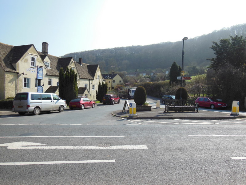
Just to the north of the monument you'll find the little village of North Nibbley. Here you'll find the Black Horse Inn where you can enjoy some post walk refreshments. There's a good menu and outdoor seating in the front and out back in the pretty enclosed garden area. You can find the pub at the foot of the monument at 1 Barrs Lane, North Nibley with a postcode of GL11 6DT for your sat navs.
Dog Walking
The climb is a popular one for people with their dogs so you're bound to see other pets on a fine day. The Black Horse mentioned above is also very dog friendly.
Further Information and Other Local Ideas
The monument is only a couple of miles south of the popular market town of Dursley. Here you can try the circular Dursley Walk which visits the nature reserve at Cam Peak and the Iron Age Hillfort at Uley Bury.
Just south of Wotton-Under-Edge there's Kingswood where you could visit the 15th century Abbey Gatehouse. The historic site is owned by English Heritage and is all that survives of the former Cistercian abbey.
For more walking ideas in the area see the Cotswolds Walks page.
Cycle Routes and Walking Routes Nearby
Photos
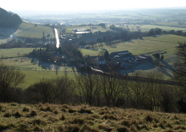
Southend from the Tyndale Monument. View at almost midday, with the sun directly ahead. Southend consists of three farms; right below is Millmans Farm, with Southend Farm left, and Windmill Fruit Farm with its market garden beyond. The B4060 glistens as it passes through the hamlet.
The monument and North Nibley Seen from Drakestone Point at the south western end of Stinchcombe Hill. The Somerset Monument at Hawkesbury Upton is hidden behind Nibley Knoll, almost in line with the monument.


