Talkin Tarn Country Park
![]()
![]() Explore this 165 acre country park in Brampton, and enjoy the large glacial tarn, mature woodland and gentle meadows with the stunning Pennine Hills as a backdrop. The park includes a well maintained path around the tarn and three other way-marked trails taking you through the surrounding woodland and fields. Facilities include a tearoom, gift shop and row boats available for hire on the tarn.
Explore this 165 acre country park in Brampton, and enjoy the large glacial tarn, mature woodland and gentle meadows with the stunning Pennine Hills as a backdrop. The park includes a well maintained path around the tarn and three other way-marked trails taking you through the surrounding woodland and fields. Facilities include a tearoom, gift shop and row boats available for hire on the tarn.
Just a mile to the west you will find Gelt Woods. This is a great place to extend your walk with nice footpaths along the River Gelt and lots of wildlife to look out for in the RSPB reserve.
Postcode
CA8 1HN - Please note: Postcode may be approximate for some rural locationsTalkin Tarn Country Park Ordnance Survey Map  - view and print off detailed OS map
Talkin Tarn Country Park Open Street Map  - view and print off detailed map
Talkin Tarn Country Park OS Map  - Mobile GPS OS Map with Location tracking
Talkin Tarn Country Park Open Street Map  - Mobile GPS Map with Location tracking
Pubs/Cafes
At the northern end of the lake there's a very good tea room where you can enjoy some refreshments after your walk. They serve a good range of snacks with delicious ice creams and cakes. There's a nice balcony here too with fine views over the lake.
Dog Walking
The lake paths and woodland trails are ideal for dog walking so you're bound to bump into other owners on a fine day. Please note there is now a dogs on leads zone which includes the footpath starting from the car park entrance and Alex Boathouse, onwards in front and behind the Tearoom area and then extends to along the path just past the sailing boats.
Further Information and Other Local Ideas
Head a couple of miles south of the park and you'll find another nice waterside walk around Castle Carrock Reservoir. It's a lovely and peaceful area with the associated village of Castle Carrock also worth a visit.
The circular Brampton Walk visits the park from the train station located just to the north east. It also goes on to explore Gelt Woods. You can catch trains to Brampton station from Carlisle and Newcastle. Just a couple of miles to the north east of Brampton there's Miltonrigg Woods to explore. There's more peaceful woodland trails here with pretty bluebells in the spring and lots wildlife to see. Lanercost Priory is also located in this area. The English heritage run site was originally founded in 1169 as an Augustinian monastery. Today the substantial priory ruins are well worth a visit for the fascinating history and architecure.
A few miles to the south west you'll find the worthy village of Wetheral where you can visit a historic ruined priory, the River Eden and the National Trust's Wetheral Woods. Near here there's also the Wreay Woods Nature Reserve where you can look out for otters by the River Petteril.
Just to the east there's Geltsdale. Here you'll find a rugged RSPB nature reserve with becks, hills, old quarries, a pretty tarn and lots of wildlife to see.
For more walking ideas in the area see the North Pennines Walks and Cumbria Walks pages.
Cycle Routes and Walking Routes Nearby
Photos
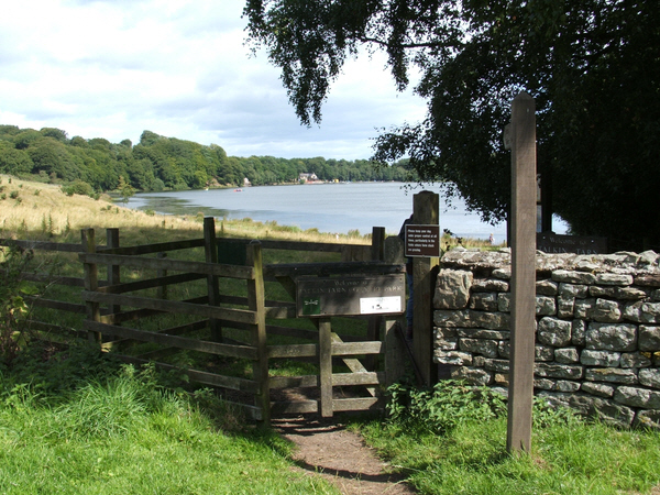
Entrance to Talkin Tarn by Tarn End House Hotel. Lovely view across the tarn with footpath sign and gate. Taken in the summer of 2006.


