GPS Cycle and Walking Routescycle iconwalk icon

Tamara Coast To Coast Way

88.86 miles (143 km)

Ordnance Survey Map Open Streetmap Travel from south Cornwall to North Cornwall on this 89 mile walking trail.
You'll pass through the beautiful Tamar valley with part of the route running along the popular Tamar Valley Discovery Trail. Other highlights include the long riverside sections along the River Tamar and more waterside paths along the scenic Tamar Lakes and the lovely Bude Canal.
You'll also pass through a series of pretty Cornish villages and enjoy some wonderful coastal views towards the end of the walk.
The walk is marked out on the Ordnance Survey map below. It begins in southern Cornwall at the Cremyll Ferry and heads north to the coast at Morwenstow.

Tamara Coast To Coast Way OS Map Ordnance survey map - Mobile GPS OS Map with Location tracking

Tamara Coast To Coast Way Open Street Map Open Streetmap - Mobile GPS Map with Location tracking

Cycle Routes and Walking Routes Nearby

Photos

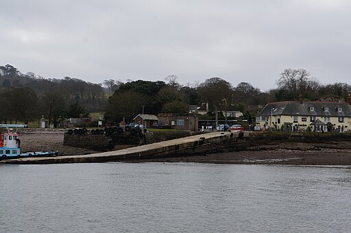
The quay at Cremyll - geograph.org.uk - 4388485

The quay at Cremyll at the start of the walk

St Mary's Church - Tamerton Foliot - geograph.org.uk - 2497301

St Mary's Church

Upper Tamar Lake and Dam - panoramio

Upper Tamar Lake and Dam

Tamar Valley Discovery Trail - geograph.org.uk - 5096070

Tamar Valley Discovery Trail, Calstock 

Tamar Valley Discovery Trail - geograph.org.uk - 5550921

Tamar Valley Discovery Trail at Bere Ferrers

Tamar Valley Discovery Trail near Weir Quay - geograph.org.uk - 4095989

Near Weir Quay

Henna Cliff - geograph.org.uk - 1567744

Henna Cliff. On the coast near Morwenstow

The Vicarage and the Church of St Morwenna and St John the Baptist, Crosstown in the Parish of Morwenstow, Cornwall - geograph.org.uk - 4919274

The Vicarage and the Church of St Morwenna and St John the Baptist, Crosstown in the Parish of Morwenstow, Cornwall

Video

GPS Files

GPX File

Tamara Coast to Coast Way.gpx (On Desktop:Right Click>Save As. On Ipad/Iphone:Click and hold>Download Linked File)