River Test Way Walk
![]()
![]() Travel through the Test Valley on this 45 mile walk through Hampshire and Berkshire.
Travel through the Test Valley on this 45 mile walk through Hampshire and Berkshire.
The route starts Eling Tide Mile near Totton heading north towards the Lower Test Nature Reserve and Romsey along the river. Here the river runs parallel to the old Andover Canal which you can explore on the Romsey Canal Walk.
The route continues through Kimbridge and then onto the impressive National Trust owned Mottisfont Abbey. This 13th century Augustinian priory is surrounded by glorious grounds and is a major highlight on the trail. In this area you will also pick up the path along the old Sprat And Winkle Line railway which closed in 1964. This section is also suitable for cyclists.
The path continues through Stockbridge, Wherwell and the pretty village of St Mary Bourne with its delightful thatched houses. This section also passes Harewood Forest and Danebury Hill Fort near Stockbridge. It's worth taking a a short detour to climb the hill and enjoy some splendid views over the Test Valley.
The final section is a gradual climb through Hurtsbourne Tarrant and Linkenholt towards Inkpen Beacon and Walbury Hill in Berkshire where the trail finishes.
At 297 m (974 ft) Walbury Hill is the highest point in Berkshire and South East England. At the summit you can enjoy great views over the county and explore the Iron Age Hill fort of Walbury Camp.
Test Way Ordnance Survey Map  - view and print off detailed OS map
Test Way Open Street Map  - view and print off detailed map
*New* - Walks and Cycle Routes Near Me Map - Waymarked Routes and Mountain Bike Trails>>
Test Way OS Map  - Mobile GPS OS Map with Location tracking
Test Way Open Street Map  - Mobile GPS Map with Location tracking
Pubs/Cafes
On the route you could stop off at Mottisfont Abbey and enjoy refreshments in the National Trust tea rooms. Near here there's also the excellent Mill Arms in the village of Dunbridge. It's in a lovely spot and includes a new conservatory for looking out over the garden with two open fireplaces indoors for colder days. You can find the pub at Barley Hill, Dunbridge with a postcode of SO51 0LF for your sat navs. The pub above is also very dog friendly and will often provide water and biscuits for your canine friend.
In Longparish there's The Cricketers to consider. The attractive former coaching inn is in a nice location close to the river. They serve good quality, homemade food which you can enjoy in the lovely garden area. You can find them at postcode SP11 6PZ for your sat navs. The village itself is also worth exploring with picturesque thatched cottages, old mills, weirs and pretty lakes along the river.
In the pretty village of St Mary Bourne, near Andover, there's the George Inn. The pub does a fine Sunday Carvery and is popular with cyclists and walkers. Postcode for sat navs is SP11 6BG.
Further Information and Other Local Ideas
At the start point for the walk there's Eling Tide Mill to investigate. The Grade II listed mill is a major local attraction with picturesque walks and some fascinating local history.
Also near the start of the route you will pass the Testwood Lakes Nature Reserve. Here you'll find a variety of interesting wild flowers and woodland around the lakes. You can also look out for various wildfowl and waders on the water using the two bird hides. The reserve is located just to the west of the path, about a mile from the start point in Totton.
If you head east from the trail at St Mary Bourne you could visit the source of the river at Ashe, near Overton. The village also has some nice trails to Deane Park and a noteworthy 15th century pub to investigate.
Cycle Routes and Walking Routes Nearby
Photos
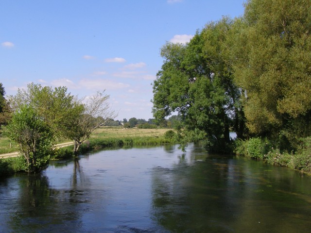
River Test in summer. View upstream from a bridge that crosses the River Test, just to the west of Longbridge Farm, about 3 miles north of Totton. The Test Way footpath crosses this bridge. The banks of the river here are used for private fishing.
Signpost at a junction on the trail. From this point northwards the trail follows this track, as far as the A3090 road west of Romsey. The track leads off to the right towards the bridge over the Test near Longbridge Farm, and it is not a right of way. The Test Way footpath takes a longer route to the same bridge, along public rights of way.
A view of the footpath near Town Copse, just south of Romsey. The footpath follows the course of this farm track, seen here between Town Copse (off to the left) and the River Test (off to the right). The path leads to the A3090 road at the foot of Pauncefoot Hill.
Heading south from Stockbridge. The trail runs along the course of the disused railway line for many miles. The path isn't right alongside the river as you might expect, but it does follow the Test Valley. The riverside itself is all privately owned around Stockbridge, and people pay huge amounts of money for the fishing rights.
Stile and waymarker, Ridge Lane. Here the footpath leaves the road and heads off along the left edge of this field, headed towards the bridge at Romsey. The River Test itself is about a kilometre to the east, passing through the Broadlands Estate.
Boardwalk at Nursling. This is a part of the footpath leading to Mill Lane, Nursling, with the river across the field to the left. At this very wet time of year the path is incredibly muddy and only this short section has a raised boardwalk to keep you out of the mud/water. There is an overflowing stream to the right of the path.
Official diversion, near Forton. The footpath used to follow the northwest bank of the river as you walked southwest from Forton, which involved a dangerous dash across the A303 dual carriageway. It has been "officially diverted" over the flyover (where the communications mast is on the left of the photo), presumably for safety reasons. The route of the public footpath through this field of young wheat shows up nicely.
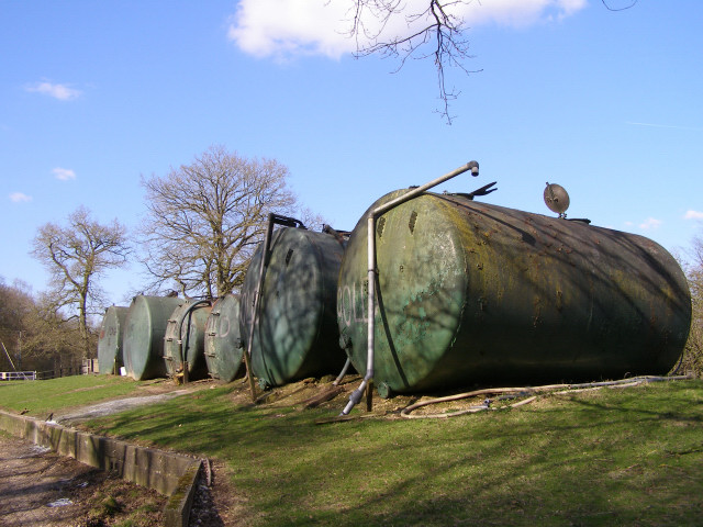
Storage tanks at Pachington Piggery, Harewood Forest. The piggery at Pachington is hidden amongst the trees of Harewood Forest, west of the old Longparish Station. These storage tanks are on a bank next to one of the concrete tracks that were laid in the Second World War when the forest was used to store munitions. The trail follows this route through the south of Harewood Forest.


