Thirsk Walks
![]()
![]() Enjoy a pleasant riverside stroll through this small market town, on this circular walk. Thirsk is an attractive town with a large medieval market square and some interesting Georgian architecture. The rushing waters of the Cod Beck River and fine views towards the Hambleton Hills and Yorkshire Dales make it a very popular place for a walk.
Enjoy a pleasant riverside stroll through this small market town, on this circular walk. Thirsk is an attractive town with a large medieval market square and some interesting Georgian architecture. The rushing waters of the Cod Beck River and fine views towards the Hambleton Hills and Yorkshire Dales make it a very popular place for a walk.
The walk starts in the centre of town and picks up footpaths along the Cod Beck river. You follow the river north to the village of South Kilvington before turning west towards the woodland of the Underwood Plantation. You then turn south to head through the countryside to New Thirsk, before returning to the town centre.
You can then head south towards Sowerby Flats and explore the delightful Georgian village street of Sowerby.
The town was the home of the authour James Herriot. You can explore the villages and countryside associated with his work on the Herriot Way long distance trail. There's also a musuem at Skeldale House in the Kirkgate of Thirsk. It was the surgery of local vet James Wight, better known by his pen name, James Herriot. The museum tells the history of veterinary science and is one of the most popular attractions in the town.
Thirsk is only a few miles east of the North York Moors National Park. Here you can enjoy a waterside walk around the nearby Gormire Lake or visit the fascinating 12th century ruins of Byland Abbey.
You could also visit Sutton Bank and the Kilburn White Horse which are also close by. Sutton Bank is a high point in the Hambleton Hills and commands splendid views over the North York Moors, the Vale of York and the Vale of Mowbray.
The Cleveland Way long distance trail also runs through the eastern section of the park and is another good option for extending your walking in the Thirsk area.
Thirsk Ordnance Survey Map  - view and print off detailed OS map
Thirsk Open Street Map  - view and print off detailed map
Thirsk OS Map  - Mobile GPS OS Map with Location tracking
Thirsk Open Street Map  - Mobile GPS Map with Location tracking
Walks near Thirsk
- Gormire Lake - A short and easy walk around this pretty lake in the North York Moors
- Herriot Way - This long distance circular route takes you through areas of the Yorkshire Dales associated with the vet and author James Herriot.
The walk begins in the pretty village of Aysgarth in Wensleydale - Sutton Bank and the Kilburn White Horse - This challenging circular walk in the North York Moors visits the Kilburn White Horse, the lovely Gormire Lake and the scar at Sutton Bank
- Cleveland Way - This wonderful trail runs from Helmsley to Filey, taking you through the beautiful North York Moors national park, atop the Hambleton Hills ridge and along the stunning North Yorkshire coastline.
The trail begins in Helmsley, with the first section taking you through the heather moorland of the North York Moors, passing the village of Osmotherley, the pretty Cod Beck Reservoir and the ancient stones at Lord Stones Country Park and the Wainstones.
After enjoying the fabulous views on the elevated moors you arrive at Saltburn to begin the coastal stretch - Felixkirk - This Yorkshire village is located in the Hambleton District, just west of the North York Moors.
- Hambleton Hills - This walk explores the Hambleton Hills range on the western edge of the North York Moors
- Byland Abbey - Visit this fascinating ruined abbey before exploring the surrounding countryside of Ryedale
- Helmsley to Rievaulx Abbey - This is a popular walk which takes you from the medieval Helmsley Castle to the fascinating ruins of Rievaulx Abbey
- Oulston Reservoir - This walk visits Oulston Reservoir in the Hambleton district of North Yorkshire.
- Boltby Forest - This large area of coniferous woodland on the western edge of the North York Moors is very popular with mountain bikers and walkers
- Hawnby Hill - This circular walk takes you up to the summit of Hawnby Hill from the village of Hawnby in Ryedale area of the North York Moors
- Coxwold - This pretty little village in the North York Moors makes a fine base for walkers
- Easingwold - This attractive market town is located in a fine location for walkers, sitting on the edge of the North York Moors National park and the Howardian Hills.
- Crayke - This picturesque village is located just to the east of Easingwold in the Hambleton District of North Yorkshire
Pubs/Cafes
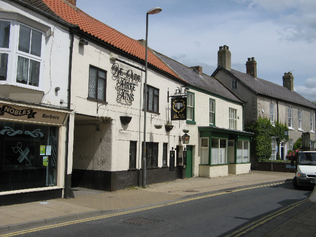
- Little 3 - there's some excellent cask ales at this historic 13th century inn. It's the oldest pub in the town and includes quirky beams and welcoming fires. They also have the largest garden in the town. Find them on Finkle Street at postcode YO7 1DA.
- The Golden Fleece - 19th century coaching inn on the market place at postcode YO7 1LL
- The Old Oak Tree - pleasant local pub in South Kilvington serving a fine Sunday lunch. Postcode for sat navs is YO7 2NL.
Dog Walking
The river and country trails make for a fine dog walk. The Little 3 pub mentioned above is also dog friendly.
Further Information and Other Local Ideas
For enthusiasts of the Herriot books pay a visit The World of James Herriot. This award winning attraction is housed in a 1940s period house with veterinary science exhibits. It was the original practice of James Herriot, at 23 Kirkgate, known as "Skeldale House" in the books. The museum includes a recreation of the original living quarters and sets from the All Creatures Great and Small television series. This ran on the BBC during the 1970s and starred
Christopher Timothy as the famous vet.

Pictured above, The World of James Herriot. Probably the most famous property in Thirsk, number 23 Kirkgate was the former veterinary practice of D.V Sinclair and J.A Wight, otherwise known as 'Farnon and Herriot'. This was the very centre of 'Herriot Country' until the death of Alf Wight in 1995. The house reopened as a museum in 1999 and is owned by Hambleton District Council. The veterinary practice continues in modern buildings on the industrial estate on York Road. On the right is one of the TV show's sets.
Photos
Thirsk Marketplace. The A170 road runs through here. The town is built around the medieval market square, which still hosts an open-air market each Monday and Saturday. The market was established in 1145 and is the focal point for local farmers, traders and visitors


