Ventnor Downs and St Boniface Down Walk
![]()
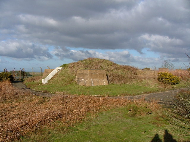
![]() Visit the highest point on the Isle of Wight and enjoy wonderful views over the island's coast and countryside on this circular walk. Look out for various pretty wildflowers, heather and New Forest Ponies on St Boniface Down. You may also see other wildlife such as skylark, meadow pipit, buzzards, kestrels, various butterflies and a herd of Old English goats which graze on Bonchurch Down and Coombe Bottom. The area also has an interesting military history with various WW2 buildings and the RAF Ventnor Radar Station which played an important role in the Battle of Britain.
Visit the highest point on the Isle of Wight and enjoy wonderful views over the island's coast and countryside on this circular walk. Look out for various pretty wildflowers, heather and New Forest Ponies on St Boniface Down. You may also see other wildlife such as skylark, meadow pipit, buzzards, kestrels, various butterflies and a herd of Old English goats which graze on Bonchurch Down and Coombe Bottom. The area also has an interesting military history with various WW2 buildings and the RAF Ventnor Radar Station which played an important role in the Battle of Britain.
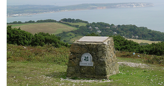
The walk starts from the Ventnor Down National Trust car park and takes you across Luccombe Down, Bonchurch Down and St Boniface Down. There's some challenging climbing but you are rewarded with fabulous views to Sandown Bay, Culver Cliffs and Portsmouth.
You can extend your walk by heading to the nearby Wroxall Down or by following the Isle of Wight Coast Path west to St Catherine's Lighthouse. The Shanklin to Ventnor Coastal Walk is also very popular with more lovely sea views and some interesting woodland trails.
You can visit the downs by bike by following Regional Cycle Route 67 otherwise known as the 'Round the Island' route.
Postcode
PO38 1YL - Please note: Postcode may be approximate for some rural locationsVentnor Downs Ordnance Survey Map  - view and print off detailed OS map
Ventnor Downs Open Street Map  - view and print off detailed map
Ventnor Downs OS Map  - Mobile GPS OS Map with Location tracking
Ventnor Downs Open Street Map  - Mobile GPS Map with Location tracking
Explore the Area with Google Street View 
Pubs/Cafes
Head to the Bonchurch Inn for some refreshments on your walk. Located in an Island Stone building this noteworthy pub includes a delightful Dickensian courtyard where you can sit out and enjoy your meal on warm summer days. They also offfer authentic Italian cuisine, and comfortable accommodation if you need to stay over. You can find the pub just to the south east of the downs at Bonchurch Shute with a postcode of PO38 1NU for your sat navs.
Further Information and Other Local Ideas
The Ventnor to Steephill Cove Walk takes you to a popular little cove with kiosks, self catering cottages and a beach. The circular walk also visits the splendid Ventnor Botanical Gardens where you can enjoy a variety of Mediterranean plants and flowers.
Just east of the downs there's the Devils Chimney Walk which visits an unusual geological feature in a wooded area known as the Landslip.
The Shanklin to Ventnor Railway Walk starts from Shanklin train station and will take you to Wroxall and Ventnor via the old railway line and the Downs. The first section to Wroxall is also suitable for cyclists.
Cycle Routes and Walking Routes Nearby
Photos
Bonchurch Down and Ventnor. View south west from near the footpath and viewpoint at around the 230m contour on Bonchurch Down. Photograph emphasises the steep scarp slope of the chalk downs and the low gorse vegetation.
Looking down onto Bonchurch. The Victorians thought this village to be 'heaven on earth'. There are large houses set among trees, with unexpected views of the sea, and a village pond given by H de Vere Stacpole, author of Blue Lagoon. Other residents included Tennyson, Macauley and Elisabeth Sewell. St Boniface's Church is in the middle of the picture. It was built in 1847-8. By Ferrey, 1847-8. Quite a large church in Norman style with transepts and a bellcote. The stained glass is mostly by Wailes, but the two saints in the E and W windows of the S transept are by Henry Holiday, 1878. In the churchyard is the mausoleaum of the Leeson family, with egyptian motifs and the dates 1864, 1867 and 1872.
Cattle Grazing. The gate leads through to the junction of two footpaths, with the right one leading up onto St.Boniface Down. The gate and the left hand path are in this grid square, the right path is in the adjacent square. The sign on the gatepost warns walkers of grazing cattle. They might just notice, since one cow is lying down, preventing the gate from being opened!


