Verwood Walks - Near and Around
![]()
![]() This Dorset town is a nice place to start a walk with extensive woodland and heathland to explore. It's also located close to the New Forest National Park and the Cranborne Chase AONB where there are numerous walking opportunities.
This Dorset town is a nice place to start a walk with extensive woodland and heathland to explore. It's also located close to the New Forest National Park and the Cranborne Chase AONB where there are numerous walking opportunities.
This circular walk from the town takes you into the adjacent Verwood Forest, visiting the Stephen's Castle Nature Reserve and the Cranborne Common Nature Reserve. It's a pleasant place for walking or cycling, with a series of nice wide tracks to follow to the two reserves and across Boveridge Heath.
At Stephen's Castle you'll find a short hill climb to a lovely viewpoint with views across the town and the surrounding countryside. There's also picturesque ponds, Bronze Age tumulus, peaceful woodland trails and pretty purple heather in the warmer months. Look out for various woodland birds and butterflies as you make your way through the wildlife rich area.
Postcode
BH31 6DT - Please note: Postcode may be approximate for some rural locationsVerwood Ordnance Survey Map  - view and print off detailed OS map
Verwood Open Street Map  - view and print off detailed map
Verwood OS Map  - Mobile GPS OS Map with Location tracking
Verwood Open Street Map  - Mobile GPS Map with Location tracking
Walks near Verwood
- Ringwood - This circular walk from Ringwood takes you to some of the highlights of the area
- Blashford Lakes - This walk takes you around Blashford Lakes Nature Reserve and Ibsley Water on the edge of the New Forest
- Avon Valley Path - This wonderful river valley footpath takes you from Salisbury to Christchurch on the South Coast.
You start by the magnificent cathedral in Salisbury and head south towards Downton - Rockford and Ibsley Common - This circular walk explores the Rockford and Ibsley Commons in the New Forest
- Moors Valley Country Park - Moors Valley Country Park and Forest, is situated in Ashley Heath, on the Dorset/Hampshire border
- Castleman Trailway - Travel from Ringwood to Poole along the disused Southampton to Dorchester railway line on this easy cycle and walking route
- Fordingbridge - This walk follows a section of the Avon Valley Path from the Hampshire town of Fordingbridge to Ibsley.
- Avon Heath Country Park - This is a short, easy walk around the delightful Avon Heath Country Park near Ringwood
- Hurn Forest - Enjoy a cycle or walk through this pleasant area of woodland near Bournemouth
- Godshill - This New Forest village is a fine place to start a walk with a number of great local trails and a fine local pub to relax in after your exercise.
- Holt Heath National Nature Reserve - Enjoy a walk through beautiful Dorset heathland in this delightful National Nature Reserve near Wimborne Minster
Pubs/Cafes
The Monmouth Ash is a nice place for some rest and refreshment after your exercise. The historic pub includes a charming old interior with oak beans, open fires and flagstone floors. The pub’s name, unique in Britain, commemorates the 1685 capture of the Duke of Monmouth (Charles II’s illegitimate son) in Verwood, after the Monmouth Rebellion to overthrow James II was defeated. Legend has it that the Duke was captured after his clothes were found below an Ash tree. Monmouth was beheaded for treason on 15 July 1685. Many of his supporters were tried during the Bloody Assizes, led by Judge Jeffreys, and were condemned to death or transportation. James II was able to consolidate his power and reigned until 1688, when he was deposed by another nephew, William III of Orange, in the Glorious Revolution.
They serve a delicious Sunday roast and have a nice big garden to relax in on warmer days.
You can find the pub on Manor Road at postcode BH31 6DT for your sat navs.
Dog Walking
The woodland and heathland trails are ideal for a dog walk. The Monmoth Ash pub mentioned above is also dog friendly.
Further Information and Other Local Ideas
Just to the south east of the town you'll find the Moors Valley Country Park. Here you can enjoy some well maintained cycling and walking trails with on site bike hire. The neighbouring town of Ringwood can also be found on the eastern fringes of the park.
Photos
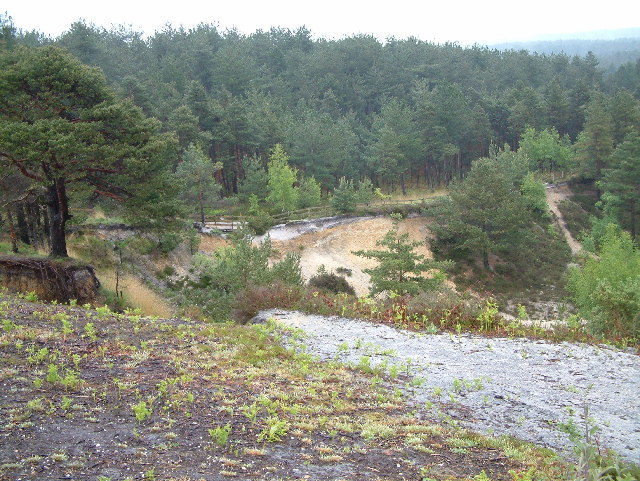
Stephen's Castle. Verwood used to support a brick and pottery industry, obtaining raw materials from local pits such as this; local pits have supported the building of motorways & Mulberry Harbour. Now a nature reserve.
Stephen's Stone, near Verwood. In 1220 Stephen's Stone was recorded as "LE HORESTONE" and was a boundary point in this area so could be a boundary stone. It is thought to be about 3 tonnes in weight.
Forestry, near Alderholt, Dorset. Dense conifer plantation in the distance. In the foreground amongst the heather are self sown conifers. Near the vehicles are members of the Two Trees conservation group and New Forest volunteer rangers, who are here to remove some of these invasive trees to create a wide band of heather which will provide an improved habitat for heathland creatures.
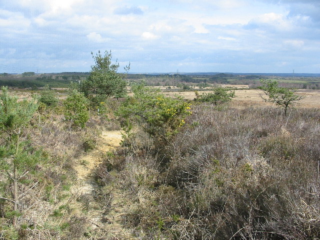
Cranborne common. The common is now a nature reserve,and an important heathland habitat.The view is taken from the SW corner of the square looking NE towards Alderholt.


