Weymouth Circular Walk
![]()
![]() A circular walk around the seaside town of Weymouth, visiting the promenade, the ruins of Sandsfoot Castle and the pretty Radipole Lake Nature Reserve.
A circular walk around the seaside town of Weymouth, visiting the promenade, the ruins of Sandsfoot Castle and the pretty Radipole Lake Nature Reserve.
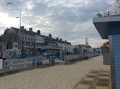
The walk starts on the front, near to the train station. From here you can pick up the South West Coast Path and follow it past the piers to Nothe Point and Nothe Fort. The historic fort is well worth a visit with an interesting museum and the adjacent Nothe Gardens to explore.
The path continues south to the noteworthy Sandsfoot Castle. The artillery fort was constructed by Henry VIII in 1542. Sandsfoot saw service during the English Civil War, when it was held by Parliament and Royalists in turn during the conflict. It survived the interregnum but, following Charles II's restoration to the throne, the fortress was withdrawn from military use in 1665. You can view the ruins of the castle today which is located next to the picturesque Sandsfoot Cove.
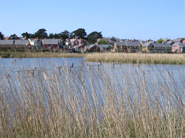
At the castle cove you can pick up the Rodwell Trail, a shared cycling and walking path running along a disused railway. It will take you inland to the Radipole Lake RSPB reserve where there are some nice waterside footpaths to try. The Wild Weymouth Discovery Centre is also located at Radipole Lake and features nature and bird exhibits and programs, trails and viewing blinds.
To continue your walking in the area you could head to the famous Chesil Beach or continue along the coast path on the
Weymouth to Durdle Door Walk and the Weymouth to Swanage Coastal Walk.
Weymouth Circular Walk Ordnance Survey Map  - view and print off detailed OS map
Weymouth Circular Walk Open Street Map  - view and print off detailed map
Weymouth Circular Walk OS Map  - Mobile GPS OS Map with Location tracking
Weymouth Circular Walk Open Street Map  - Mobile GPS Map with Location tracking
Further Information and Other Local Ideas
Just a few miles to the west there's the worthy village of Langton Herring to explore. The settlement includes a 17th century village pub and nice trails leading to the Moonfleet Manor Hotel. The coastal hotel is in a fine position with wonderful views to enjoy with your delicious afternoon tea. Near here there's also Littlebredy which is something of a hidden gem. The delightful village includes the Little Bredy Walled Garden, a waterfall, a lake, an old church and footpaths along the River Bride which runs through the village.
For more walking ideas in the area see the Dorset Walks page.
Cycle Routes and Walking Routes Nearby
Photos
Perches at Radipole Lake. Look out for birds such as Cattle Egrets, Gadwall, Tufted Duck, Mediterranean Gull, Marsh Harrier, Great Crested Grebe, Dunnock, Cormorant
Nothe Fort. The coastal defence was built between 1860 and 1872 by 26 Company of the Royal Engineers to protect Portland and Weymouth Harbours, with Portland then becoming an important Royal Navy base.
The Nothe Gardens. The informal gardens are often acclaimed to be the most beautiful the borough has to offer. On the coast below the gardens are Stone Pier at the entrance to Weymouth Harbour and Newton's Cove on the other side. It's great for wildlife with bats, roe deer, foxes, badgers, hedgehogs, shrews, mice and a variety of birds to see.


