GPS Cycle and Walking Routes

Wild About Worcester Way Circular Walk

12 miles (19 km)

This waymarked circular walk explores the green spaces surrounding the cathedral city of Worcester.
The walk starts on Worcester Bridge near to the cricket ground and the cathedral. The route includes riverside paths along the River Severn, several nature reserves, city parks, woodland trails, pretty meadows and historic buildings. There's also lots of wildlife to see, a visit to the popular Worcester Woods Country Park and a pleasant stretch along the Worcester and Birmingham Canal.
To continue your walking in the city try the Worcester Riverside Walk.

Wild About Worcester Way OS Map - Mobile GPS OS Map with Location tracking

Wild About Worcester Way Open Street Map - Mobile GPS Map with Location tracking

Photos

Worcester Bridge

Worcester Bridge

Gregory's Mill Top Lock near Barbourne, Worcester - geograph.org.uk - 5674514

Gregory's Mill Top Lock near Barbourne, Worcester

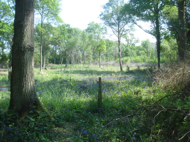
Bluebells in Nunnery Wood - geograph.org.uk - 839530

Bluebells in Nunnery Wood

New Road Cricket Ground and Worcester Cathedral - geograph.org.uk - 5844444

New Road Cricket Ground and Worcester Cathedral

Pond in Offerton Lane Local Nature Reserve - geograph.org.uk - 1890754

Pond in Offerton Lane Local Nature Reserve

Worcester - County Hall (geograph 3976307)

Worcester

Gheluvelt Park pond outflow - geograph.org.uk - 504428

Gheluvelt Park pond outflow. This weir takes water out of the pond and into the Barbourne Brook, which flows to the Severn in another half a mile.

Worcester , Battenhall Park - geograph.org.uk - 6292452

Worcester , Battenhall Park

Video

GPS Files

GPX File

Wild About Worcester Way.gpx (On Desktop:Right Click>Save As. On Ipad/Iphone:Click and hold>Download Linked File)