Worcester Woods Country Park
![]()
![]() This 100 acre park in Worcester consists of two nature reserves, a huge open field and a busy Countryside Centre with cafe facilities.
This 100 acre park in Worcester consists of two nature reserves, a huge open field and a busy Countryside Centre with cafe facilities.
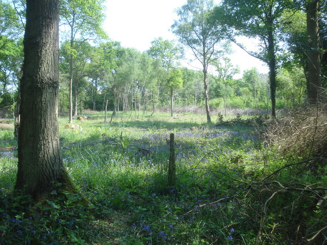
There are also bluebell woods, wildflower meadows and a pond which attracts a wide variety of wildlife. The site includes two waymarked walking trails to follow through the park. Worcester Woods is located on the outskirts of Worcester, just over a mile from the city centre and cathedral.
At the cathedral you can extend your walking and try our Worcester Riverside Walk along the River Severn. There's more waterside walking along the towpath of the Worcester and Birmingham Canal too.
Postcode
WR5 2LG - Please note: Postcode may be approximate for some rural locationsPlease click here for more information
Worcester Woods Country Park Ordnance Survey Map  - view and print off detailed OS map
Worcester Woods Country Park Open Street Map  - view and print off detailed map
Worcester Woods Country Park OS Map  - Mobile GPS OS Map with Location tracking
Worcester Woods Country Park Open Street Map  - Mobile GPS Map with Location tracking
Pubs/Cafes
The on site Orchard Cafe is a nice place for some post walk refreshment. They have a good range of meals using locally sourced, organic, fair trade products.
Dog Walking
The woodland and parkland trails are ideal for dog walking so you'll probably see other owners on your visit. The on site cafe mentioned above is also very dog friendly with Water, Treats and even a Doggy Ice Cream available.
Further Information and Other Local Ideas
Head a short distance east from the park and you could visit Spetchley Park. Here you'll find a country mansion standing in 4500 acres of gardens and parkland. It's a lovely place for a stroll with wonderfully laid out gardens and fine views towards the Malvern Hills.
For a longer circular walk in the city you could try the Wild About Worcester Way. The waymarked walk explores the green spaces around the city including nature reserves, city parks, woodland trails, pretty meadows and historic buildings.
For more walking ideas in the area see the Worcestershire Walks page.
Cycle Routes and Walking Routes Nearby
Photos
Worcester Woods Countryside Centre. Photo taken from the top of the embankment which also forms the top of the slide in the play area. The countryside centre includes a cafe, information point and a couple of seminar rooms. On the flag pole flies the "Green flag award".
Trail in Nunnery Wood on the western side of the park. The wood and surrounding meadows are well-maintained and now have educational trails - a really good place for kids to learn about the countryside and its management.
Bluebells in Nunnery Wood. The wood is noted for the bluebell display in spring. This section has been recently coppiced with the hazel cropped to the ground and the oaks left standing. Nothing is wasted - the hazel is split and made into wattle hurdles, logs and chipped bark are sold to the public, and the remaining brush is left in the wood for wildlife cover (as can be seen on the right).


