Witley Common
![]()
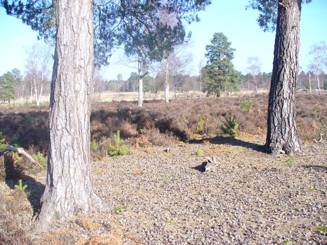
![]() This large area of common land in Surrey consists of heathland, ponds and birch, oak and pine woodland. It's run by the National Trust and is covered with lots of good footpaths to follow. The area is full of flora and fauna with purple heathers, interesting fungi and birds such as Tree pipits, Nightingales and Woodlarks.
This large area of common land in Surrey consists of heathland, ponds and birch, oak and pine woodland. It's run by the National Trust and is covered with lots of good footpaths to follow. The area is full of flora and fauna with purple heathers, interesting fungi and birds such as Tree pipits, Nightingales and Woodlarks.
There's lots of good options to continue your walking in the area. If you head west you will soon come to Thursley National Nature Reserve and Frensham Ponds Country Park.
You can visit the ponds and the expansive Hankley Common on the Tilford Walk or the circular Elstead Walk.
Postcode
GU8 5QA - Please note: Postcode may be approximate for some rural locationsPlease click here for more information
Witley Common Ordnance Survey Map  - view and print off detailed OS map
Witley Common Open Street Map  - view and print off detailed map
Witley Common OS Map  - Mobile GPS OS Map with Location tracking
Witley Common Open Street Map  - Mobile GPS Map with Location tracking
Explore the Area with Google Street View 
Dog Walking
The woodland and heathland on the common are ideal for walking your dog. You'll probably see plenty of other owners on a fine weekend day.
Further Information and Other Local Ideas
You could pick up the circular Chiddingfold Walk and visit Hydon's Ball and the splendid Winkworth Arboretum. In the pretty village itself there's a nice village green, a beautiful landscaped open garden and one of the oldest pubs in England.
In nearby Godalming there's Pewley Down, St Martha's Hill, the Chilworth Gunpowder Mills and Blackheath Common to explore.
For more walking ideas in the area see the Surrey Walks page.


