Worthing to Bramber Castle Circular Walk
![]()
![]() This circular walk explores the South Downs to the north of this West Sussex seaside town.
This circular walk explores the South Downs to the north of this West Sussex seaside town.
On the way you'll pass an Iron Age Hillfort, enjoy riverside paths along the River Adur and pay a visit to Bramber Castle. The route uses sections of the South Downs Way and the Monarch's Way, two waymarked trails which run through the area.
The walk starts from the Storrington Rise car park in the Findon Valley area of the town. From here you can pick up footpaths taking you up onto the South Downs. Follow the trail east and you can visit the historic hillfort at Cissbury Ring where there are fine views to enjoy.
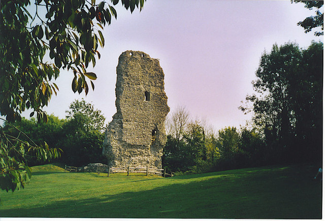
After exploring the fort you pick up the Monarch's Way and follow it north east to the attractive bowl shaped valley at Steyning Bowl. Near here you can pick up the South Downs Way and head east towards Botolphs where you can pick up a riverside path along the River Adur. Follow the path north and will take you to Upper Beeding and the historic Bramber Castle. The castle ruins date all the way back to the 11th century and the site includes a church which is still in use today.
After exploring the castle the route picks up the Monarch's Way again and follows it west towards Steyning Bowl and Canada Bottom. After passing Cissbury Ring again you descend back to the car park.
Postcode
BN14 0HT - Please note: Postcode may be approximate for some rural locationsWorthing Ordnance Survey Map  - view and print off detailed OS map
Worthing Open Street Map  - view and print off detailed map
*New* - Walks and Cycle Routes Near Me Map - Waymarked Routes and Mountain Bike Trails>>
Worthing OS Map  - Mobile GPS OS Map with Location tracking
Worthing Open Street Map  - Mobile GPS Map with Location tracking
Walks near Worthing
- The South Downs Way - This beautiful 100 mile long trail runs from Winchester to the coastal town of Eastbourne
- Monarch's Way - This incredible 615-mile walk approximates the escape route taken by King Charles II in 1651 after being defeated in the Battle of Worcester
- Devils Dyke - This circular walk explores this beautiful valley near Brighton
- Fulking - The pretty village of Fulking sits in a lovely position on the South Downs
- Cissbury Ring - Visit this historic hill fort in West Sussex and enjoy terrific views over the South Downs countryside on this circular walk
- Highdown Hill and Highdown Gardens - This walk visits Highdown Gardens before climbing Highdown Hill in the South Downs
- Chanctonbury Ring - Climb to this early Iron Age hill fort on the South Downs and enjoy wonderful views over the surrounding countryside and coast
- Clapham Wood - These mysterious woods are located in the Arun District of West Sussex, next to the village of Clapham
- Angmering Park Estate Woods - The expansive area of woodland surrounding the Angmering Park Estate has miles of public bridleways and footpaths for walkers and cyclists to try.
- Lancing Ring - This circular walk explores the Lancing Ring Nature Reserve in West Sussex.
- Findon - This West Sussex village is in a fine spot for exploring the South Downs
Dog Walking
The South Downs trails are great for fit dogs. There's also some nice woodland trails to try in nearby Clapham Wood.
Further Information and Other Local Ideas
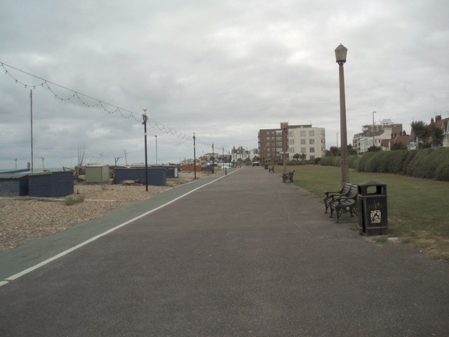
To continue your walking around Worthing head to the Iron Age Fort at Chanctonbury Ring or the lovely Highdown Hill and Highdown Gardens. There's also nice coastal paths along the Worthing Esplanade and beach.
Heading west along the coast path will take you to the nearby town of Littlehampton. The neighbouring town is well worth a visit with its two award winning beaches, some fine architecture and the longest bench in Britain to see. You can also pick up the the Arundel to Littlehampton River Walk here and enjoy a walk along the River Arun to Arundel and its historic castle.
Just to the north east is the Lancing Ring Nature Reserve. The reserve is a great place for wildlife walks with splendid views over the Adur Valley from the high points.
For more walking ideas in the area see the Sussex Walks and South Downs Walks pages.
Photos
Start of the walk at Storrington Rise Car Park at base of Cissbury Ring: Findon. Situated in the NE corner of the grid square, the walk to the ring starts here and in less than one kilometre one gets to the ring.
Workings at Cissbury Ring. This is the south-western side and lowest part of the ring. The depression seen here is the site of one of the former flint mines. These would have been dug as deep pits through the layers of chalk and poor flint to a good seam of flint about 30 feet below. This would have been worked out horizontally, and hauled to the surface here, within the safety of the ring fortifications. Flints were used as tools and weapons. This was all stone age stuff, 5,000 years ago.
Steyning Bowl. This bowl shape valley is an impressive feature dominating the gridsquare - taken from North to south.
Bramber Castle. This is the only major remain of the Norman castle. It received very heavy damage during the English Civil War.


