Zennor Churchway and Tinners Way
![]()
![]() A circular walk offering splendid views of the Cornish countryside and coast around St Ives and St Just.
A circular walk offering splendid views of the Cornish countryside and coast around St Ives and St Just.
The walk begins at the beautiful resort of St Ives, taking you past the harbour and pier and around St Ives head. The path then climbs through or past Venton Vision, Trowan, Trevalgan, Trevega, Trendrine, Boscubben, Wicca, Lower Tregerthen and Tremedda, mostly at between 350 and 400 feet – before descending to the pretty little village of Zennor.
From Zennor you continue to Higher Porthmeor, Rosemergy and Pendeen on an easy section of the walk which passes farms and the old flour mill at Trewey.
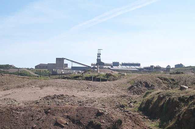
The path then heads from Pendeen towards Cape Cornwall passing the interesting Geevor Mine Museum and the charming Lower Boscaswell village before joining the coast path to Cape Cornwall. The coastal views from here are wonderful with Land's End just four miles away. This section also passes the Kenidjack Valley and the fascinating Botallack Mine, a National Trust owned site where you can explore the ancient mining engine houses.
At Cape Cornwall you join the Tinners Way and turn back east towards the delightful town of St Just with galleries and tea shops to enjoy. You then cross a series of heather covered commons with various landmarks of historical interest including Tregeseal Stone Circle, Chun Quoit and Castle, and Bosullow Trehyllys iron age settlement.
The path continues through Bosullow Common and onto Towednack, passing the fascinating Nine Maidens stone circle and the Bodrifty Iron Age Village on the way.
The final section takes you from the pretty village of Towdenack and descends to the finish point back at St Ives.
Please click here for more information
Zennor Churchway and Tinners Way Ordnance Survey Map  - view and print off detailed OS map
Zennor Churchway and Tinners Way Open Street Map  - view and print off detailed map
Zennor Churchway and Tinners Way OS Map  - Mobile GPS OS Map with Location tracking
Zennor Churchway and Tinners Way Open Street Map  - Mobile GPS Map with Location tracking
Pubs/Cafes
The Rosemergy Farmhouse is a nice place for a pit stop and a delicious cream tea. There's a delightful tea garden with stunning sea views onto the Atlantic Ocean and the North Cornish moors. The cafe is located close to the historic Carn Galver Engine House on the northern fringes of the Penwith Moors. Postcode is TR20 8YX. They are dog friendly.
Further Information and Other Local Ideas
Around Rosemergy you could take a detour from the trail to pick up the Penwith Moors and Men-An-Tol Walk. This fascinating walk visits several ancient sites including Men-An-Tol standing stones and the Lanyon Quoit dolmen. You'll also pass the remains of the old Ding Dong Mines and climb to the fine viewpoint at Carn Galver. Just head south from the path at Rosemergy to explore this area.
For more walking ideas in the area see the Cornwall Walks page.
Cycle Routes and Walking Routes Nearby
Photos
Bodrifty Iron Age settlement. In this area of enclosed moorland excavated in the 1950s are the remains of an Iron Age (600 BC - AD 43) settlement, consisting of the ruins of eight roundhouses within a low enclosing bank. Nearby at Bodrifty Farm there is a reconstruction of one of the roundhouses which is open to visitors
Coastal view, Venton Vision. The view here takes in The Island, Godrevy Head and St Agnes Head.
Elevation Profile


