Clyne Valley Country Park
![]()
![]() Explore 700 acres of wooded hillsides, steep gorges, meadows and wet valley floor in this country park near Swansea and Gowerton. The park is great for walking and cycling with the trackbed of the old London Midland Scottish Railway forming the park's main footpath and cycleway.
Explore 700 acres of wooded hillsides, steep gorges, meadows and wet valley floor in this country park near Swansea and Gowerton. The park is great for walking and cycling with the trackbed of the old London Midland Scottish Railway forming the park's main footpath and cycleway.
There are a number of water features in the park with the Clyne River, streams, old footbridges and a number of lakes and ponds to enjoy. Look out for birdlife that includes wagtails, wrens, nuthatches, robins and woodpeckers.
If you would like to continue your walk/cycle you can follow the traffic free Swansea bike path along the coast into Swansea, or north to Gowerton.
The nearby Singleton Park with its beautiful botanical gardens is also well worth visiting.
Postcode
SA2 8EW - Please note: Postcode may be approximate for some rural locationsClyne Valley Country Park Ordnance Survey Map  - view and print off detailed OS map
Clyne Valley Country Park Open Street Map  - view and print off detailed map
Clyne Valley Country Park OS Map  - Mobile GPS OS Map with Location tracking
Clyne Valley Country Park Open Street Map  - Mobile GPS Map with Location tracking
Dog Walking
The woodland trails are ideal for dog walking so you'll probably see other owners on a fine day. Be mindful of the cyclists as you make your way around the railway path area.
Further Information and Other Local Ideas
There's some good mountain bike trails in the park with downhill sections and jumps to try. See the video below for more details.
A few miles east of the park there's a fine climb to Kilvey Hill to try as well. There's some peaceful woodland trails and excellent views over Swansea city and docks from this prominent viewpoint. You can also pick up the Swansea Canal and enjoy a cycle or walk along the towpath to Pontardawe.
The Swansea Bike Path passes the eastern edge of the park. The shared cycling and walking route runs along a surfaced path from Mumbles Head to Swansea, with splendid views of Swansea Bay and its beaches.
Cycle Routes and Walking Routes Nearby
Photos
Footbridge on the river Clyne in Clyne Valley Country Park. Just east of the cycle path near the lake you can descend to this footbridge. Obscured behind the tree with two trunks is another set of steps which rises up the other side of the valley, presumably corresponding to the public right of way marked on the maps.
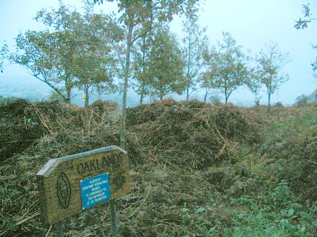
Oaklands in the park. Just beside the lane up to the lodge, where it levels out at the top is this clearing. Several young oak trees have been planted in the clearing and a sign erected by the society that did it. From the spot beyond the oaks (on a clearer day) you can see across to the east side of the Clyne valley with a view from Killay down to Singleton.
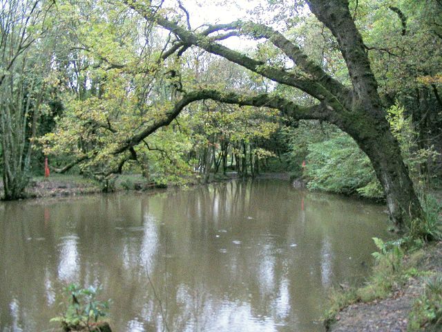
Lake view. An old railway has been turned into a surfaced path up the Clyne valley. A short walk north from the coast is this lake right beside the path. This is the view from a minor loop that diverts around the far side of the lake.
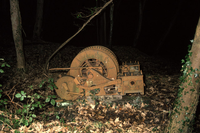
Ynys Colliery. This is an in situ winch built 1891 by J Wild & Co Ltd, Oldham. It was installed here c1912 and stopped about 1921. It is amazing that as much has survived has did in 1989 when I last saw it. It's well hidden in a wooded area and we started looking at dusk and found it in full darkness with the aid of torches. Amazingly, our party escaped from the woods unscathed.
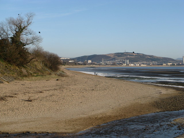
Blackpill Beach close to the Clyne River Mouth. The part of Blackpill Beach lying to the north of the mouth of the Clyne River taken from the cycle/foot bridge. Swansea City Centre backed by Kilvey Hill are in the distance. Immediately to the left of the picture the former LMS railway line from Swansea Victoria to Shrewsbury left the sea front and swung inland across a road bridge into the Clyne Valley. The line was closed in 1964.


