Balderhead Blackton and Hury Reservoirs
![]()
![]() This walk visits a series of picturesque reservoirs in Baldersdale, on the east side of the Pennines. The walk starts at the parking area at the eastern end of Balderhead Reservoir where there are wonderful views over the water to the surrounding countryside. You then head around Blackton Reservoir to the western end of Hury Reservoir, before returning to Balderhead via the Pennine Way. It's a fairly easy walk with some waterside sections and wonderful views of the beautiful Baldersdale. The area around Blackton Reservoir is a nature reserve so look out for a variety of wildlife on your walk.
This walk visits a series of picturesque reservoirs in Baldersdale, on the east side of the Pennines. The walk starts at the parking area at the eastern end of Balderhead Reservoir where there are wonderful views over the water to the surrounding countryside. You then head around Blackton Reservoir to the western end of Hury Reservoir, before returning to Balderhead via the Pennine Way. It's a fairly easy walk with some waterside sections and wonderful views of the beautiful Baldersdale. The area around Blackton Reservoir is a nature reserve so look out for a variety of wildlife on your walk.
If you would like to continue your walk you could follow the Pennine Way north to the nearby Grassholme Reservoir.
Postcode
DL12 9UX - Please note: Postcode may be approximate for some rural locationsBalderhead Blackton and Hury Reservoirs Ordnance Survey Map  - view and print off detailed OS map
Balderhead Blackton and Hury Reservoirs Open Street Map  - view and print off detailed map
Balderhead Blackton and Hury Reservoirs OS Map  - Mobile GPS OS Map with Location tracking
Balderhead Blackton and Hury Reservoirs Open Street Map  - Mobile GPS Map with Location tracking
Pubs/Cafes
One nice idea is to head east to the little village of Romaldkirk and visit the Rose and Crown. The hotel is set in a fine old coaching inn, dating from the 18th century. They serve high quality food and have an interior with bags of character. You can find them at postcode DL12 9EB for your sat navs. After your pint you could enjoy a stroll around the picturesque village which includes a noteworthy Saxon Church and fine views of the Teesdale countryside.
Dog Walking
The country and waterside trails make for a fine walk with your dog. The Rose and Crown mentioned above is also very dog friendly.
Further Information and Other Local Ideas
Head east and you could pick up the popular Teesdale Way. The waymarked trail will take you along the River Tees through Romaldkirk and Cotherstone.
A few miles west of the site you can climb to Mickle Fell. The fell is significant as being the highest point within the historic county of Yorkshire and the highest point within County Durham.
For more walking ideas in the area see the County Durham Walks and North Pennines Walks pages.
Cycle Routes and Walking Routes Nearby
Photos
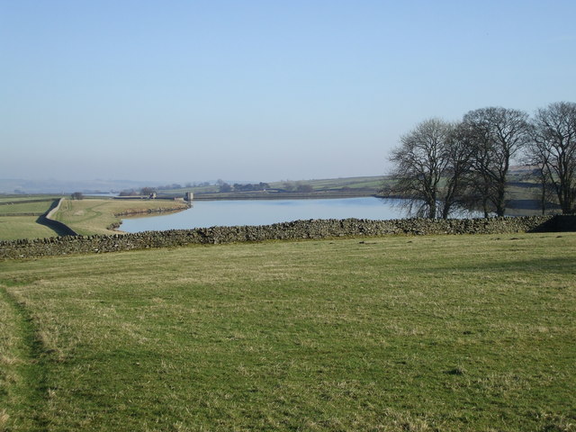
Balderhead reservoir from west of Carnigill. The public road to Balderhead ends at a small car park just west of Carnigill - the track continues beyond a locked gate. This view looks over the wall a little east of the road end, past Carnigill farm and down to the north shore of the reservoir.
Bridleway south of Clove Lodge, just to the south of the reservoirs. Two bridleways head onto the moor south of Clove Lodge - the more easterly is the Pennine Way which crosses the moor. Between the Pennine Way and How Sike is this bridleway which the map shows rather pointlessly heading south for a mile and just ending. In practice, the vehicle track doesn't follow the line of the bridleway on the map, and does indeed evaporate, though at the point where this photo was taken it is both well-defined and still where the map shows it. The view looks north over the route taken by the Pennine Way between Balderhead reservoir (whose dam is visible on the left) and the smaller Blackton Reservoir as it heads onto Hunderthwaite Moor on its way to Upper Teesdale.
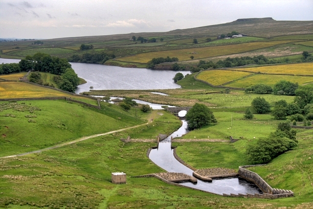
View from the top of Hury reservoir. This dam holds back a small area of water between Hury reservoir and Blackton reservoir, and is the source for the long spillway which bypasses Hury reservoir on its right. The "care when casting" sign indicates that fishing is allowed at this end of the reservoir (unlike at the dam), but not much else is. There is no flow at all in the spillway at this point in dry conditions, so unauthorised boat launching would be pointless. But it is noticeable that various field drains add a little volume to the spillway on its way down, so that there may be a usable flow by the time the dam is reached, and weirs there add more.
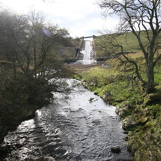
The start of the Balder descent. The River Balder has not been free-flowing since the Hury reservoir was built in 1892, so any navigation by boat must now start here.The pool below the overspill channel is readily accessible through a gate to the right of this photograph, though there is no convenient parking nearer than either end of the dam. The south end car park is very open to scrutiny by water company staff which may be an issue for some paddlers depending on intentions. The River needs a lot more water in it than this to be paddled, and trees can be a significant hazard. Most of the flow is coming from the tailrace somewhat hidden behind the grassy bank to the right of the picture, with only a small amount coming down the spillway. The spillway itself has seen descents by canoeists, but the authorities do not really approve. If there is enough water to paddle the river, the spillway is likely to be very fast with a significant impact and stopper at the bottom - canoe descents seem to have mostly been done in a low level such as seen here, at which level the river will not really "go".


