Watergrove Reservoir
![]()
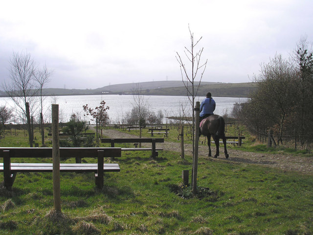
![]() Enjoy a circular walk around the pretty Wardle reservoir in Greater Manchester. There's a car park at the southern end of the water on Ramsden Road where you can pick up the footpath around the water. The reservoir is surrounded by attractive moorland with great views across Manchester to the Cheshire plain.
Enjoy a circular walk around the pretty Wardle reservoir in Greater Manchester. There's a car park at the southern end of the water on Ramsden Road where you can pick up the footpath around the water. The reservoir is surrounded by attractive moorland with great views across Manchester to the Cheshire plain.
Watergrove is great for wildlife watching with birds such as Common Sandpiper and Curlew to look out for. There's also mammals such as Fox, Stoat and Weasel. In the summer there are lots of wildflowers such as Marsh Orchid, Birdsfoot Trefoil, Tormentil, Harebell and Sneezewort. These attract a wide variety of butterflies to the area.
The Weighver's Way and the Pennine Bridleway run past the reservoir so you could pick up these long distance paths to extend your walk. If you head west you can climb to Brown Wardle Hill for more great views over the Pennines. The hills stands at 400m (1,312 ft) making it one of the highest points in Rochdale and Greater Manchester. Just beyond the hill is the town of Whitworth and Cowm Reservoir where there's another circular trail. Greenbooth Reservoir is also nearby and well worth a visit. If you head east from Watergrove Reservoir you can climb to Dobbin Hill and Stansfield Hill.
Postcode
OL12 9NJ - Please note: Postcode may be approximate for some rural locationsWatergrove Reservoir Ordnance Survey Map  - view and print off detailed OS map
Watergrove Reservoir Open Street Map  - view and print off detailed map
Watergrove Reservoir OS Map  - Mobile GPS OS Map with Location tracking
Watergrove Reservoir Open Street Map  - Mobile GPS Map with Location tracking
Explore the Area with Google Street View 
Pubs/Cafes
Head south into Wardle village and you could visit the Globe Inn for some post walk refreshment. The pretty village pub serves good home cooked food and has a nice beer garden for warmer days. You can find them at 218 Ramsden Road with a postcode of OL12 9NU for your sat navs.
Dog Walking
The reservoir is a popular place for dog walkers so expect to see other people with their pets on a fine day. The Globe Inn mentioned above is also dog friendly.
Further Information and Other Local Ideas
A few miles to the north there's Gorpley Reservoir near Todmorden. The area includes the woodland and waterfalls of Gorpley Clough.
For more walking ideas in the area see the Greater Manchester Walks page.
Cycle Routes and Walking Routes Nearby
Photos
Watergrove Reservoir. View of the reservoir, looking N from the top of the dam. The car park is behind the photographer. The water is very low and the line of the old road that used to give access up the valley can be seen in the temporary island in the reservoir.
Ruined buildings by the reservoir, Wardle. I had forgotten how recent this reservoir is until I saw that it is not on the 1940s OS map. These derelict buildings look older, but are not on the 1937 map so might be former waterworks offices and treatment plant.
A view over the good sized public car park at the site. Located on the south side of the reservoir, just below the dam. The car park is the end of the road after driving up through the village of Wardle.
Remains of Roads Farm, Wardle. One of the many farms in this valley that were demolished because in the catchment of the reservoir, but it might well have already been abandoned.


