Walk around Todmorden - Centenary Way
![]()
![]() This is a splendid circular walk through the beautiful Calder Valley from the market town of Todmorden in West Yorkshire.
This is a splendid circular walk through the beautiful Calder Valley from the market town of Todmorden in West Yorkshire.
The walk takes you across a series of atmospheric moors and past several lovely reservoirs, including Ramsden Clough and Warland reservoirs. There are also waterside sections to enjoy along the Rochdale Canal before a visit to the noteworthy Stoodley Pike.
This 1,300ft hill includes the Stoodley Pike Monument at the summit. It was built in 1856 when peace was declared at the end of the Crimean War and is a major highlight on the walk.
Todmorden Centenary Way Ordnance Survey Map  - view and print off detailed OS map
Todmorden Centenary Way Open Street Map  - view and print off detailed map
Todmorden Centenary Way OS Map  - Mobile GPS OS Map with Location tracking
Todmorden Centenary Way Open Street Map  - Mobile GPS Map with Location tracking
Walks near Todmorden
- Stoodley Pike - This circular walk takes you to the Stoodley Pike monument from Todmorden
- Rochdale Canal - Follow the Rochdale canal from Manchester to Sowerby Bridge on this waterside route through Greater Manchester and Yorkshire
- Withens Clough Reservoir - Enjoy an easy circular walk around this attractive reservoir in the south Pennines
- Cragg Vale - The small village of Cragg Vale is located near Mytholmroyd in the Calderdale area of the South Pennines
- Pennine Way - This fabulous 268 mile path takes you through three of England's finest national parks
- Blackstone Edge - Climb to this gritstone escarpment in the Pennine Hills and enjoy wonderful views over Greater Manchester and Yorkshire
- Bridestones - Visit these fascinating sandstone sculptures on this splendid walk in Dalby Forest
- Todmorden to Hebden Bridge Canal Walk - This walk follows a popular section of the Rochdale Canal from Todmorden to Hebden Bridge
- Gorpley Reservoir - This walk visits Gorpley Clough and Reservoir in Todmorden
- Gaddings Dam - This circular walk visits the Gaddings Dam reservoir near Todmorden.
- Warland Reservoir - This walk takes you to a series of reservoirs in the Calderdale area of West Yorkshire
Pubs/Cafes
Back in the town The Golden Lion is in a great spot for some post walk refreshments. It's located right next to the canal and has an outdoor area with views over the water. They do excellent Thai food and have a good selection of craft beers too. You can find them at Fielden Square with a postcode of OL14 6LZ for your sat navs. The pub is also dog friendly if you have your canine friend with you.
Further Information and Other Local Ideas
On the eastern side of the walk you'll pass close to Bell House Moor and Cragg Vale. This area has an interesting history connected to the The Cragg Vale Coiners, a band of counterfeiters that produced fake gold coins in the late 18th century. On Bell House Moor you will pass close to the house of the leader of the Cragg Vale Coiners.
Just north of Warland Reservoir you could take a small detour to visit Gaddings Dam. The small reservoir is notable for having the highest beach in Britain.
For more walking ideas in the area see the South Pennines Walks page.
Photos
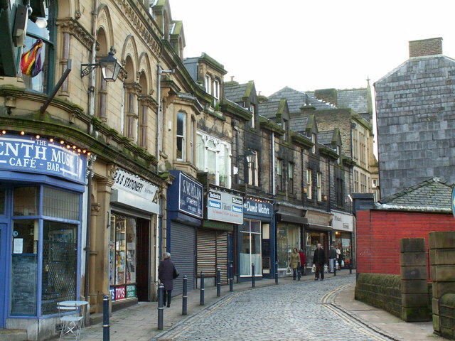
Water Street, Todmorden. Named after Walsden Water, which runs alongside the street, partially culverted
Warland Reservoir. Road at the side of Light Hazzles Reservoir
Stoodley Pike, local landmark and highlight on the walk. The site was probably used for bronze age burials, since bones were found when excavating for the first circular tower. This was built in 1815 to celebrate the peace at the end of the Napoleonic war. Unfortunately, it collapsed when the next war started, on the day the Russian ambassador left London before the Crimean War. The present monument was built in 1856. You can climb up the inner spiral staircase counting 39 steps in the dark to get a great view. It may also have been a beacon site. A beacon was temporarily put up and lit on 19th July 1988 to commemorate the great chain of beacons 400 years earlier, when the Spanish Armada was sighted off the southern coast.
Langfield Common Footpath to Gaddings Dam (forward),the post says "Pennine Way 2-3/4 Miles to White house"
Elevation Profile


