National Cycle Route 24
![]()
![]() National Cycle Route 24 runs from Bath to Eastleigh in Hampshire, for a distance of just under 80 miles.
National Cycle Route 24 runs from Bath to Eastleigh in Hampshire, for a distance of just under 80 miles.
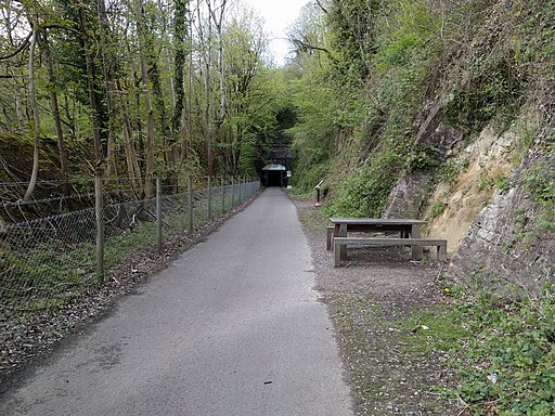
Route highlights include the traffic free section at the start on the Two Tunnels Greenway and the Kennet and Avon Canal.
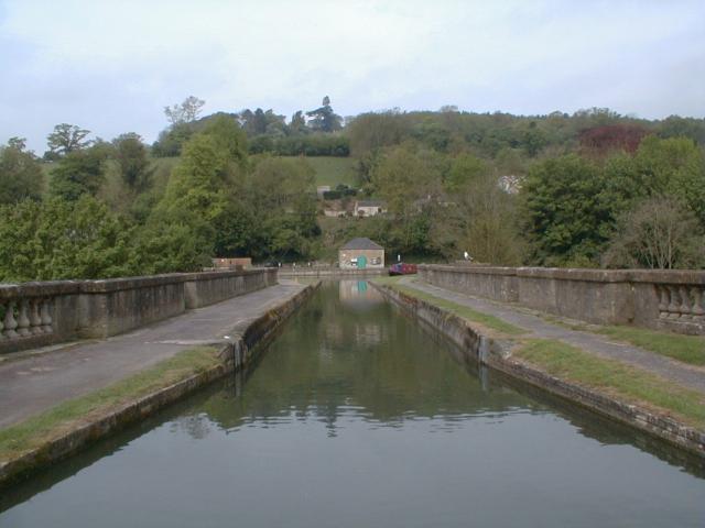
You'll also pass the photogenic Dundas Aqueduct on the Colliers Way.
Towns on the route include Radstock, Frome, Warminster and Salisbury with its famous cathedral.
See the list below for a series of shorter rides along the route.
Scroll further down for a route video and the complete gpx file.
Cycle Routes along National Cycle Route 24
- Two Tunnels Greenway - This is a super, shared cycling and walking path making use of a disused railway path through Bath and the surrounding countryside
- Colliers Way - This shared cycling and walking path runs from the Dundas Aqueduct to Radstock and Frome
- Bath to Frome - Travel to the eastern tip of the Mendip Hills on National Cycle routes 4, 24 and 48
- Warminster to Frome - Follow National Cycle route 24 from Wiltshire into Somerset on this ride through the splendid Longleat Estate
- Romsey to Andover - This route follows National Cycle route 24 and a long off road section along the Test Way from Romsey to Andover.
You start at Romsey railway station and soon join the Test Way path which follows the River Test passing King's Somborne and Stockbridge - Romsey to Southampton - Follow NCN routes 24 and 23 through Hampshire on this short easy route
- Salisbury to Romsey - Follow National Cycle route 24 from Wiltshire into Hampshire on this pleasant route
- Salisbury to Warminster - This ride follows National Cycle route 24 along quiet country roads from Salisbury to Warminster.
National Cycle Route 24 Ordnance Survey Map  - view and print off detailed OS map
National Cycle Route 24 Open Street Map  - view and print off detailed map
National Cycle Route 24 OS Map  - Mobile GPS OS Map with Location tracking
National Cycle Route 24 Open Street Map  - Mobile GPS Map with Location tracking
Further Information and Other Local Ideas
Around Longleat you can link up with National Cycle Route 25 which starts near the famous Park and historic Wiltshire house.
The route links with National Cycle Route 246 just north of Romsey. The route runs from Hampshire based Romsey to Kintbury in West Berkshire.
Cycle Routes and Walking Routes Nearby
Photos
Jericho Bridge. This bridge used to span the railway line from Radstock to Frome. The track has now been converted to the Colliers Way cycleway.
Conduit Bridge. Crossing the Frome to Radstock railway. This part is disused though the rails are still in situ. The signpost tells us it is now part of Cycle Route 24.


