Barton Broad Boardwalk
![]()
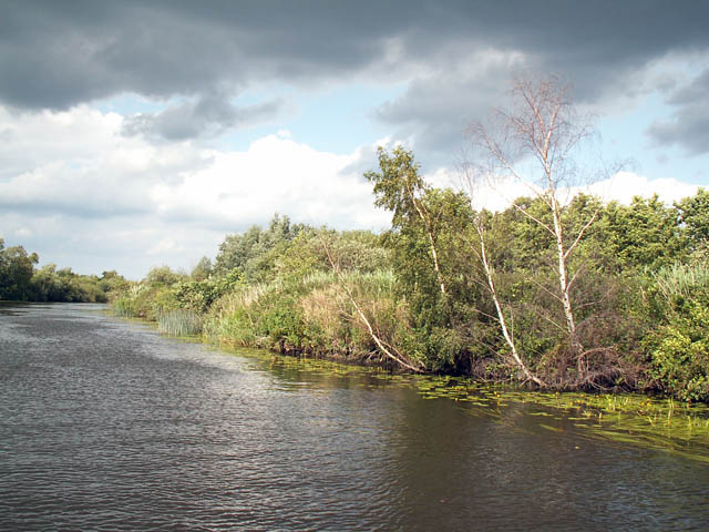
![]() This walk takes you to the lovely Barton Broad Boardwalk where you can follow the accessible path through swampy woodland and enjoy wonderful views across Barton Broad.
This walk takes you to the lovely Barton Broad Boardwalk where you can follow the accessible path through swampy woodland and enjoy wonderful views across Barton Broad.
The walk starts at the car park on Long Road (shown on the streetview link) and then follows Irstead road to the boardwalk. It's a nice easy stroll through the countryside on a good country lane. You'll see the boardwalk on your left after about 10-15 minutes. You then follow the boardwalk through dense woodland with various interesting species of plants. Look out for a variety of wildlife including common terns, otters, kingfishers and herons.
Postcode
NR12 8XP - Please note: Postcode may be approximate for some rural locationsBarton Broad Boardwalk Ordnance Survey Map  - view and print off detailed OS map
Barton Broad Boardwalk Open Street Map  - view and print off detailed map
Barton Broad Boardwalk OS Map  - Mobile GPS OS Map with Location tracking
Barton Broad Boardwalk Open Street Map  - Mobile GPS Map with Location tracking
Explore the Area with Google Street View 
Further Information and Other Local Ideas
Just to the south east you can explore the lovely How Hill House. The site includes lovely parkland and gardens with riverside paths along the River Ant which runs through the area.
Just to the south there's the worthy village of Horning where there are some nice footpaths around the Bure Marshes Nature Reserve, a fine riverside pub and a foot ferry service to take you over the Bure. Salhouse Broad can also be accessed in this area.
For more walking ideas in the area see the Norfolk Broads Walks page.
Cycle Routes and Walking Routes Nearby
Photos
Along the boardwalks. Looking along the boardwalks onto Barton Broad. A great many diverse species live on the broads, most noticeable here were the dragonflies.
Boathouse by the staithe. At the end of Staithe Road at the northern end of the broad. Barton Turf is a small Broadland village with its own staithe and boatyard, giving direct access to Barton Broad. There is no shop, pub or post office and the village church, dedicated to St Michael and All Angels is located more than one kilometre distant from the village.
Restoration measures, Barton Broad. The broad used to suffer from severe eutrophication and silting. The nutrient-rich mud was pumped out, and an ecological intervention put in place - excluding fish from certain areas, in order to increase the population of Daphnia (water flea) and thereby control the algae. Lower algae levels mean clearer water, and greater plant growth, which in turn provides shelter for Daphnia from predation by fish. This photo shows one of the fish "exclosures" - below the floats, mesh curtains hang to the bottom of the broad.


