Biggin Dale
![]()
![]() This walk explores the beautiful Biggin Dale National Nature Reserve in the Peak District.
This walk explores the beautiful Biggin Dale National Nature Reserve in the Peak District.
You can start the walk from the little village of Biggin, just to the east of the reserve. The Waterloo Inn is a good start an end point to the walk. From here follow public footpaths south to Dalhead before turning west to reach the reserve. A footpath then heads south through the site, passing the caves before reaching
the River Dove at Wolfscote Dale. You can extend the walk by continuing along the delightful riverside paths either to the south or north west.
As a nature reserve there's lots of different plants and wildflowers to see in the warmer months. The limestone scenery encourages pretty flowers such as purple orchid, harebells and bluebells in the spring.
Biggin Dale Ordnance Survey Map  - view and print off detailed OS map
Biggin Dale Open Street Map  - view and print off detailed map
Biggin Dale OS Map  - Mobile GPS OS Map with Location tracking
Biggin Dale Open Street Map  - Mobile GPS Map with Location tracking
Pubs/Cafes
Head to the excellent Waterloo Inn in Biggin for some refreshments after your walk. The quaint old pub does very good food and also has a decent campsite if you need to stay over. There's a friendly, cosy interior while outside there are several tables with village and countryside views. You can find it on Main Street at Biggin-by-Hartington with a postcode of SK17 0DH for your sat navs.
Dog Walking
The dale is a fine place for a dog walk and the Waterloo Inn mentioned above is also dog friendly.
Further Information and Other Local Ideas
Head east of the dale and you can pick up the Tissington Trail. This shared cycling and walking trail is a great way to see the area.
If you continue south along the river you will soon come to Dovedale. This beauty spot is one of the highlights of the national park and includes the famous stepping stone. Also near here is the climb to Thorpe Cloud which gives fabulous views over the dales.
To the west there's the circular Wetton Walk which takes you to the splendid Thor's Cave and the historic Wetton Mill where there are some delightful riverside tea rooms. The circular walk from Hulme End can also be picked up here.
To the east is Minninglow where you will find a fine hill climb and some significant ancient tombs.
For more walking ideas in the area see the White Peak Walks page.
Cycle Routes and Walking Routes Nearby
Photos
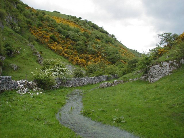
End of Biggin Dale. What appears to be a path in the foreground is a stream, running to meet the River Dove flowing down Wolfscote Dale.
Footpaths join near to the wood, to the right is the path to Dalehead and to the left is the path to Hartington. The slope under the trees seems to be a popular place for walkers to stop for a break.


