Wolfscote Dale
![]()
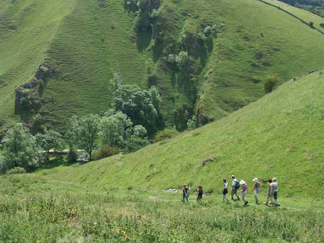
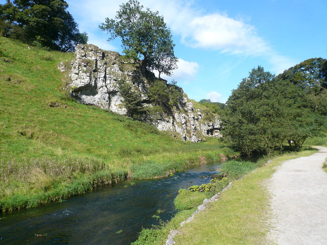
![]() This walk visits Wolfscote Dale in the Dove Dale area of the Peak District. You can start the walk from the village of Hartington just north of the dale. There's a car park and cafe in the village so it makes a good start and end point for the walk. The footpaths then head south to Beresford Dale Nature Reserve where there's riverside paths, weirs, woodland, wildflowers and birdlife to enjoy. The route then crosses a wooden footbridge and leads you into the Wolfscote Dale Nature Reserve. The footpath winds its way along the River Dove with woodland sections and a number of weirs to enjoy. It's a beautiful area with the option of continuing south along the river to Milldale and then on to Dovedale. You could also visit the nearby Ilam Park where there are beautiful gardens and views of the River Manifold. Just to the east of Wolfscote Dale is the Biggin Dale Nature Reserve. You could return to Hartington on the footpath through the reserve. It's a lovely area with lots of interesting plants and flowers to look out for.
This walk visits Wolfscote Dale in the Dove Dale area of the Peak District. You can start the walk from the village of Hartington just north of the dale. There's a car park and cafe in the village so it makes a good start and end point for the walk. The footpaths then head south to Beresford Dale Nature Reserve where there's riverside paths, weirs, woodland, wildflowers and birdlife to enjoy. The route then crosses a wooden footbridge and leads you into the Wolfscote Dale Nature Reserve. The footpath winds its way along the River Dove with woodland sections and a number of weirs to enjoy. It's a beautiful area with the option of continuing south along the river to Milldale and then on to Dovedale. You could also visit the nearby Ilam Park where there are beautiful gardens and views of the River Manifold. Just to the east of Wolfscote Dale is the Biggin Dale Nature Reserve. You could return to Hartington on the footpath through the reserve. It's a lovely area with lots of interesting plants and flowers to look out for.
The dale is located near to the pretty village of Alstonefield which makes a worthy alternative start point for the walk.
You could enjoy post walk refreshments in the lovely beer garden at the George Inn Pub on Church Lane in the village centre. The noteworthy inn dates from the 18th century and is situated in a lovely spot on the village green.
Wolfscote Dale Ordnance Survey Map  - view and print off detailed OS map
Wolfscote Dale Open Street Map  - view and print off detailed map
Wolfscote Dale OS Map  - Mobile GPS OS Map with Location tracking
Wolfscote Dale Open Street Map  - Mobile GPS Map with Location tracking
Pubs/Cafes
Head to the Devonshire Arms pub in Hartington village after your exercise. The quaint old 17th century pub has a lovely large beer garden to relax in during the warmer months. You can find it at Market Place, postcode SK17 0AL.
You could also take a small detour from the route and visit the pretty little village of Biggin. There's the excellent Waterloo Inn here which has a good outdoor area with country and village views. It's also dog friendly if you have your four legged friend with you.
Further Information and Other Local Ideas
To the west there's the circular Wetton Walk which takes you to the splendid Thor's Cave and the historic Wetton Mill where there are some delightful riverside tea rooms.
The circular walk from Hulme End starts from the nearby village where you'll find the car park and visitor centre for the Manifold Valley. It visits the dale and several other local highlights.
For more walking ideas in the area see the White Peak Walks page.


