Thor's Cave Walk
![]()
![]() This walk takes you to the stunning natural cavern
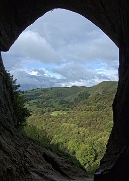
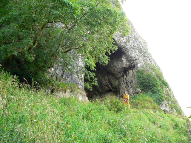
of Thor's Cave in the Manifold Valley area of the Peak District. There is a good footpath through the countryside from the nearby village of Wetton which takes you to the cave. Once there you can enter the cave and enjoy the fascinating rock formations and mineral colours. It's a magical place with interesting nooks and crannies to explore. There are also great views of the Manifold Valley through the cave entrance. You can return to Wetton along the same path and then enjoy refreshments at the 18th century Royal Oak Inn. It's also nice to have a stroll around Wetton Village with its little cottages, village green and church which has a 14th century tower.
This walk takes you to the stunning natural cavern
of Thor's Cave in the Manifold Valley area of the Peak District. There is a good footpath through the countryside from the nearby village of Wetton which takes you to the cave. Once there you can enter the cave and enjoy the fascinating rock formations and mineral colours. It's a magical place with interesting nooks and crannies to explore. There are also great views of the Manifold Valley through the cave entrance. You can return to Wetton along the same path and then enjoy refreshments at the 18th century Royal Oak Inn. It's also nice to have a stroll around Wetton Village with its little cottages, village green and church which has a 14th century tower.
The River Manifold and the Manifold Way run right past the caves so an alternative route would be to start from Waterhouses and follow the lovely riverside path to the cave. If you'd like to cycle to the cave you can hire bikes from the Manifold Valley Cycle Centre and follow the Manifold Way to the cave.
If you'd like to extend your walking in the area then you could visit the nearby Dovedale where you will find a lovely walking path along the River Dove to the famous stepping stones.
Postcode
DE45 1AE - Please note: Postcode may be approximate for some rural locationsThor's Cave Ordnance Survey Map  - view and print off detailed OS map
Thor's Cave Open Street Map  - view and print off detailed map
*New* - Walks and Cycle Routes Near Me Map - Waymarked Routes and Mountain Bike Trails>>
Thor's Cave OS Map  - Mobile GPS OS Map with Location tracking
Thor's Cave Open Street Map  - Mobile GPS Map with Location tracking
Pubs/Cafes
The Royal Oak in Wetton is a popular choice for walkers. The 18th-century inn has a good menu, a nice sun lounge and a beer garden to relax in when the weather is fine. You can find the pub at postcode DE6 2AF for your sat navs.
The delightful Wetton Mill Tea Rooms are located just north of the cave. You can sit outside next to the river and enjoy a delicious meal or snack here. You can find them at Dale farm with postcode DE6 2AG.
Dog Walking
The route is fine for dog walking and the Royal Oak pub mentioned above is also dog friendly.
Further Information and Other Local Ideas
The Ilam Circular Walk runs close to the caves and provides an opportunity for visiting the area from the village of Ilam. The trail visits the National Trust's Ilam Park before exploring the Manifold Valley just to the south of the caves. As such you could use the trail, with a short extension along the river, to visit the site.
The circular Wetton Walk visits the cave from the nearby village. It then heads north along the river to visit the historic Wetton Mill before climbing to Wetton Hill for fines views over the area.
The circular walk from Hulme End starts from the nearby village where you'll find the car park and visitor centre for the Manifold Valley. It visits the cave and several other local highlights.
For more walking ideas in the area see the White Peak Walks page.


