Biscathorpe Walk
![]()
![]() This Lincolnshire Wolds walk takes you from the medieval village at Biscathorpe to another medieval site at nearby Wykeham. It's an attractive area with lovely views of the River Bain valley and some interesting historical sites to investigate.
This Lincolnshire Wolds walk takes you from the medieval village at Biscathorpe to another medieval site at nearby Wykeham. It's an attractive area with lovely views of the River Bain valley and some interesting historical sites to investigate.
The walk starts at Biscathorpe Park next to the site of the ancient settlement. Here you can pick up the Viking Way and follow the waymarked trail north towards on Burgh on Bain and Grimblethorpe. The route then turns west, crossing the River Bain, before coming to Wykeham with its hall, pond and ancient village. The ruins of the 14th century church are still visible. Wykeham Hall survived the abandonment of the village, and still stands.
The village is located just a few miles west of Louth where you can enjoy an easy waterside walk along the Louth Canal.
Postcode
LN11 9RA - Please note: Postcode may be approximate for some rural locationsBiscathorpe Ordnance Survey Map  - view and print off detailed OS map
Biscathorpe Open Street Map  - view and print off detailed map
Biscathorpe OS Map  - Mobile GPS OS Map with Location tracking
Biscathorpe Open Street Map  - Mobile GPS Map with Location tracking
Walks near Biscathorpe
- Donington on Bain - This pretty village is located in the Lincolnshire Wolds AONB, on the banks of the River Bain
- Louth Canal - Enjoy a waterside walk along the Louth Canal from Louth to Tetney Marshes
- Horncastle - This walk takes you along the old Horncastle Canal and the River Bain from the town centre of this Lincolnshire town.
- Market Rasen - This Lincolnshire based town is located in the West Lindsey district of the county
- Hubbard's Hills - This area of natural beauty in Louth is a lovely place for an afternoon stroll
- Alford - This small market town is located in a lovely spot on the edge of the Lincolnshire Wolds AONB
- Snipe Dales Country Park - Explore 220 acres of country park and nature reserve in the beautiful Lincolnshire Wolds
- Chambers Farm Wood - Enjoy a series of peaceful walking trails in this forest and nature reserve in Wragby
- Woodhall Spa - Woodhall Spa is a very attractive former spa town on the edge of the Lincolnshire Wolds
- Tealby - This pretty village near Market Rasen is surrounded by some lovely rolling Lincolnshire Wolds countryside
- Willingham Woods - These woods near Market Rasen have miles of good footpaths and cycling trails to try.
- Covenham Reservoir - Enjoy a circular walk around this pretty reservoir and along the Louth Canal on this waterside walk in Lincolnshire.
- Belchford - This pretty village lies in the Lincolnshire Wolds, an Area of Outstanding Natural Beauty
- Hagworthingham - This small Lincolnshire village is located in the East Lindsey district near Horncastle
- Binbrook - This pretty village is located in the East Lindsey district of Lincolnshire near to the town of Market Rasen.
- Lincolnshire Wolds Way - This circular walk explores the Lincolnshire Wolds AONB, visiting numerous pretty villages, parks and hills.
Further Information and Other Local Ideas
Head south and you can visit the neighbouring village of Donington on Bain. Here you'll find a noteworthy 12th century church and a fine 18th century pub. The area also includes Goulceby and the unique landscape of the splendid Red Hill Nature Reserve. There's a steep chalk escarpment with wonderful views and some rare plants and flowers to see here.
The long distance Lincolnshire Wolds Way passes through the area. The circular trail visits some of the highlights of the AONB on a decent waymarked footpath.
For more walking ideas in the area see the Lincolnshire Walks page.
Photos
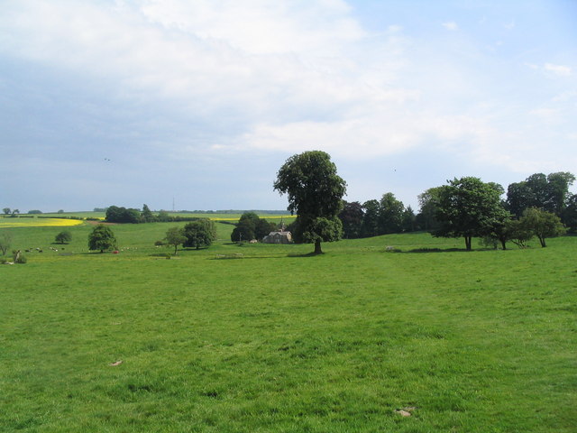
View across site of medieval village of Biscathorpe. Very little to see in terms of the old village. But a nice view across the River Bain towards the church of St Helen
Ford near Biscathorpe. There are two small fords on the road between Gayton-le-Wold and Biscathorpe. This is the more northerly
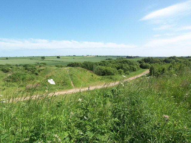
Looking along the Viking Way which is heading for the deserted medieval village of East Wykeham. Photo taken from Grim's Mound which stands just above the 120m contour.


