Bradenham Woods
![]()
![]() This circular walk explores the woodland and countryside surrounding the pretty village of Bradenham in the Chilterns. The area is run by the National Trust so there are good, waymarked footpaths and facilties.
This circular walk explores the woodland and countryside surrounding the pretty village of Bradenham in the Chilterns. The area is run by the National Trust so there are good, waymarked footpaths and facilties.
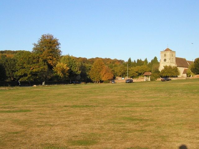
The walk starts in the car park in Bradenham. It's a typically lovely English village with pretty cottages, a village green, village pond and a cricket pitch. You will pass Bradenham Manor House and the fascinating St Botolph church which has sections dating from the 14th century. The footpath then gently climbs away from the village with wonderful views over the Chilterns. You then pick up woodland trails through the deciduous woodland of Park Wood. The wood is in an elevated position above the village so there are nice views back towards Bradenham, including the Manor House and the Church.
After leaving the wood you descend back towards the village and the finish point at the car park.
If you are coming by train then Saunderton train station is only about a mile from the village.
If you would like to extend your walking in the area then both Hughenden Park and West Wycombe Park are great options. You could also explore Naphill Common which has many woodland footpaths. Our longer circular walk from High Wycombe visits the common, Hughenden Park and Downley Common.
Postcode
HP14 4HF - Please note: Postcode may be approximate for some rural locationsPlease click here for more information
Bradenham Woods Ordnance Survey Map  - view and print off detailed OS map
Bradenham Woods Open Street Map  - view and print off detailed map
Bradenham Woods OS Map  - Mobile GPS OS Map with Location tracking
Bradenham Woods Open Street Map  - Mobile GPS Map with Location tracking
Further Information and Other Local Ideas
For more walking ideas in the area see the Buckinghamshire Walks and the Chilterns Walks pages.
Cycle Routes and Walking Routes Nearby
Photos
Bradenham Manor. The 17th century manor house, was once the home of Isaac D'Israeli, father of Benjamin Disraeli, who lived at nearby Hughenden Manor.


