Bramble Hill Walk
![]()
![]() This circular walk in the New Forest explores the area around Bramble Hill near the village of Bramshaw.
This circular walk in the New Forest explores the area around Bramble Hill near the village of Bramshaw.
On the way you'll explore Black Bush Plain, Bramshaw Wood, Two Beeches Bottom, Pipers Wait and the Bramble Hill Hotel.
You can start the walk from the Bramble Hill car park near Longcross Pond where there are often ponies to be seen wetting their whistle. From here you can pick up the trails heading east to explore Black Bush Plain before heading towards the area around the Bramble Hill Hotel. You can stop off for a cream tea in the delightful gardens of the hotel before heading back to the car park.
To extend the walk head north east to explore Canada Common.
Postcode
SP5 2BS - Please note: Postcode may be approximate for some rural locationsBramble Hill Ordnance Survey Map  - view and print off detailed OS map
Bramble Hill Open Street Map  - view and print off detailed map
*New* - Walks and Cycle Routes Near Me Map - Waymarked Routes and Mountain Bike Trails>>
Bramble Hill OS Map  - Mobile GPS OS Map with Location tracking
Bramble Hill Open Street Map  - Mobile GPS Map with Location tracking
Further Information and Other Local Ideas
Head west towards Fritham and you can pick up the Frogham to Fritham Circular Walk. The route visits the viewpoint on the Hampton Ridge before heading to the lovely Latchmore Brook and Hasley Hill Inclosure near Fordingbridge. Near Frogham you can pick up the Godshill Walk and enjoy the rhododendrons of the Godshill Inclosure before a climb to the Castle Hill viewpoint. The Ashley Walk area is also located near here and another popular area to start a walk with its large car park and pleasant heathland trails.
For more walking ideas in the area see the New Forest Walks page.
Cycle Routes and Walking Routes Nearby
Photos
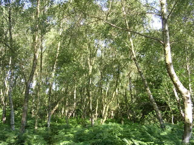
Silver birch trees at the Bramble Hill car park. The Forestry Commission car park at Bramble Hill, close to the Longcross crossroads is surrounded by silver birch with bracken growing beneath. The older woodland nearby (in the neighbouring grid square) contains mainly oak and beech.
Gorse and holly at Pipers Wait. Thought to be unlucky to cut down, it forms the centre of many a hedge and performs this role well given its prickly nature. The evergreen leaves and long lasting berries have contributed to Holly’s reputation for “eternity and power” to ward off destruction and evil spirits. In Shropshire, there is a type of Holly without prickles called “Slike Holly”. It has a white hardwood and was used for carving and making handles such as stock whips. Holly is to be brought indoors only at Christmas otherwise it brings bad luck. Holly is often planted in front of a house to bring good luck. and is thought to bring protection against storms. Gorses are very spiny evergreen shrubs. They have small scale-like leaves. The flowers and seed-pods use small explosions to reproduce. People used gorse to fuel fires for baking, making bricks and cooking.
Spreading beeches, Bramshaw Wood. Bramshaw Wood is open woodland, mainly of beech and oak with holly beneath. It was reputedly the source of oak timber for the building of Salisbury Cathedral. Much of it is on steep northeast facing slopes, and it can be quite wet underfoot.
View down Two Beeches Bottom. Looking northeast from the northern part of Black Bush Plain, the hills of Hampshire/Wiltshire can be seen in the distance. In the foreground is the top of Two Beeches Bottom, a broad valley that runs down from the high ground between Bramshaw Inclosure and Bramshaw Wood.
Stock alongside Longcross Pond. The pond is a watering hole for the itinerant commoners' stock on the highest part of the New Forest heathland to the northeast of Fritham.


