Brigg Walks - Canal and New River Ancholme Walk
![]()
![]() This North Lincolnshire based market town has some fine waterside walking through the Ancholme Valley.
This North Lincolnshire based market town has some fine waterside walking through the Ancholme Valley.
This walk from the town takes you north along the New River Ancholme canal to South Ferriby on the south bank of the Humber Estuary.
The walk starts in the town centre near the tourist information centre. From here you can pick up the waterside path and follow it north to Castlethorpe Bridge, Broughton Carrs, Appleby Carrs, Saxby All Saints Bridge and Horkstow Bridge before coming to the South Ferriby Marina and the Ferriby Sluice on the Humber.
You can extend the walk by crossing the famous Humber Bridge and exploring Humber Bridge Country Park in Hessle on the northern side of the river. If you head along the river east you will reach the famous port city of Hull where you can explore the docks and visit The Deep, a huge aquarium with over 3500 fish.
Brigg Ordnance Survey Map  - view and print off detailed OS map
Brigg Open Street Map  - view and print off detailed map
Brigg OS Map  - Mobile GPS OS Map with Location tracking
Brigg Open Street Map  - Mobile GPS Map with Location tracking
Walks near Brigg
- Twigmoor Woods - Enjoy a short stroll around these pretty woods near Scunthorpe
- Laughton Woods - Follow the long woodland trail through Laughton Woods on this easy walk in Lincolnshire
- Messingham Sand Quarry - This pretty nature reserve near Scunthorpe has nice footpaths running around and between a series of lagoons
- Normanby Hall Country Park - Explore the three hundred acres of parkland and woodland surrounding the 19th century Normanby Hall
- Gainsborough - This interesting market town in Lincolnshire is located in the West Lindsey district of the county
- Humber Bridge Country Park - This Country Park and Local Nature Reserve consists of woods, meadows, ponds and cliffs
- Humber Bridge - Follow the footpath across the Humber Bridge and enjoy fine views over the River Humber and the city of Hull in East Riding of Yorkshire
- Hessle Foreshore Walk - This walk takes you along a section of the Trans Pennine Trail from Hessle to Hull in East Riding of Yorkshire
- Scunthorpe - The industrial Lincolnshire town of Scunthorpe has some nice local parks and woodland to explore on foot.
- Caistor - This circular walk from the Roman Town of Caistor takes you through the countryside to the neighbouring villages of Nettleton and Rothwell
- Viking Way - Follow in the footsteps of the Norse invaders on this long distance walk from the Humber Bridge to Oakham in Rutland
- Great Limber - This historic Lincolnshire based village is surrounded by some attractive countryside and woodland
- Hull - This Yorkshire port city has some fine riverside trails and pictureque local parks to explore on foot.
- Barton Upon Humber - This Lincolnshire based market town sits in a nice location for waterside walks on the banks of the Humber Estuary.
- Burton Upon Stather and Alkborough Flats - Burton Upon Stather is a North Lincolnshire based village located near Scunthorpe on the eastern side of the River Trent.
- Nettleton - This Lincolnshire based town is located just south of Caistor in the West Lindsey District of the country.
Pubs/Cafes
The 18th century Yarborough Hunt is a good choice for some refreshments in the town. The pub has a cosy interior with real fires and a courtyard/beer garden if the sun is shining. You can find them at 49 Bridge Street with postcode DN20 8NS.
Dog Walking
The riverside path is a nice one to do with your dog. The Yarborough Hunt mentioned above is also dog friendly.
Further Information and Other Local Ideas
Head east and you can pick up the long distance Viking Way around Bigby. A little further east is the village of Great Limber with its 13th century church and the historic Brocklesby Estate.
To the west you'll find Twigmoor Woods where there's miles of woodland trails to explore.
For more walking ideas in the area see the Lincolnshire Walks page.
Photos
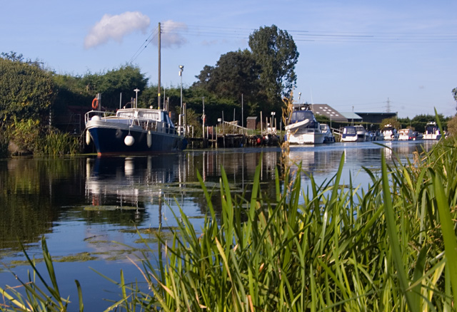
Old River Ancholme. Part of the river which retains its natural course through the town, seen here south east of the point where it rejoins the straightened 'New' river.


