Craster Circular Walk to Cullernoise Point and Arnold NWT
![]()
![]() A circular walk around the Northumberland village of Craster, visiting the Arnold NWT Nature Reserve and the interesting cliff formations at Cullernose Point on the coast. The small fishing village is located in the Northumberland Coast Area of Outstanding Natural Beauty. It has a pretty harbour and nice coastal footpaths to try. The village is located just to the south of the striking ruins of Dunstanburgh Castle. This circular walk heads in the other direction to visit Cullernose Point where you will find basaltic cliffs which are a significant feature of the local landscape. The walk then passes along a quiet country lane to visit the Arnold Memorial Northumberland Wildlife Trust Reserve where you can look out for various migrant birds and red squirrels.
A circular walk around the Northumberland village of Craster, visiting the Arnold NWT Nature Reserve and the interesting cliff formations at Cullernose Point on the coast. The small fishing village is located in the Northumberland Coast Area of Outstanding Natural Beauty. It has a pretty harbour and nice coastal footpaths to try. The village is located just to the south of the striking ruins of Dunstanburgh Castle. This circular walk heads in the other direction to visit Cullernose Point where you will find basaltic cliffs which are a significant feature of the local landscape. The walk then passes along a quiet country lane to visit the Arnold Memorial Northumberland Wildlife Trust Reserve where you can look out for various migrant birds and red squirrels.
The long distance St Oswald's Way and the Northumberland Coast Path run through the village. You can pick this up and head north to visit the castle and the lovely Beadnell Bay on our Craster to Seahouses Walk. Heading south will take you to Boulmer with its row of cottages and pretty natural haven. Just beyond the village you will come to the picturesque coastal resort of Alnmouth. You can try this beautiful section of the path on our Craster to Alnmouth Walk.
Postcode
NE66 3TR - Please note: Postcode may be approximate for some rural locationsCraster Ordnance Survey Map  - view and print off detailed OS map
Craster Open Street Map  - view and print off detailed map
*New* - Walks and Cycle Routes Near Me Map - Waymarked Routes and Mountain Bike Trails>>
Craster OS Map  - Mobile GPS OS Map with Location tracking
Craster Open Street Map  - Mobile GPS Map with Location tracking
Walks near Craster
- Craster to Alnmouth - Enjoy a walk along the beautiful Northumberland Coast Path on this route from Craster to Alnmouth
- Craster to Dunstanburgh Castle - This walk takes you along a beautiful stretch of the Northumberland Coast Path from Craster to Dunstanburgh Castle and then on to Embleton Bay and the Newton Pool Nature Reserve.
Dunstanburgh Castle was built in the 14th century, being one of the largest and grandest fortifications in Northern England at the time - St Oswald's Way - Explore the coastline, islands, river valleys, hills, villages, forests and farmland of Northumberland and follow in the footstepts of St
- Beadnell to Low Newton - A popular walk from the Northumberland village of Beadnell to Low Newton By Sea along section of the Northumberland Coast Path
- Craster to Seahouses - This walk follows a lovely section of the Northumberland Coast Path from Craster to Seahouses
- Warkworth River Walk - Enjoy a nice stroll along the River Coquet on this easy circular walk in the popular village of Warkworth.
The walk starts from the ancient bridge of two arches which crosses the river, just north of the castle - Warkworth to Alnmouth - This is another splendid stretch of the Northumberland Coast Path, with a historic castle, beautiful beaches, interesting villages and lovely bays to enjoy.
- Alnwick to Bamburgh Walk - This walk takes you from Alnwick Castle to Bamburgh Castle on the Northumberland Coast Path
- Alnwick - This attractive town in Northumberland is surrounded by lovely countryside and a number of large parks which are ideal for walkers
- Embleton Bay - This attractive bay is located just north of Craster on the Northumberland coast
- Druridge Bay Country Park - This beautiful country park on the Northumberland coast consists of three miles of beach and sand dunes, a large freshwater lake, peaceful woodland and meadows
- Alnmouth To Boulmer Beach Walk - This walk takes you along the beach from Alnmouth To Boulmer on the Northumberland coast.
- Howick Hall - This circular walk visits the lovely gardens at Howick Hall before heading through the countryside to visit the coastal village of Craster.
Pubs/Cafes
The Jolly Fisherman is in a fine spot for some rest and relaxation after your exercise. The historic pub includes a fine interior with roaring fires, stone flagged floors and low beamed ceilings. They serve delicious sea food which you can enjoy with a lovely sea view over Craster's delightful harbour. You can find them at Haven Hill at postcode NE66 3TR for your sat navs.
Dog Walking
The coastal paths make for a bracing dog walk. The Jolly Fisherman mentioned above is also dog friendly.
Further Information and Other Local Ideas
For more walking ideas in the area see the Northumberland Walks page.
Photos
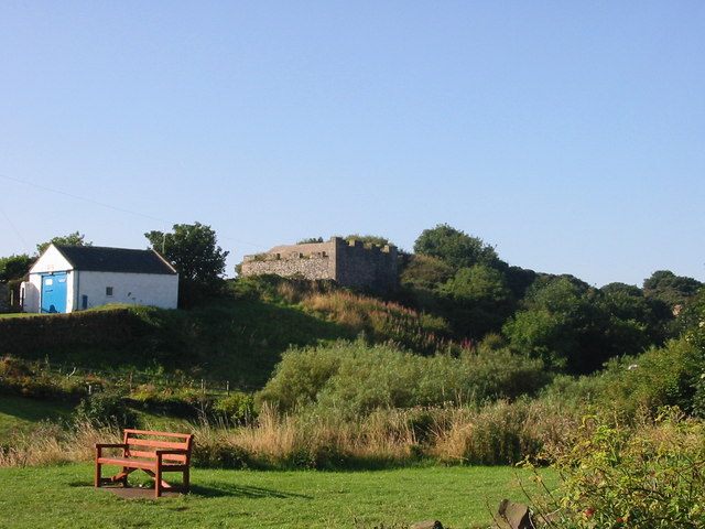
Long Heugh. The continuation inland of the cliff edge that forms the south face of Cullernose Point, see from the Coastal Path


